Îles de Los
| Native name: <span class="nickname" ">Îles de Los | |
|---|---|
 Los Islands | |
| Geography | |
| Location | Atlantic Ocean |
| Coordinates | 16°36′S 11°41′E / 16.600°S 11.683°ECoordinates: 16°36′S 11°41′E / 16.600°S 11.683°E |
| Archipelago | Îles de Los |
| Total islands | 8 |
| Major islands | Tamara (Fortoba), Kassa and Roume |
| Area | 80 km2 (31 sq mi) |
| Length | 10 km (6 mi) |
| Width | 7 km (4.3 mi) |
| Highest elevation | 47 m (154 ft) |
| Highest point | Sommet Lacroix |
| Administration | |
|
Guinea | |
Îles de Los (English: Los Islands) are an island group lying off Conakry in Guinea. Their name is derived from the Portuguese: Ilhas dos Ídolos, "Island of the Idols".[1] They are located about 2 km off the headland limiting the southern side of Sangareya Bay.[2]
The islands are best known for their beaches and forested interiors and are popular with tourists. Ferries sail to the Los from Conakry.
Geography
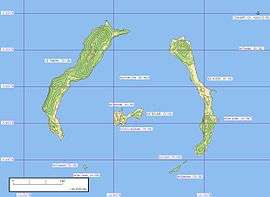
There are three main islands: Tamara (Fortoba), Kassa and Roume. Île de Corail, Île Blanche, Île Cabris, Île Poulet, Îlot Cabri and Îlot de la Bouteille are smaller islands and islets located in the southern half.[1]
Tamara
Tamara is home to the Île Tamara lighthouse. There was also a prison built on Tamara.
Roume
This island has also previously been known as Crawford Island, when under British rule. Roume is said to have inspired the novel Treasure Island.
Kassa
This island has also previously been known as Factory Island. The name is derived from the Portuguese word "casa".
History
The islands been inhabited for a long time and rose to prominence for their role in slave trade. In 1755 Miles Barber of the African Company of Liverpool established a factory there employing workers skilled in ship repair as well as pilots for the local rivers. This led to Kassa being known as "Factory Island".[3]
British possession (1818-1904)
Charles MacCarthy, the Governor of Sierra Leone signed a treaty with Mangé Demba whereby the islands were ceded to the British for the payment of an annual rent on 6 July 1818.[4] McCarthy then asked Peter Machlan, a surgeon with the 2nd West Indian Regiment to write an account of the islands and surrounding areas. This was published as Travels into the Baga and Soosoo country during the year 1821.[4]
Part of French Guinea (1904-1958)
Following a visit by Edward VII to France, and a return visit by President Loubet of France, a Franco-British agreement was reached by 7 April 1904: Îles de Los was handed over to France in exchange for France relinquishing fishing rights in Newfoundland and Labrador.[5] They were incorporated into French Guinea, one of the constituent parts of French West Africa on July 1904.[6] Scipio O'Connor was the first colonial administrator appointed by the French.[5]
References
- 1 2 "Îles de Los". Mapcarta. Retrieved 16 October 2016.
- ↑ "Baie de Sangareya". Mapcarta. Retrieved 16 October 2016.
- ↑ Mouser, Bruce (2002). A slaving voyage to Africa and Jamaica : the log of the Sandown, 1793 - 1794. Bloomington, Ind. [u.a.]: Indiana University Press. p. viii. ISBN 0253340772.
- 1 2 Machlan, Peter (1821). Travels into the Baga and Soosoo Countries in 1821. Freetown, Sierra leone: J. Mitton and co.
- 1 2 Diallo, Mamadou; Coquery-Vidrovitch, Catherine (2005). Répression et enfermement en Guinée : Le pénitencier de Fotoba et la prison centrale de Conakry de 1900 à 1958. Paris: L'Harmattan.
- ↑ "IV. La formation de la colonie de la Guinée française (1875-1904)". webguinee.net. Afriq Access & Tierno S. Bah. Retrieved 1 April 2016.
- Barb Rayner (29 July 2003). "Grand Manan to twin with African Islands". The Saint Croix Courier. Retrieved 2009-04-16.