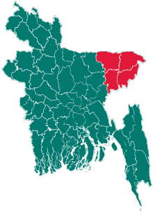
Madhabpur Upazila
| Madhabpur মাধবপুর | |
|---|---|
| Upazila | |
 Madhabpur Location in Bangladesh | |
| Coordinates: 24°6.2′N 91°17.5′E / 24.1033°N 91.2917°ECoordinates: 24°6.2′N 91°17.5′E / 24.1033°N 91.2917°E | |
| Country |
|
| Division | Sylhet Division |
| District | Habiganj District |
| Area | |
| • Total | 294.27 km2 (113.62 sq mi) |
| Population (1991) | |
| • Total | 250,069 |
| • Density | 850/km2 (2,200/sq mi) |
| Time zone | BST (UTC+6) |
| Website | Official Map of Madhabpur |
Madhabpur (Bengali: মাধবপুর) is an upazila of Habiganj District[1] in the Division of Sylhet, Bangladesh.
History
War at Teliapara Tea Garden
On 4 April 1971, during Bangladesh Liberation War the senior army officers assembled at the headquarters of 2nd East Bengal at Teliapara under this upazila area, a semi hilly area covered by tea gardens where General MAG Osmani, Lieutenant Colonel Abdur Rob, Lieutenant Colonel Salahuddin Mohammad Reja, Major Kazi Nuruzzaman, Major Khaled Mosharraf, Major Nurul Islam, Major Shafat Jamil, Major Mainul Hossain Chowdhury and others were present. In this meeting four senior commanders were entrusted with the responsibility of operational areas. Sylhet-Brahmanbaria area was placed under the command of Major Shafiullah, Comilla-Noakhali area was given to Major Khaled Mosharraf while Chittagong-Chittagong Hill Tracts was given to Major Ziaur Rahman and Kushtia-Jessore area was placed under command of Major Abu Osman Chowdhury. In the meeting the organization concept of the freedom fighter forces and the command structure were chalked out under the command of General MAG Osmani.[2]
Geography
Madhabpur is located at 24°06′10″N 91°17′30″E / 24.1028°N 91.2917°E . It has 44053 households and total area 294.27 km2 (114 sq mi).
Demographics
As of the 1991 Bangladesh census, Madhabpur has a population of 250069. Males constitute 50.72% of the population, and females 49.28%. This Upazila's eighteen up population is 122903. Madhabpur has an average literacy rate of 23.9% (7+ years), and the national average of 32.4% literate.[3]
Administration
Madhabpur has 1 Pourashava, 11 unions/wards, 181 mauzas/mahallas, and 269 villages.
Unions
- Dharmaghor
- Baghasura
- Bahara
- Nayapara
- Jagadispur
- Andiura
- Bulla
- Shahjahanpur
- Chatiyain
- Chowmohani
See also
References
- ↑ A.B.M Masud Laskar (2012), "Madhabpur Upazila", in Sirajul Islam and Ahmed A. Jamal, Banglapedia: National Encyclopedia of Bangladesh (Second ed.), Asiatic Society of Bangladesh
- ↑ Lieutenant General M Harun-Ar-Rashid, BP (16 December 2004), Victory Day Special: Attack on Kalachara, The Daily Star
- ↑ "Population Census Wing, BBS.". Archived from the original on 2005-03-27. Retrieved November 10, 2006.
