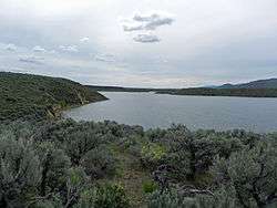
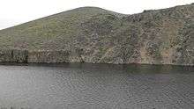
Magic Reservoir
| Magic Reservoir | |
|---|---|
 | |
| Location | Blaine and Camas counties, Idaho |
| Coordinates | 43°16′51″N 114°22′41″W / 43.28083°N 114.37806°WCoordinates: 43°16′51″N 114°22′41″W / 43.28083°N 114.37806°W[1] |
| Type | reservoir |
| Primary inflows | Big Wood River and Camas, Lava, Poison, and Rock creeks[2] |
| Primary outflows | Big Wood River |
| Basin countries | United States |
| Built | 1910 |
| Surface area | 14,000 acres (5,700 ha) |
| Water volume | 195,000 acre feet (241,000,000 m3) |
| Surface elevation | 4,800 feet (1,500 m) |
Magic Reservoir is a reservoir on the Big Wood River on the border of Blaine and Camas counties, Idaho. However, most of the reservoir is located in Blaine County. The reservoir and surrounding Bureau of Land Management land offers opportunities for boating, fishing, camping, and hunting, among other activities. The reservoir is impounded by Magic Dam, which was built in 1910.[3][4]
References
- ↑ "January 23, 2013". Geographic Names Information System. United States Geological Survey.
- ↑ Idaho: Fairfield (Map). 1:100,000. Bureau of Land Management. 2009. ISBN 978-1-4113-2446-6.
- ↑ "Magic Reservoir". All Trips Sun Valley Idaho. Retrieved January 23, 2013.
- ↑ "Magic Reservoir". Idaho Fish and Game Department. Retrieved January 23, 2013.
This article is issued from Wikipedia - version of the 12/21/2015. The text is available under the Creative Commons Attribution/Share Alike but additional terms may apply for the media files.