Mahavanona
| Mahavanona | |
|---|---|
|
crossing Mahavanona | |
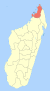
 Mahavanona Location in Madagascar | |
| Coordinates: 12°27′S 49°22′E / 12.450°S 49.367°E | |
| Country |
|
| Region | Diana |
| District | Antsiranana II |
| Elevation[1] | 115 m (377 ft) |
| Population (2001)[2] | |
| • Total | 12,075 |
| Time zone | EAT (UTC3) |
.jpg)
Mahavanona is a town and commune (Malagasy: kaominina) in Madagascar. It belongs to the district of Antsiranana II, which is a part of Diana Region. It is located at the Besokatra River on the Route nationale 6 between Antsiranana and Anivorano Nord.
According to 2001 commune census the population of Mahavanona was 12,075.[2]
Primary and junior level secondary education are available in town. The majority 52% of the population are farmers, while an additional 46% receives their livelihood from raising livestock. The most important crop is rice, while other important products are bananas and maize. Services provide employment for 1% of the population. Additionally fishing employs 1% of the population.[2]
References and notes
- ↑ Estimated based on DEM data from Shuttle Radar Topography Mission
- 1 2 3 "ILO census data". Cornell University. 2002. Retrieved 2008-02-13.
| Ambanja |
|  |
|---|---|---|
| Ambilobe | ||
| Antsiranana I | ||
| Antsiranana II | ||
| Nosy Be | ||
Coordinates: 12°27′S 49°22′E / 12.450°S 49.367°E