Mandritsara District
Not to be confused with Mandritsara, the Malagasy commune with same name.
| Mandritsara District | |
|---|---|
| District | |
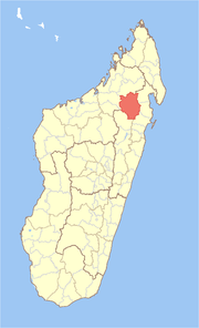 Location in Madagascar | |
| Coordinates: 16°18′S 48°59′E / 16.300°S 48.983°E | |
| Country |
|
| Region | Sofia |
| Area[1] | |
| • Total | 10,512 km2 (4,059 sq mi) |
| Population (2001) | |
| • Total | 204,503 |
| • Density | 19.5/km2 (51/sq mi) |
| • Ethnicities | Tsimihety |
| Time zone | EAT (UTC3) |
Mandritsara is a district in northern Madagascar. It is a part of Sofia Region and borders the districts of Befandriana-Nord in north, Maroantsetra in northeast, Mananara in east, Soanierana Ivongo in southeast, Andilamena in south and Boriziny (Port-Bergé) in west. The area is 10,512 km2 (4,059 sq mi) and the population was estimated to be 204,503 in 2001.[1]
The district is further divided into 22 communes.
References and notes
- 1 2 "Madagascar Administrative units". Retrieved 2008-02-28.
Coordinates: 16°18′S 48°59′E / 16.300°S 48.983°E
| Analalava |  | |
|---|---|---|
| Antsohihy | ||
| Bealanana | ||
| Befandriana-Nord | ||
| Boriziny (Port-Bergé) |
| |
| Mampikony | ||
| Mandritsara | ||
This article is issued from Wikipedia - version of the 4/22/2015. The text is available under the Creative Commons Attribution/Share Alike but additional terms may apply for the media files.