Manod Mawr
| Manod Mawr | |
|---|---|
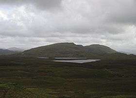
 Manod Mawr North Top and Manod Mawr from Moel Penamnen | |
| Highest point | |
| Elevation | 661 m (2,169 ft) |
| Prominence | 266 m (873 ft) |
| Parent peak | Arenig Fach |
| Listing | Marilyn, Hewitt, Nuttall |
| Naming | |
| Translation | great snowdrift (Welsh) |
| Pronunciation | Welsh: [ˈmanɔd ˈmaur] |
| Geography | |
| Location | Gwynedd, Wales |
| Parent range | Moelwynion |
| OS grid | SH723446 |
| Topo map | OS Landranger 124 |
| Listed summits of Manod Mawr | ||||
| Name | Grid ref | Height | Status | |
|---|---|---|---|---|
| Manod Mawr North Top | 658 m (2,159 ft) | Hewitt, Nuttall | ||
| Moel Penamnen | 623 m (2,044 ft) | Hewitt, Nuttall | ||
Manod Mawr is a mountain in North Wales and forms part of the Moelwynion.
Although known as a mountain in the eastern Moelwyns, it and its sister peaks are sometimes known as the Ffestiniog hills.
Manod Mawr is a mountain which has been extensively quarried. The recently closed Graig Ddu Quarry is to be found on the 600-metre (2,000 ft) contour, in the hollow between Manod Mawr's summit and Manod Mawr North Top. Manod Mawr's summit is in the exclusion zone of the Snowdonia National Park around Blaenau Ffestiniog, while Manod Mawr North Top's summit only just misses out on the national park's protection. There were fears the quarry would eventually remove the North Top.[1]
References
- ↑ Nuttall, John & Anne (1999). The Mountains of England & Wales - Volume 1: Wales (2nd edition ed.). Milnthorpe, Cumbria: Cicerone. ISBN 1-85284-304-7.
External links
Coordinates: 52°59′01″N 3°54′13″W / 52.98348°N 3.90360°W
This article is issued from Wikipedia - version of the 10/10/2013. The text is available under the Creative Commons Attribution/Share Alike but additional terms may apply for the media files.