Marys River Peak
| Marys River Peak | |
|---|---|
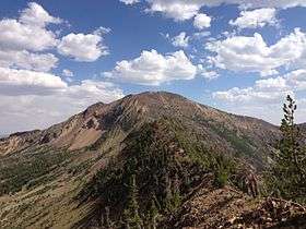 View of Marys River Peak from Emerald Lake Pass | |
| Highest point | |
| Elevation | 10,575 ft (3,223 m) [1] |
| Prominence | 730 ft (223 m) [1] |
| Coordinates | 41°45′34″N 115°21′43″W / 41.7593523°N 115.3620103°WCoordinates: 41°45′34″N 115°21′43″W / 41.7593523°N 115.3620103°W [2] |
| Geography | |
 Marys River Peak Nevada, U.S. | |
| Location | Elko County, Nevada, U.S. |
| Topo map | USGS Gods Pocket Peak |
Marys River Peak is the highest mountain in the Marys River Range of northern Elko County, Nevada, United States.[1] It is located within the Jarbidge Wilderness, which is administered by the Jarbidge Ranger District of the Humboldt-Toiyabe National Forest. The peak's name is derived from the Marys River, a tributary of the Humboldt.
Summit panorama

360-degree panorama from the summit of Marys River Peak
References
- 1 2 3 "Marys River Peak". Peakbagger.com. Retrieved 2014-01-28.
- ↑ "Marys River Peak". Geographic Names Information System. United States Geological Survey. Retrieved 2014-01-28.
| Wikimedia Commons has media related to Marys River Peak. |
This article is issued from Wikipedia - version of the 8/24/2016. The text is available under the Creative Commons Attribution/Share Alike but additional terms may apply for the media files.