Route 114A (Rhode Island–Massachusetts)
| |||||||
|---|---|---|---|---|---|---|---|
| Route information | |||||||
| Length: |
3.4 mi (5.5 km) RI: 0.4 mi (0.6 km) MA: 3.0 mi (4.8 km) | ||||||
| Existed: | c. 1960s – present | ||||||
| Major junctions | |||||||
| South end: |
| ||||||
|
| |||||||
| North end: |
| ||||||
| Location | |||||||
| States: | Rhode Island, Massachusetts | ||||||
| Counties: | RI: Providence, MA: Bristol | ||||||
| Highway system | |||||||
| |||||||


Route 114A is an alternate state route to Rhode Island Route 114, located along the Massachusetts – Rhode Island border in East Providence, RI and Seekonk, MA. The road begins and ends within East Providence in Rhode Island at Route 114. Most of the road, however, is located within Seekonk in Massachusetts.
Route description
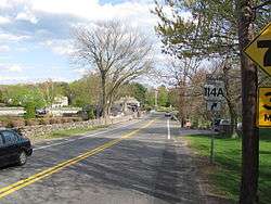
Route 114A begins as Mink Road at an intersection with Route 114 in East Providence. It crosses into the Massachusetts town of Seekonk after 0.1 miles (0.16 km) and continues north as Mink Street then Fall River Avenue through Seekonk center. Route 114A continues north back into Rhode Island, where it ends back at Route 114, which is overlapped with U.S. Route 1A (US 1A) at this point in East Providence.
This is the only instance in Massachusetts of an "A" or "alternate" route carrying the numerics for a highway signed in another state, as Massachusetts Route 114 is over 50 miles (80 km) away, running between Lawrence and Marblehead. Three other such instances of this exist in New England. One is in New Hampshire, where New Hampshire Route 113B is actually a loop off Maine State Route 113. The other two are in Vermont, where Vermont Route 10A is a continuation of New Hampshire Route 10A, a loop off New Hampshire Route 10; and Vermont Route 22A is a continuation of New York Route 22A, a spur off New York Route 22.
History
Route 114A was not commissioned until some time in the 1960s.
Major intersections
| State | County | Location | mi[1] | km | Destinations | Notes |
|---|---|---|---|---|---|---|
| Rhode Island | Providence | East Providence | 0.0 | 0.0 | Southern terminus of Route 114A | |
| RI–MA border | 0.1 0.0 | 0.16 0.0 | Rhode Island–Massachusetts state line | |||
| Massachusetts | Bristol | Seekonk | 0.4– 0.5 | 0.64– 0.80 | Brief concurrency between the two routes | |
| 0.9 | 1.4 | Exit 1 on I-195 | ||||
| 2.7 | 4.3 | |||||
| MA–RI border | 3.0 0.1 | 4.8 0.16 | Massachusetts–Rhode Island state line | |||
| Rhode Island | Providence | East Providence | 0.4 | 0.64 | Northern terminus of Route 114A | |
1.000 mi = 1.609 km; 1.000 km = 0.621 mi
| ||||||
References
- ↑ Google (December 30, 2013). "Route 114A (Rhode Island–Massachusetts)" (Map). Google Maps. Google. Retrieved December 30, 2013.