Mehammarsåta
| Mehammarsåta | |
|---|---|
|
Mehammarsåto Midhamarsåta | |
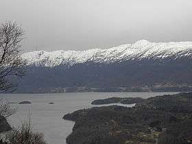 Mehammarsåta (tallest peak to the right), seen from Tysnes | |
| Highest point | |
| Elevation | 749 m (2,457 ft) |
| Prominence | 749.0 metres (2,457.3 ft) |
| Isolation | 16.68 kilometres (10.36 mi) |
| Coordinates | 59°53′50″N 05°27′52″E / 59.89722°N 5.46444°ECoordinates: 59°53′50″N 05°27′52″E / 59.89722°N 5.46444°E |
| Geography | |
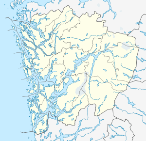 Mehammarsåta Location in Hordaland | |
| Location | Hordaland, Norway |
Mehammarsåta or Midhamarsåta is the highest mountain on the island of Stord in the municipality of Stord in Hordaland county, Norway. The 749-metre (2,457 ft) tall mountain lies in the northeastern part of the municipality, just south of the municipal border with Fitjar.[1]
References
- ↑ "Mehammarsåta, Stord (Hordaland)" (in Norwegian). yr.no. Retrieved 2015-02-02.
This article is issued from Wikipedia - version of the 12/6/2015. The text is available under the Creative Commons Attribution/Share Alike but additional terms may apply for the media files.