Michael Army Airfield
| Michael Army Airfield Dugway Army Airfield | |||||||||||
|---|---|---|---|---|---|---|---|---|---|---|---|
|
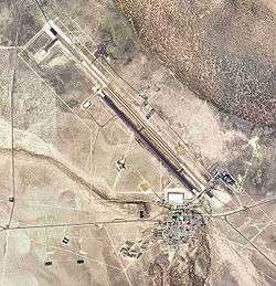
2006 USGS Photo | |||||||||||
| IATA: DPG – ICAO: KDPG – FAA LID: DPG | |||||||||||
| Summary | |||||||||||
| Airport type | Military: Army Airfield | ||||||||||
| Operator | United States Army | ||||||||||
| Serves | Dugway Proving Ground | ||||||||||
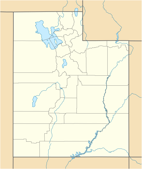
| Location | Dugway, Utah | ||||||||||
| Built | 1951 | ||||||||||
| Elevation AMSL | 4,349 ft / 1,326 m | ||||||||||
| Coordinates | 40°11′58″N 112°56′15″W / 40.19944°N 112.93750°W | ||||||||||
| Map | |||||||||||
 KDPG Location of Michael Army Airfield | |||||||||||
| Runways | |||||||||||
| |||||||||||
|
Sources: Federal Aviation Administration[1] | |||||||||||
Michael Army Airfield (IATA: DPG, ICAO: KDPG, FAA LID: DPG) is a military airport located at the Dugway Proving Ground and owned by the United States Army. It is nine miles (14 km) west of the proving grounds baracks at Dugway, Tooele County, Utah, United States.
Overview
Michael Army Airfield (MAAF) is located in a secluded, distant location and the secretive nature of its missions are generally undisclosed by the Army. Built by the Army during World War II, as Dugway Army Airfield, the facility is located in the Dugway Proving Ground which is one of the Army's main facilities for developing defenses against biological and chemical attacks. Workers at Dugway test defense gear to make sure they can survive nuclear, biological and chemical attacks.
MAAF is located just south of Hill Air Force Base's massive Utah Test and Training Range, where F-16 Falcon fighters from Hill train in air-to-air combat and the Air Force tests cruise missiles, and is used occasionally by the Air Force as an emergency landing field.
It has been called the "new Area 51" by some, with the Dugway Proving Ground serving as a buffer zone, as the Nevada Test Site served for Groom Lake.
Projects
In the 1990s, MAAF was associated with the NASA X-38 Crew Return Vehicle (CRV) program, for the International Space Station. That program, however, was canceled in 2002 due to budget cuts.
One frequently rumored test project is the Lockheed Martin X-33.[2] It is undetermined if MAAF will be used in association with the Boeing X-37 Advanced Technology Demonstrator, the military derivative of the X-38, a classified project which was transferred from NASA to the Defense Advanced Research Projects Agency on 13 September 2004.
In 2009, it was announced that Michael AAF will be used for the development and testing of Unmanned Aircraft Systems (UAS), which are sent overseas to provide soldiers with an aerial view - via video feed - of combat situations.[3]
Facilities
Michael AAF previously had a 13,125-foot (4,000 m) runway which was in poor condition.[4][5] An FAA airport diagram effective January 2008 shows a 7,000 by 150-foot (46 m) runway (12/30) open parallel to the prior runway,[6] but the diagram effective February 2009 shows a new 11,000 by 150-foot (46 m) runway is open in place of the original runway.[7]
See also
References
- ↑ FAA Airport Master Record for DPG (Form 5010 PDF), effective 2007-12-20
- ↑ Wilson, Jim (June 1997). "The new 'Area 51.' U.S. Air Force moves its top-secret test site". Popular Mechanics 174 (6): 54. ISSN 0032-4558.
- ↑ Drones Take Flight at Dungway
- ↑ "Michael AAF in Need of a New Runway" (PDF). Transportation News. U.S. Army Corps of Engineers. Sep 2001.
- ↑ Army Airfield (MAAF) at GlobalSecurity.org
- ↑ FAA airport diagram, effective 17 January 2008
- ↑ FAA airport diagram, effective 14 February 2008
External links
- Pappalardo, Joe (October 2009). New Area 51: Mojave's Desert Outpost Holds Space Flight's Future. Popular Mechanics.
- FAA Airport Diagram (PDF), effective December 8, 2016
- FAA Terminal Procedures for DPG, effective December 8, 2016
- Resources for this U.S. military airport:
- FAA airport information for DPG
- AirNav airport information for KDPG
- ASN accident history for DPG
- NOAA/NWS latest weather observations
- SkyVector aeronautical chart for KDPG