Minam River
| Minam River | |
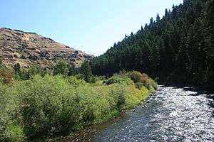 Minam River near its confluence with the Wallowa River | |
| Country | United States |
|---|---|
| State | Oregon |
| County | Union and Wallowa |
| Source | Eagle Cap Wilderness |
| - location | Wallowa–Whitman National Forest, Union County |
| - elevation | 7,684 ft (2,342 m) [1] |
| - coordinates | 45°10′07″N 117°21′28″W / 45.16861°N 117.35778°W [2] |
| Mouth | Wallowa River |
| - location | Minam, Wallowa County |
| - elevation | 2,536 ft (773 m) [2] |
| - coordinates | 45°37′17″N 117°43′14″W / 45.62139°N 117.72056°WCoordinates: 45°37′17″N 117°43′14″W / 45.62139°N 117.72056°W [2] |
| Length | 51 mi (82 km) [3] |
| Basin | 239 sq mi (619 km2) [4] |
| Discharge | |
| - average | 455 cu ft/s (13 m3/s) [5] |
 Location of the mouth of the Minam River in Oregon | |
The Minam River is a tributary of the Wallowa River, 51 miles (82 km) long,[3] in northeastern Oregon in the United States. It drains a rugged wilderness area of the Wallowa Mountains northeast of La Grande.
It rises in the Wallowas in the Eagle Cap Wilderness of the Wallowa–Whitman National Forest, just south of the Wallowa–Union border approximately 25 miles (40 km) southeast of La Grande at Blue Lake. It flows generally northwest through the mountains along the Wallowa–Union county line. It joins the Wallowa from the south at the community of Minam near Oregon Route 82.[6] Its headwaters include springs stemming from outflow from Minam Lake,[7] also the source of the Lostine River.[8]
From its headwaters to the Eagle Cap Wilderness boundary downstream of Cougar Creek, a distance of 39 miles (63 km), the Minam River was declared part of the National Wild and Scenic Rivers System in 1988. Accessible mainly by United States Forest Service trails, the river basin supports diverse wildlife, including wolverine, bighorn sheep, elk, American black bear, and cougar.[7]
The Minam, except for the lower 8 miles (13 km), where the surrounds have been heavily logged and otherwise altered, is largely pristine. It and the Wenaha River are the two largest rivers in Oregon that are nearly pristine.[5]
| point | geolocation | USGS map |
|---|---|---|
| mouth at Wallowa River | 45°37′17″N 117°43′14″W / 45.621256°N 117.720478°W | Minam |
| GNIS point 2, RM 10.1 | 45°30′00″N 117°41′07″W / 45.499866°N 117.685198°W | Mount Moriah |
| GNIS point 3 | 45°22′29″N 117°39′09″W / 45.374586°N 117.652424°W | Mount Fanny |
| GNIS point 4 | 45°20′51″N 117°37′34″W / 45.347364°N 117.626036°W | Jim White Ridge |
| GNIS point 5 | 45°15′00″N 117°31′46″W / 45.249867°N 117.529373°W | China Cap |
| GNIS point 6, RM 33.8 | 45°12′40″N 117°30′03″W / 45.210980°N 117.500761°W | Steamboat Lake |
| Blue Lake source RM 46 | 45°10′07″N 117°21′28″W / 45.168485°N 117.357688°W | Eagle Cap |
Tributaries
From source to mouth, the named tributaries of the Minam River are Pop and Trail creeks, which enter from the left; Lowry Gulch, left; Wild Sheep Creek, right; Granite Gulch, right; Elk Creek, left; and Last Chance Gulch, right. Then Cap, Rock, and Lackey creeks, all from the left; Pole Creek, right, Pot Creek, left; North Minam River, right, and Little Pot and Jerry creeks, left.[9]
Then Threemile, Garwood, Whoopee, Chaparral, Wallowa, Horseheaven, and Horse Basin creeks, all from the right; the Little Minam River, left; Faun Creek, right, and Lobo and Eagle creeks, left. Then Murphy, Trout, Cougar, Gunderson, and Squaw creeks, all from the right.[9]
See also
References
- ↑ Source elevation derived from Google Earth search using GNIS source coordinates.
- 1 2 3 "Minam River". Geographic Names Information System (GNIS). United States Geological Survey. November 28, 1980. Retrieved September 28, 2011.
- 1 2 "The National Map: National Hydrography Dataset". United States Geological Survey. Retrieved May 3, 2011.
- ↑ "Minam River Spring Chinook Population" (PDF). Northwest Fisheries Science Center of the National Oceanic and Atmospheric Administration. p. 2. Retrieved August 17, 2010.
- 1 2 Palmer, Tim (2014). Field Guide to Oregon Rivers. Corvallis: Oregon State University Press. p. 289–90. ISBN 978-0-87071-627-0.
- ↑ Oregon Atlas & Gazeteer. Freeport, Maine: DeLorme Mapping. 1991. p. 87. ISBN 0-89933-235-8.
- 1 2 "National Wild and Scenic Rivers: Minam River, Oregon". United States Forest Service. August 18, 2011. Retrieved December 24, 2015.
- ↑ "Lostine River, Oregon". National Wild and Scenic Rivers System. Retrieved December 12, 2012.
- 1 2 "United States Topographic Map". United States Geological Survey. Retrieved December 23, 2015 – via Acme Mapper.