Mishodaghi Mount
| Mishoodaghi | |
|---|---|
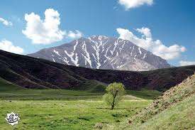 Mishoodaghi and its foothills in spring. | |
| Highest point | |
| Elevation |
2,855 m (9,367 ft) 2,855 m (9,367 ft) |
| Coordinates | 38°19′33″N 45°37′14″E / 38.32583°N 45.62056°ECoordinates: 38°19′33″N 45°37′14″E / 38.32583°N 45.62056°E |
| Geography | |
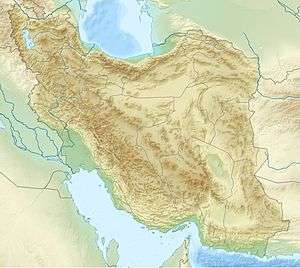 Mishoodaghi Iran | |
| Location | East Azerbaijan, Iran |
Mishoodaghi Mount is a mountain range in East Azerbaijan Province of Iran. It is located between Tasouj, Marand, and Shabestar cities. Mishodaghi peak has several peaks including: Ali-Alamdar (highest peak 2855 m), Falak daghi, Kooseh-Baba, and Uzoun-Bel.[1] Yam Ski Resort is located in northern foot hills of Mishodaghi.[2]
Mishoodaghi has a diverse wild life. Since 2007 it is considered protected area by Department of Environmental of Iran.
The best access route to Mishoodaghi is Road 32 (Iran) in between Tabriz-Marand. This road passes through north eastern hills of Mishoodaghi.
References
This article is issued from Wikipedia - version of the 8/30/2016. The text is available under the Creative Commons Attribution/Share Alike but additional terms may apply for the media files.