Missouri Route 265
| ||||
|---|---|---|---|---|
| Route information | ||||
| Maintained by MoDOT | ||||
| Length: | 66 mi (106 km) | |||
| Major junctions | ||||
| South end: |
| |||
| North end: |
| |||
| Highway system | ||||
| ||||

Route 265 is a highway in southwest Missouri. Its northern terminus is at Interstate 44 in Mount Vernon; its southern terminus is at U.S. Route 65 (for which it was numbered after) south of Branson. Much of the highway is concurrent with other routes (including Route 39, U.S. Route 60, Route 413, Route 13, Route 76, and Route 165). It is also known as the Ozark Mountain Parkway.
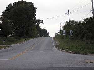
Route 265 east of Marionville at its junction with Route 413. This three mile section is one of 3 short sections of the highway not concurrent with another highway, the other two being 5.6 miles from Route 76 to Route 165, near Table Rock Dam, and 3.2 miles from Route 165 to US 65 at its Southern terminus.
This article is issued from Wikipedia - version of the 6/20/2010. The text is available under the Creative Commons Attribution/Share Alike but additional terms may apply for the media files.