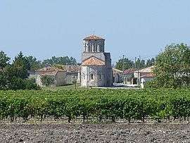
Moings
| Moings | |
|---|---|
 | |
 Moings | |
|
Location within Nouvelle-Aquitaine region  Moings | |
| Coordinates: 45°28′46″N 0°21′35″W / 45.4794°N 0.3597°WCoordinates: 45°28′46″N 0°21′35″W / 45.4794°N 0.3597°W | |
| Country | France |
| Region | Nouvelle-Aquitaine |
| Department | Charente-Maritime |
| Arrondissement | Jonzac |
| Canton | Jonzac |
| Government | |
| • Mayor (2008–2014) | Patrick Berthelot |
| Area1 | 7.57 km2 (2.92 sq mi) |
| Population (2008)2 | 173 |
| • Density | 23/km2 (59/sq mi) |
| Time zone | CET (UTC+1) |
| • Summer (DST) | CEST (UTC+2) |
| INSEE/Postal code | 17238 / 17500 |
| Elevation | 32–68 m (105–223 ft) |
|
1 French Land Register data, which excludes lakes, ponds, glaciers > 1 km² (0.386 sq mi or 247 acres) and river estuaries. 2 Population without double counting: residents of multiple communes (e.g., students and military personnel) only counted once. | |
Moings is a former commune in the Charente-Maritime department in southwestern France. On 1 January 2016, it was merged into the new commune Réaux-sur-Trèfle.[1]
Population
| Historical population | ||
|---|---|---|
| Year | Pop. | ±% |
| 1962 | 191 | — |
| 1968 | 225 | +17.8% |
| 1975 | 211 | −6.2% |
| 1982 | 203 | −3.8% |
| 1990 | 186 | −8.4% |
| 1999 | 176 | −5.4% |
| 2008 | 173 | −1.7% |
See also
References
- ↑ Arrêté préfectoral 6 July 2015 (French)
| Wikimedia Commons has media related to Moings. |
This article is issued from Wikipedia - version of the 11/19/2016. The text is available under the Creative Commons Attribution/Share Alike but additional terms may apply for the media files.