Moriyama-Jieitai-Mae Station
Moriyama-Jieitai-Mae Station 守山自衛隊前駅 | |
|---|---|
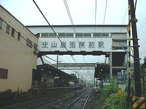 Moriyama-Jieitai-Mae Station overpass | |
| Location |
Nijakenya 5-7, Moriyama, Nagoya, Aichi (名古屋市守山区廿軒家5-7) Japan |
| Operated by | Meitetsu |
| Line(s) | Meitetsu Seto Line |
| History | |
| Opened | 1905 |
| Previous names | Moriyamashi (until 1966) |
| Traffic | |
| Passengers (2009) | 1,088 daily |
Moriyama-Jieitai-Mae Station (守山自衛隊前駅 Moriyama-Jieitai-Mae-eki) is a railway station operated by Meitetsu's Seto Line located in Moriyama-ku, Nagoya, Aichi Prefecture, Japan. It is located 7.0 rail kilometers from terminus of the line at Sakaemachi Station.[1] This station provides access to Camp Moriyama, part of the Japan Ground Self Defence Force Tenth Division, which is responsible for Aichi and surrounding prefectures.
Passengers may transfer to Moriyama Station on the Yutorito Line.
History
Moriyama-Jieitai-Mae Station was opened on April 2, 1905, as Rentai -Mae Station (聯隊前駅 Rentai-Mae-eki) on the privately operated Seto Electric Railway. It was named after its location in front of an Imperial Japanese Army base occupied by the IJA 33rd Infantry Regiment of the IJA 3r d Division. The Seto Electric Railway was absorbed into the Meitetsu group on September 1, 1939, and the station was renamed Nijakenya Station (二十軒家駅 Nijakenya-eki) on February 10, 1941, for security reasons. It was again renamed to Moriyama-machi Station (守山町 Moriyama-machi-eki) on June 1, 1946, and Moriyama-shi Station (守山市 Moriyama-shi-eki) on February 1, 1955. It assumed its present name on March 15, 1966. A new station building was completed on March 24, 1984. The station has been unattended after August 2006. The Tranpass system of magnetic fare cards with automatic turnstiles was implemented in 2012.
Lines
Layout
Moriyama-Jieitai-Mae Station has two opposed side platforms. The station is unattended.
Platforms
| 1 | ■ Meitetsu Seto Line | For Owari Seto |
| 2 | ■ Meitetsu Seto Line | For Ōzone and Sakaemachi |
Adjacent stations
| « | Service | » | ||
|---|---|---|---|---|
| Nagoya Railroad | ||||
| Seto Line | ||||
| Express: Does not stop at this station | ||||
| Local Express: Does not stop at this station | ||||
| Yada | Local | Hyōtan-yama | ||
External links
- (Japanese) Meitetsu Station information
Notes
- ↑ 守山自衛隊前 [Moriyama-Jieitai-Mae] (in Japanese). Nagoya Railroad. Retrieved 29 November 2010.
Coordinates: 35°11′47″N 136°57′28″E / 35.1964°N 136.9578°E