Mount Alf
Location of Sentinel Range in Western Antarctica.

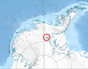
Northern Sentinel Range map.
Mount Alf (77°55′S 86°07′W / 77.917°S 86.117°WCoordinates: 77°55′S 86°07′W / 77.917°S 86.117°W) is a mountain rising over 3,200 m between Mount Sharp and Mount Dalrymple in the north part of the Sentinel Range, Antarctica. It surmounts Sabazios Glacier to the northeast.
The mountain was mapped by the Marie Byrd Land Traverse party, 1957-58. Named by the Advisory Committee on Antarctic Names (US-ACAN) for Edward A. Alf, meteorologist, member of the 1957 wintering party at Byrd Station.[1]
References
- ↑ "Mount Alf". Geographic Names Information System. United States Geological Survey. Retrieved 2010-11-11.
![]() This article incorporates public domain material from the United States Geological Survey document "Mount Alf" (content from the Geographic Names Information System).
This article incorporates public domain material from the United States Geological Survey document "Mount Alf" (content from the Geographic Names Information System).
This article is issued from Wikipedia - version of the 11/12/2015. The text is available under the Creative Commons Attribution/Share Alike but additional terms may apply for the media files.