Mount Bearskin
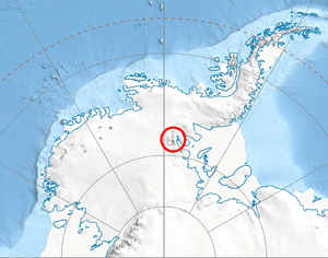
Mount Bearskin (78°20′S 85°37′W / 78.333°S 85.617°WCoordinates: 78°20′S 85°37′W / 78.333°S 85.617°W) is a mountain (2,850 m) located 5 nautical miles (9 km) northeast of Mount Tyree, between Patton and Crosswell Glaciers, in the Sentinel Range, Ellsworth Mountains. It is linked to Tyree Ridge by Podgore Saddle.
The mountain was mapped by the United States Geological Survey (USGS) from surveys and U.S. Navy air photos, 1957-59. It was named by the Advisory Committee on Antarctic Names (US-ACAN) for Captain Leland S. Bearskin of the United States Air Force (USAF), who participated in establishing the IGY South Pole Station in the 1956-57 season.
Maps
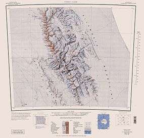
- Vinson Massif. Scale 1:250 000 topographic map. Reston, Virginia: US Geological Survey, 1988.
![]() This article incorporates public domain material from the United States Geological Survey document "Mount Bearskin" (content from the Geographic Names Information System).
This article incorporates public domain material from the United States Geological Survey document "Mount Bearskin" (content from the Geographic Names Information System).