Mount Lewis (Nevada)
| Mount Lewis | |
|---|---|
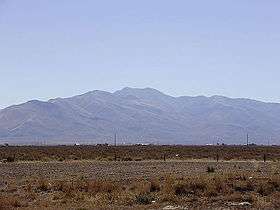 View of Mount Lewis from Interstate 80 near Battle Mountain | |
| Highest point | |
| Elevation | 9,678 ft (2,950 m) NAVD 88[1] |
| Prominence | 4,280 ft (1,305 m) [2] |
| Coordinates | 40°24′12″N 116°51′41″W / 40.403405°N 116.861459°WCoordinates: 40°24′12″N 116°51′41″W / 40.403405°N 116.861459°W [1] |
| Geography | |
 Mount Lewis Nevada, U.S. | |
| Location | Lander County, Nevada, U.S. |
| Parent range | Shoshone Range |
| Topo map | USGS MT LEWIS |
| Climbing | |
| Easiest route | A well-maintained gravel road ascends directly to the summit[3] |
Mount Lewis is the highest peak in the Shoshone Range in Lander County, Nevada, United States. It is the most topographically prominent peak in Lander County and the twentieth-most prominent peak in Nevada.[4] The peak is located about 14 miles southeast of the town of Battle Mountain.[1] An FAA Long Range Air Route Surveillance Radar station is located just west of the summit.[5] The peak is on public land administered by the Bureau of Land Management and thus has no access restrictions.
Summit panorama
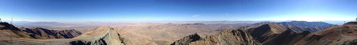
360-degree panorama from the summit of Mount Lewis
References
- 1 2 3 "MT LEWIS". NGS data sheet. U.S. National Geodetic Survey. Retrieved 2014-10-12.
- ↑ "Mount Lewis, Nevada". Peakbagger.com. Retrieved 2014-10-12.
- ↑ "Mount Lewis". SummitPost.org.
- ↑ "Nevada Peaks with 2000 feet of Prominence". Peakbagger.com. Retrieved 2014-10-23.
- ↑ "Air Defense Radar Stations - Information for Battle Mountain, NV (FAA site)". Radomes, Inc. Retrieved 2014-10-12.
| Wikimedia Commons has media related to Mount Lewis (Nevada). |
This article is issued from Wikipedia - version of the 8/24/2016. The text is available under the Creative Commons Attribution/Share Alike but additional terms may apply for the media files.