Mount Mullen
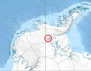
Mount Mullen is a double-peaked mountain 4.0 kilometres (2.5 mi) east-southeast of Mount Milton in the south Sentinel Range of the Ellsworth Mountains, Antarctica. Located at the west extremity of Petvar Heights, the mountain rises to an elevation of 2,400 metres (7,900 ft) and together with Kasilag Pass forms the divide between Kornicker Glacier and Wessbecher Glacier.
The feature was named by US-ACAN in 2006, after Roy R. Mullen, a former employee of the USGS (1960–95, associate chief of the National Mapping Division with responsibility for Antarctic activities 1980–95, USGS representative to SCAR).
Maps
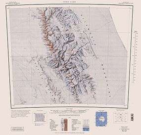
- Vinson Massif. Scale 1:250 000 topographic map. Reston, Virginia: US Geological Survey, 1988.
October 20, 1951-Entered USGS NOT 1960-Primary Source
References
- Mount Mullen. SCAR Composite Antarctic Gazetteer.
![]() This article incorporates public domain material from the United States Geological Survey document "Mount Mullen" (content from the Geographic Names Information System).
This article incorporates public domain material from the United States Geological Survey document "Mount Mullen" (content from the Geographic Names Information System).
Coordinates: 78°46′55″S 84°45′44″W / 78.78194°S 84.76222°W