Mount Peary
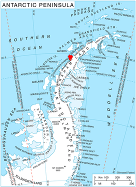
Mount Peary (65°15′S 63°52′W / 65.250°S 63.867°WCoordinates: 65°15′S 63°52′W / 65.250°S 63.867°W) is a conspicuous massif, 1,900 m, with a flat, snow-covered summit several miles in extent, surmounted by a marginal peak on the west, standing 7 nautical miles (13 km) east-northeast of Cape Tuxen and dominating the area between Wiggins and Bussey Glaciers on Kiev Peninsula in Graham Land. Discovered by the French Antarctic Expedition, 1908–10, under Charcot and named by him for R. Admiral Robert E. Peary, U.S. Navy, American Arctic explorer and first to attain the North Pole, in 1909.
References
![]() This article incorporates public domain material from the United States Geological Survey document "Mount Peary" (content from the Geographic Names Information System).
This article incorporates public domain material from the United States Geological Survey document "Mount Peary" (content from the Geographic Names Information System).