Mount Shakka
| Mount Shakka | |
|---|---|
| 釈迦ヶ岳 | |
 Mount Shakka (November 2008) | |
| Highest point | |
| Elevation | 1,799.6 m (5,904 ft) |
| Listing | List of mountains and hills of Japan by height |
| Coordinates | 34°06′51″N 135°54′11″E / 34.11417°N 135.90306°ECoordinates: 34°06′51″N 135°54′11″E / 34.11417°N 135.90306°E |
| Geography | |
 Mount Shakka | |
| Parent range | Ōmine Mountains |
| Topo map |
Geographical Survey Institute 25000:1 釈迦ヶ岳 50000:1 和歌山 |
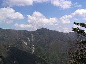
Mount Shakka (釈迦ヶ岳 Shakka-ga-take) is a mountain in the Ōmine Mountains. It marks part of the border between Totsukawa and Shimokitayama in Yoshino District of Nara Prefecture.
References
This article is issued from Wikipedia - version of the 12/7/2015. The text is available under the Creative Commons Attribution/Share Alike but additional terms may apply for the media files.