Mowanjum Community
| Mowanjum Western Australia | |||||||
|---|---|---|---|---|---|---|---|
 Mowanjum | |||||||
| Coordinates | 17°21′22″S 123°42′04″E / 17.356°S 123.701°ECoordinates: 17°21′22″S 123°42′04″E / 17.356°S 123.701°E | ||||||
| Population | 295 (2011)[1] | ||||||
| Location | 10 km (6 mi) south east of Derby, Western Australia | ||||||
| LGA(s) | Shire of Derby-West Kimberley | ||||||
| State electorate(s) | Kimberley | ||||||
| Federal Division(s) | Durack | ||||||
| |||||||
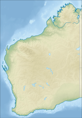
Mowanjum is a medium-sized Aboriginal community, located 10 km south east of Derby in the Kimberley region of Western Australia, within the Shire of Derby-West Kimberley. At the 2011 census, Mowanjum had a population of 295.[1]
History
The Mowanjum Community began as a mission of the Presbyterian Church 1912. It was originally known as the Port George IV mission and a few years later as Kunmunya. The mission was located in the very isolated and rugged North West Kimberley coast of Western Australia. In 1951 this mission was moved south to Wotjulum near Yampi Sound and finally to the outskirts of Derby near the airport in 1956. The name Mowanjum was inscribed in the Derby marsh in 1956 by David Mowaljarlai. It means "settled" or "on firm ground. The 3 men attributed to founding the Mowanjum Community are Albert Barunga, Alan Mungulu and David Mowaljarlai. The community was again shifted in 1975 to its present site 10 km east of Derby following government requirements for additional land for the Derby Airport.
Strong links to traditional country have been preserved and the numerous outstations, including Pantijan, Kunmunya, Dodnun and Yallon etc. are directly linked to both European and traditional history. Mowanjum's outstations are under Mowanjum community management. Mowanjum includes people from three main language groups:
Between 300 and 500 people reside at Mowanjum Community depending on seasonal conditions in surrounding language group areas.
Mowanjum Community has its own art and cultural organisation MASWAC (Mowanjum Artists Spirit of the Wandjina Aboriginal Corporation). It was founded in 1998 by Mowanjum Community Administrator Maxine Clarke, Mowanjum Kimberley Tafe Arts lecturer Mark Norval and its first chairperson Donny Woolagoodja. In 2002 community administrator John Oster and MASWAC compiled a business plan to build a Gallery-Museum at Mowanjum at a cost of 2.8 million dollars. Mark Norval of Kimberley TAFE, community chairperson Edward Mungulu and Mark Davies community administrator developed further business plans and funding options for the project. During 2004 and 2006 this new Art Centre was constructed by Leamy Constructions of Derby at a final cost of 5 million dollars. The principal funds for the project came from the Australian Federal Government 2.2 million, the Western Australian State Government 2.2 million and Aztec Mining Co of South Perth 0.4 million.
The Mowanjum Arts and Cultural Festival is one of Australia's longest running indigenous festivals. It has run annually since 1998 under the guidance of MASWAC and Mowanjum Cultural Projects Officer Peter Croll.
The artists from MASWAC have had major exhibitions in Perth 1998, Melbourne 1999, Sydney 1999, Sydney Olympic Games 2000, Slovenia 2000, Broome 2003, Perth 2007. Artists from Mowanjum also participated in the Holmes a Court exhibition of Kimberley Art in 2010.
The major wandjina artists to emerge from MASWAC since its beginning in 1997 have been Donny Woolagoodja, Mabel King, Gordon Barunga, Sandra Mungulu and Leah Umbagai. Prominent Mowanjum artists prior to the formation of Maswac include Wattie Karrawarra, Jack Wheera, Charlie Numblemoore, Alan Mungulu, David Mowaljarlai, Sam Woolagoodja, Spider Burgu, Paddy Morlumbun, Guduwola Mungulu and Pudjuwola Barunga.
Governance
The community is managed through its incorporated body, Mowanjum Aboriginal Corporation, incorporated under the Aboriginal Councils and Associations Act 1976 on 23 January 1981.
Town planning
Mowanjum Layout Plan No.1 has been prepared in accordance with State Planning Policy 3.2 Aboriginal Settlements. Layout Plan No.1 was endorsed by the community on 23 July 2003 and the WAPC on 23 September 2003. The Layout Plan map-set and background report can be viewed at Western Australia Planning Commission official site.
See also
References
- 1 2 Australian Bureau of Statistics (31 October 2012). "Mowanjum (ILOC) (Indigenous Location)". 2011 Census QuickStats. Retrieved 11 July 2015.