Mueang Bueng Kan District
| Mueang Bueng Kan เมืองบึงกาฬ | |
|---|---|
| Amphoe | |
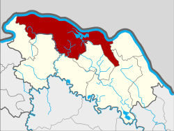 Amphoe location in Bueng Kan Province | |
| Coordinates: 18°21′29″N 103°39′11″E / 18.35806°N 103.65306°ECoordinates: 18°21′29″N 103°39′11″E / 18.35806°N 103.65306°E | |
| Country |
|
| Province | Bueng Kan |
| Seat | Bueng Kan |
| Area | |
| • Total | 791.9 km2 (305.8 sq mi) |
| Population (2012) | |
| • Total | 89,978 |
| • Density | 105.5/km2 (273/sq mi) |
| Time zone | ICT (UTC+7) |
| Postal code | 38000[1] |
| Geocode | 3801 |
Mueang Bueng Kan (Thai: เมืองบึงกาฬ; IPA: [mɯ̄aŋ bɯ̄ŋ kāːn]) is a capital district (amphoe mueang) of Bueng Kan Province, northeastern Thailand. It is 759 km north-northwest of Bangkok.
History
The district was originally named Chai Buri (ไชยบุรี) and was a part of Nakhon Phanom Province. In 1917 it was reassigned to Nong Khai,[2] and 1939 it was renamed Bueng Kan.[3]
On 3 August 2010, the proposal of separating Bueng Kan Province from Nong Khai Province was approved by Thai government.[4] As of 22 March 2011, the "Act Establishing Changwat Bueng Kan, BE 2554 (2011)" has been published in the Government Gazette.[5] The district became the capital district (amphoe mueang) of the new province, and therefore renamed to Amphoe Mueang Bueng Kan by section 4 of the Act.
On occasions during its history, especially during the 1970s and 1980s,[6][7][8] there have been some conflicts with Lao people on the border. On 23 April 1975, the people's armed forces in Bueng Kan destroyed an enemy stronghold, killing 12 and Thai authorities reportedly admitted that 17 were killed eventually out of about 50.[7] In the early 1980s two patrol boats of the Thai KPL reportedly opened fire and two Lao soldiers were arrested in Bueng Kan.[6][9]
Etymology
Bueng (TH: บึง) means "swamp" or "marsh". Kan (TH: กาฬ) is Thai for the Hindu goddess Kali; as an adjective it may mean "black" and as a noun, "black mark of death."[10]
Geography
Neighboring districts are (from the east clockwise) Bung Khla, Seka, Si Wilai, Phon Charoen, So Phisai, and Pak Khat of Bueng Kan Province. To the north across the Mekong river is the Laotian province Bolikhamxai.
Administration
The district is subdivided into 12 subdistricts (tambon), which are further subdivided into 131 villages (muban). Bueng Kan is a subdistrict municipality (thesaban tambon) which covers parts of tambon Bueng Kan and Wisit. The remaining area of Wisit subdistrict belongs to the subdistrict municipality Wisit. Non Kheng, Ho Kham, Khok Kong and Khai Si are subdistrict municipalities each covering the whole same-named subdistrict. There are further 7 tambon administrative organizations (TAO) for those subdistricts not covered by municipalities.
| No. | Name | Thai | Villages | Inh.[11] |
|---|---|---|---|---|
| 1. | Bueng Kan | บึงกาฬ | 11 | 9,999 |
| 2. | Non Sombun | โนนสมบูรณ์ | 13 | 9,903 |
| 3. | Non Sawang | โนนสว่าง | 11 | 6,739 |
| 4. | Ho Kham | หอคำ | 14 | 7,116 |
| 5. | Nong Loeng | หนองเลิง | 13 | 8,547 |
| 6. | Khok Kong | โคกก่อง | 9 | 6,901 |
| 7. | Na Sawan | นาสวรรค์ | 9 | 7,535 |
| 8. | Khai Si | ไคสี | 10 | 5,294 |
| 9. | Chaiyaphon | ชัยพร | 13 | 8,227 |
| 10. | Wisit | วิศิษฐ์ | 13 | 9,557 |
| 11. | Kham Na Di | คำนาดี | 8 | 5,075 |
| 12. | Pong Pueai | โป่งเปือย | 7 | 5,085 |
Missing numbers are tambon which now form the districts Bung Khla and Si Wilai.
References
- ↑ Before split off from Nong Khai used the code 43140
- ↑ ประกาศกระทรวงมหาดไทย เรื่อง โอนอำเภอไชยบุรีไปขึ้นจังหวัดหนองคาย (PDF). Royal Gazette (in Thai). 33 (0 ก): 320. 1917-03-25.
- ↑ พระราชกฤษฎีกาเปลี่ยนนามอำเภอ กิ่งอำเภอ และตำบลบางแห่ง พุทธศักราช ๒๔๘๒ (PDF). Royal Gazette (in Thai). 56 (0 ก): 354–364. 17 Apr 1939.
- ↑ "Govt denies being superstitious in adding the 77th province". National News Bureau of Thailand, Public Relations Department. 2010-08-04.
- ↑ พระราชบัญญัติตั้งจังหวัดบึงกาฬ พ.ศ. ๒๕๕๔ (PDF). Royal Gazette (in Thai). 128 (18 ก): 1–5. 2011-03-22.
- 1 2 Asian almanac. s.n. 1983. pp. 11, 900. Retrieved 23 Jan 2012.
- 1 2 United States. Foreign Broadcast Information Service (1975). Daily report: People's Republic of China. Distributed by National Technical Information Service. p. 350. Retrieved 23 January 2012.
- ↑ Peking review. 1973. Retrieved 23 Jan 2012.
- ↑ Kerdphol, Saiyud (1968). The struggle for Thailand: counter-insurgency, 1965-1985. S. Research Center Co. p. 80. Retrieved 23 Jan 2012.
- ↑ "Lexitron Thai-English".
- ↑ "Population statistics 2012". Department of Provincial Administration.
External links
- amphoe.com (Thai)
- bungkan.com (Thai)