Murovdag
| Murovdağ | |
|---|---|
| Murovdağ/Mrav | |
 | |
| Highest point | |
| Elevation | 3,724 m (12,218 ft) |
| Dimensions | |
| Length | 70 km (43 mi) |
| Geography | |
|
Location of the mountain | |
| Country |
De jure: Azerbaijan De facto: Nagorno-Karabakh Republic (southern slopes) and Azerbaijan (northern slopes) |
| Range coordinates | 40°16′N 46°19′E / 40.27°N 46.32°ECoordinates: 40°16′N 46°19′E / 40.27°N 46.32°E |
The Murovdağ (also spelled as Murovdagh, Azerbaijani: Murovdağ) or Mrav[1][2] (Armenian: Մռավի լեռնաշղթա - Mravi Lernash'ghta) is the highest mountain range in the Lesser Caucasus. The range is about 70 kilometres (43 mi) long, and Gamish Mountain is its highest peak at 3,724 metres (12,218 ft). It is made up mainly of Jurassic, Cretaceous and Paleogene rocks.[3]
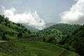
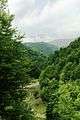
The Murovdağ ridge extends north from Hinaldag Peak through Gamish (or Gomshasar) Mountain. The northeastern slope features a group of scenic lakes, including Göygöl near the northern slope. The Karabakh Plateau extends from the south of Murovdağ. Fir and spruce forests are spread as far southeast as the Murovdağ. The summer mountain pastures of Murovdağ were traditionally used by Azerbaijani and Armenian shepherds.
The mountain ridge forms the northern part of the line of control separating the unrecognized Nagorno-Karabakh Republic from Azerbaijan. Its southern slopes run through the Martakert region of Nagorno-Karabakh.[1]
Notes
Views
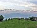 View from Nagorno-Karabakh, village of Qozlu (local name Vaghuhas)