Mutsu-Morita Station
Mutsu-Morita Station 陸奥森田駅 | |
|---|---|
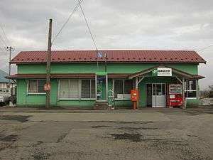 Mutsu-Morita Station in March 2008 | |
| Location |
Tokomai Midorino 11, Morita-chō, Tsugaru-shi, Aomori (青森県つがる市森田町床舞緑野11) Japan |
| Operated by |
|
| Line(s) | ■ Gonō Line |
| Distance | 114.5 kilometers from Higashi-Noshiro |
| Platforms | 2 side platforms |
| Other information | |
| Website |
www |
| History | |
| Opened | 1924 |
| Traffic | |
| Passengers (FY2015) | 78 |
| Location | |
 Mutsu-Morita Station Location within Japan | |
Mutsu-Morita Station (陸奥森田駅 Mutsu-Morita-eki) is a railway station on the JR East Gonō Line located in the city of Tsugaru, Aomori Prefecture Japan. The station is a kan'i itaku station, administered by Goshogawara Station, and operated by Tsugaru municipal authority, with point-of-sales terminal installed. Ordinary tickets, express tickets, and reserved-seat tickets for all JR lines are on sale (no connecting tickets).
Lines
Mutsu-Morita Station is served by the Gonō Line, andIt is 114.5 rail kilometers from the terminus of the Line at Higashi-Noshiro Station.
Station layout
Mutsu-Morita Station has a dual opposed side platforms, but one platform is not in use, and the other serves bi-directional traffic. The station building is attended during normal daylight operating hours.
Platforms
| 1 | ■ Gonō Line | For Goshogawara, Ajigasawa and Fukaura For Kawabe, Hirosaki and Aomori |
| 2 | ■ Gonō Line | not in use |
History
Mutsu-Morita Station was opened on November 11, 1924 as a station on the Japanese Government Railways (JGR) in former Morita Village. With the privatization of the Japanese National Railways (successor of JGR) on April 1, 1987, it came under the operational control of JR East.
Adjacent stations
| ← | Service | → | ||
|---|---|---|---|---|
| Gonō Line | ||||
| Koshimizu | Local | Nakata | ||
Passenger statistics
In fiscal 2015, the station was used by an average of 78 passengers daily (boarding passengers only).[1]
Surrounding area
- Morita Post office
See also
References
- ↑ 各駅の乗車人員 (2015年度) [Station passenger figures (Fiscal 2015)] (in Japanese). Japan: East Japan Railway Company. 2016. Retrieved 21 August 2016.
External links
- JR East station information page (Japanese)
Coordinates: 40°46′54.32″N 140°20′20.35″E / 40.7817556°N 140.3389861°E