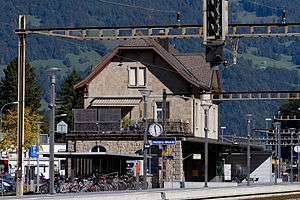
Näfels-Mollis railway station
Näfels-Mollis | ||||||||||||||||
|---|---|---|---|---|---|---|---|---|---|---|---|---|---|---|---|---|
 | ||||||||||||||||
| Location |
Bahnhofstrasse Näfels Glarus Nord, Glarus Switzerland | |||||||||||||||
| Coordinates | 47°05′56″N 9°04′10″E / 47.098825°N 9.069471°ECoordinates: 47°05′56″N 9°04′10″E / 47.098825°N 9.069471°E | |||||||||||||||
| Elevation | 438 m (1,437 ft) | |||||||||||||||
| Owned by | Swiss Federal Railways | |||||||||||||||
| Operated by | Swiss Federal Railways | |||||||||||||||
| Line(s) | Weesen-Linthal | |||||||||||||||
| Services | ||||||||||||||||
| ||||||||||||||||
| Location | ||||||||||||||||
 Näfels-Mollis Location within Switzerland | ||||||||||||||||
Näfels-Mollis railway station is a railway station in the municipality of Glarus Nord in the Swiss canton of Glarus. It is an intermediate stop on the Weesen to Linthal railway line, and serves the twin villages of Näfels and Mollis.[1][2]
The station is served by Zürich S-Bahn service S25 between Zurich and Linthal, and by St. Gallen S-Bahn service S6 between Rapperswil and Schwanden. Both services operate once per hour, combining to provide two trains per hour between Ziegelbrücke and Schwanden.[3][4][5]
References
- ↑ map.geo.admin.ch (Map). Swiss Confederation. Retrieved 2012-04-29.
- ↑ Eisenbahnatlas Schweiz. Verlag Schweers + Wall GmbH. 2012. pp. 24–25. ISBN 978-3-89494-130-7.
- ↑ "S-Bahn trains, buses and boats" (PDF). ZVV. Retrieved 2014-08-08.
- ↑ "S-Bahn St.Gallen Map" (PDF). S-Bahn. Retrieved 2014-08-08.
- ↑ "Ziegelbrücke–Linthal" (PDF). Bundesamt für Verkehr. Retrieved 2014-08-08.
External links
-
 Media related to Näfels-Mollis railway station at Wikimedia Commons
This article is issued from Wikipedia - version of the 11/19/2016. The text is available under the Creative Commons Attribution/Share Alike but additional terms may apply for the media files.