Nærum Line
| Nærumbanen | |
|---|---|
 | |
| Overview | |
| Type | Railway |
| System | Danish railways |
| Termini |
Jægersborg Nærum |
| Stations | 8 |
| Operation | |
| Opened | 1900 |
| Owner | Hovedstadens Lokalbaner |
| Operator(s) | Lokaltog A/S[1] |
| Character | Commuter trains |
| Rolling stock | RegioSprinter |
| Technical | |
| Line length | 7.8 km (4.8 mi)[2] |
| Number of tracks | Single |
| Track gauge | 1,435 mm (4 ft 8 1⁄2 in) |
| Electrification | No |
| Operating speed | 75 km/h (47 mph) |
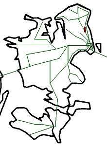
Nærumbanen is a short railway in the northern suburbs of Copenhagen which serves mainly local neighborhoods in Lyngby-Taarbæk municipality and Nærum in Rudersdal municipality. It is currently operated by the railway company Lokaltog A/S.[1] Lokaltog runs frequent light trains that connect to the S-train system at Jægersborg.
History
The railway opened as Lyngby-Vedbæk railway in 1900 with an aim of serving the industries that had settled in the Mølleå valley to exploit the hydraulic power of the Mølleå. In the early years the railway moved freight for these customers, but today it has been a passenger-only railway for many years.
The northern half of the railway between Nærum and Vedbæk quickly proved unprofitable and was abandoned in 1923. In 1936 the southern terminus in Lyngby was moved to Jægersborg. The Nærum end of the line was shortened a bit in 1954 due to the construction of the Helsingør motorway.
Stations
| Name | Opened | Comments |
|---|---|---|
| Jægersborg | 1936 | Transfer to S-trains |
| Nørgårdsvej | 2003 | |
| Lyngby Lokal | ||
| Fuglevad | ||
| Brede | 1900 | |
| Ørholm | 1900 | |
| Ravnholm | ||
| Nærum | 1954 | Transfer to buses in the Helsingør motorway, including expresses 150S, 174E and 300S |
Operations

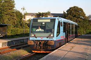
Trains on the Nærum Line are operated by the railway company Lokaltog.[1] Despite being a single-track railway, Lokaltog operates an ambitious timetable on the Nærum Line with a 10-minute frequency most of the day. Trains pass each other at Fuglevad and Ørholm. All trains are Siemens RegioSprinter light diesel units.
References
- 1 2 3 "Om Lokaltog". lokaltog.dk (in Danish). Lokaltog A/S. Retrieved 20 July 2016.
- ↑ "Fakta om Lokaltogs strækninger". lokaltog.dk (in Danish). Lokaltog A/S. Retrieved 20 July 2016.
External links
Coordinates: 55°48′33″N 12°31′37″E / 55.8093°N 12.5270°E