Na Pho District
| Na Pho นาโพธิ์ | |
|---|---|
| Amphoe | |
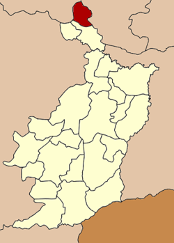 Amphoe location in Buriram Province | |
| Coordinates: 15°38′42″N 102°57′6″E / 15.64500°N 102.95167°ECoordinates: 15°38′42″N 102°57′6″E / 15.64500°N 102.95167°E | |
| Country | Thailand |
| Province | Buriram |
| Seat | Na Pho |
| Area | |
| • Total | 255.0 km2 (98.5 sq mi) |
| Population (2005) | |
| • Total | 33,135 |
| • Density | 129.9/km2 (336/sq mi) |
| Time zone | ICT (UTC+7) |
| Postal code | 31230 |
| Geocode | 3113 |
Na Pho (Thai: นาโพธิ์, pronounced [nāː pʰōː]) is the northernmost district (amphoe) of Buriram Province, northeastern Thailand.
Geography
Neighbouring districts are (from the south clockwise) Phutthaisong of Buriram Province, Nong Song Hong of Khon Kaen Province, Na Chueak and Yang Sisurat of Maha Sarakham Province.
History
The minor district (king amphoe) was created on 31 March 1981, when the four tambon Na Pho, Ban Khu, Ban Du, and Don Kok were split off from Phutthaisong District.[1] It was upgraded to a full district on 1 January 1988.[2]
Administration
The district is divided into five sub-districts (tambon), which are further subdivided into 71 villages (muban). Na Pho is a township (thesaban tambon) which covers parts of tambon Na Pho and Si Sawang. There are a further five tambon administrative organizations (TAO).
| No. | Name | Thai name | Villages | Pop. | |
|---|---|---|---|---|---|
| 1. | Na Pho | นาโพธิ์ | 18 | 7,189 | |
| 2. | Ban Khu | บ้านคู | 15 | 6,947 | |
| 3. | Ban Du | บ้านดู่ | 12 | 5,613 | |
| 4. | Don Kok | ดอนกอก | 16 | 7,922 | |
| 5. | Si Sawang | ศรีสว่าง | 10 | 5,464 |
References
- ↑ ประกาศกระทรวงมหาดไทย เรื่อง แบ่งท้องที่อำเภอพุทไธสง จังหวัดบุรีรัมย์ ตั้งเป็นกิ่งอำเภอนาโพธิ์ (PDF). Royal Gazette (in Thai). 98 (47 ง): 1090. April 21, 1981.
- ↑ พระราชกฤษฎีกาตั้งอำเภอนามน อำเภอพระยืน อำเภอหนองบัวระเหว อำเภอบ้านเหลื่อม อำเภอจะแนะ อำเภอหนองหงส์ อำเภอนาโพธิ์ อำเภอเกาะยาว อำเภอแกดำ อำเภอสระโบสถ์ อำเภอโนนคูณ อำเภอควนโดน อำเภอไชยวาน อำเภอหนองแสง และอำเภอตาลสุม พ.ศ. ๒๕๓๐ (PDF). Royal Gazette (in Thai). 104 (278 ก special): 33–37. December 31, 1987.