Nacala
| Nacala Maiaia Cidade de Nacala | |
|---|---|
|
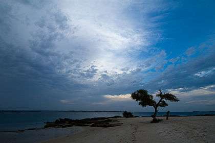
The beach at Nacala | |
| Nickname(s): Nacala-Porto | |
 Nacala | |
| Coordinates: 14°27′S 40°40′E / 14.450°S 40.667°E | |
| Country |
|
| Provinces | Nampula Province |
| District | Nacala-porto |
| Government | |
| • Type | Democratico |
| • Presidente do Municipio | Rui Chong Saw |
| Population (2007) | |
| • Total | 207,894 |
| Climate | Aw |
| Website | https://www.facebook.com/CMCNacalaPorto |
Nacala, also known as Cidade de Nacala or Nacala-Porto is a city on the northern coast of Mozambique. Located in the southwestern indentation of inner Fernao Veloso Bay, it is the deepest natural port on the east coast of Africa. Nacala serves as the terminal for the Nacala Railway, a rail link to the landlocked Malawi. South of Nacala is Mozambique Island, at one time the capital of Mozambique and now a World Heritage site.
The Nacala Development Corridor, also called "Corredor de Desenvolvimento do Norte" ("CDN"), is an area that reaches westward from Nacala to Malawi and is home to about ten million people.
History
Nacala was founded as a little town and developed as a deep waters port and an industrial, agricultural and exporting centre during the last period of the Portuguese rule of the territory which ended in the mid-1970s. Among its major industries were cement, sisal and cashew. Other important employers were the seaport, its small modern hospital, and services (banking, insurance and administration).[1]
Industry
Nacala is site of one of three cement works in Mozambique.
Transport
Nacala is the terminal of the Nacala Railway that connects to the Central East African Railway (CEAR) of Malawi. The railway system was managed by the Railroad Development Corporation until September 2008 when it was sold to a group of Mozambican investors.[2]
It is the location of the Port of Nacala. There is an airbase that has been converted into an international airport, the Nacala Airport.
Also constructed is a deep water port in Nacala. See Port of Nacala
Demographics
| Year | Population[3] |
|---|---|
| 1980 | 80,426 |
| 1997 | 164,309 |
| 2007 | 207,894 |
Climate
| Climate data for Nacala | |||||||||||||
|---|---|---|---|---|---|---|---|---|---|---|---|---|---|
| Month | Jan | Feb | Mar | Apr | May | Jun | Jul | Aug | Sep | Oct | Nov | Dec | Year |
| Average high °C (°F) | 32 (89) |
32 (89) |
32 (89) |
32 (89) |
31 (88) |
30 (86) |
29 (85) |
30 (86) |
31 (87) |
32 (89) |
32 (89) |
32 (89) |
31 (88) |
| Average low °C (°F) | 19 (67) |
19 (67) |
19 (67) |
18 (65) |
17 (63) |
16 (61) |
16 (60) |
15 (59) |
16 (61) |
18 (64) |
18 (65) |
19 (66) |
18 (64) |
| Average precipitation mm (inches) | 193 (7.6) |
193 (7.6) |
170 (6.7) |
56 (2.2) |
13 (0.5) |
10 (0.4) |
3 (0.1) |
8 (0.3) |
5 (0.2) |
5 (0.2) |
33 (1.3) |
122 (4.8) |
808 (31.8) |
| Source: Weatherbase [4] | |||||||||||||
Miscellaneous
The town is also known for its beaches and scuba diving.
Namesake
There is another town in Mozambique called Nacala, the port city being called Cidade de Nacala.
See also
References
- ↑ Nacala - no outro lado do tempo, short film of Nacala, Portuguese Mozambique before independence in 1975.
- ↑ RDC management
- ↑ "Mozambique: largest cities and towns and statistics of their population". World Gazetteer. Retrieved 2008-06-18.
- ↑ "Weatherbase: Historical Weather for Nacala, Mozambique". Weatherbase. 2011. Retrieved on November 24, 2011.
Coordinates: 14°32′34″S 40°40′22″E / 14.54278°S 40.67278°E
External links
- Port of Nacala information
- Nacala development corridor
- CEAR linkage
- Accommodation and Scuba Diving on the east side of the bay
