Nashaway people
The Nashaway (or Nashua or Weshacum) were a tribe of Algonquian Indians inhabiting the upstream portions of the Nashua River valley in what is now the northern half of Worcester County, Massachusetts, mainly in the vicinity of Sterling, Lancaster and other towns near Mount Wachusett. They are often associated with the Nipmuc, which along with variants such as Nipmug or Nipnet was the general term for all bands inhabiting central Massachusetts away from the coastlines and ending before the Connecticut River valley. The meaning of Nashaway is "river with a pebbled bottom".[1]
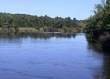
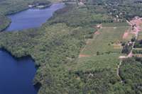
The Nashaway's principal settlement was Waushacum (possibly meaning "surface of the sea"), a parcel of land in what is now Sterling that was located between two ponds of the same name. The territory of the Nashaway was bounded downstream (to the north) on the Nashua River by the Pennacook, a powerful tribe with which numerous alliances were formed, to the east by tribes related to the Massachusett, to the south of the headwaters by other Nipmuc bands and to the west by the Connecticut River where the Pocomtuc settled.[2]
The first reports of the peoples of Massachusetts' interior were scant, and most of the tribes were grouped under the Nipmuc, the largest tribe in the area, but the sub-divisions had their own sachems and functioned independently of each other. Although they shared the similar L-dialect and other common customs, very little evidence is shown of any confederation except for the various skirmishes with English colonists that ultimately led to King Philip's War.[3] Although now classified as Nipmuc, the bands were heavily allied and possibly confederated with the Pennacook.
The tribes of the interior posed a problem for John Eliot as the tribes were too far to visit and the area still very much a frontier region. At the time of the first visits of John Prescott, the appointed minister to the tribe, power was passed from Sachem Nashawhonan (Sholan) to a Pennacook chieftain descended from Passaconaway by the name of Nanomocomuck (Monoco). Court records indicate that this sachem was charged for debts incurred for goods bought on credit and the high prices charged to them for the colonists' goods. This ultimately led to the loss of land and tensions that led to war. The fate of the Nashaway is not known, but it can be assumed that remnants of the tribe fled the area and merged with other tribes, such as the Pennacook or the Nipmuc proper and intermarried. Whatever the case, the Nashaway as a distinct tribal entity is now extinct. It is also known that many died from exile on Deer Island in Boston Harbor.[4] Their descendants can be found amongst the Abenaki of New England and Canada or the Schaghticoke.
Legacy
The Nashaway have left their imprint in many hydronyms and topographical features, such as the Sholan area of Leominster, the city and river known by "Nashua", and Mount Wachusett. During King Philip's War, the Nashaway sachem (chief) Monoco kidnapped a Lancaster villager, Mary Rowlandson, who later wrote a best-selling narrative about her captivity, forced journey from Lancaster northwest to the Connecticut river, and eventual release at redemption rock in present day Sterling, MA.[5]
References
- ↑ NIAC Publications ~ Nipmuc Place Names - Maine & Massachusetts
- ↑ Connole, Dennis A (2000), Indians of the Nipmuck Country in Southern New England, 1630-1750: An Historical Geography, McFarland Publishers.
- ↑ Willard, Joseph (1853), "Address on the Commemoration of the Two Hundredth Anniversary of the Incorporation of Lancaster, Massachusetts, Bibliolife, LLC.
- ↑ Connole, Dennis A. (2000)
- ↑ Bourne, Russell (1990), The Red King's Rebellion: Racial Politics in New England, 1675-1678, Atheneum Publishers, pg 163 ff.