National Register of Historic Places listings in Buffalo, New York

Location of Buffalo in New York
This is a list of the National Register of Historic Places listings in Buffalo, New York.
This is intended to be a complete list of the properties and districts on the National Register of Historic Places in Buffalo, New York, United States. The locations of National Register properties and districts for which the latitude and longitude coordinates are included below, may be seen in a map.[1]
There are 200 properties and districts listed on the National Register in Erie County. The city of Buffalo is the location of 128 of these properties and districts; they are listed here, while the remaining 71 properties and districts are listed separately. Another 2 properties in the city were formerly listed but have been removed.
- This National Park Service list is complete through NPS recent listings posted December 16, 2016.[2]
| Albany (Albany) – Allegany – Bronx – Broome – Cattaraugus – Cayuga – Chautauqua – Chemung – Chenango – Clinton – Columbia – Cortland – Delaware – Dutchess (Poughkeepsie, Rhinebeck) – Erie (Buffalo) – Essex – Franklin – Fulton – Genesee – Greene – Hamilton – Herkimer – Jefferson – Kings – Lewis – Livingston – Madison – Monroe (Rochester) – Montgomery – Nassau – New York (Below 14th Street, 14th to 59th Streets, 59th to 110th Streets, Above 110th Street, Islands) – Niagara – Oneida – Onondaga (Syracuse) – Ontario – Orange – Orleans – Oswego – Otsego – Putnam – Queens – Rensselaer – Richmond – Rockland – St. Lawrence – Saratoga – Schenectady – Schoharie – Schuyler – Seneca – Steuben – Suffolk – Sullivan – Tioga – Tompkins – Ulster – Warren – Washington – Wayne – Westchester (Northern, Southern, New Rochelle, Peekskill, Yonkers) – Wyoming – Yates |
Current listings
| [3] | Name on the Register | Image | Date listed[4] | Location | Neighborhood | Description |
|---|---|---|---|---|---|---|
| 1 | 20th Century Club | 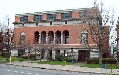 |
(#11000270) |
595 Delaware Ave. 42°54′01″N 78°52′23″W / 42.900278°N 78.873056°W |
Allentown | First club founded by women, for women, in the U.S. |
| 2 | 33-61 Emerson Place Row | 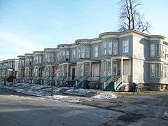 |
(#86000691) |
33-61 Emerson Pl. 42°54′47″N 78°51′38″W / 42.913056°N 78.860556°W |
East Side | Frame rowhouses built in 1893 |
| 3 | J.N. Adam-AM&A Historic District |  |
(#09000056) |
Main St., E. Eagle St., Washington St., Ellicott St. 42°53′03″N 78°52′26″W / 42.884167°N 78.873889°W |
Downtown | Former J. N. Adam & Co. and AM&A's department store and warehouse complex |
| 4 | Albright-Knox Art Gallery | 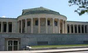 |
(#71000538) |
1285 Elmwood Ave., in Delaware Park 42°55′56″N 78°52′33″W / 42.932222°N 78.875833°W |
Elmwood Village | Contemporary and modern art gallery opened in 1905. |
| 5 | Allentown Historic District | 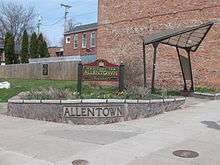 |
(#80002605) |
Off NY 384; also portions of Delaware, Elmwood, S. Elmwood, Linwood, Normal, Plymouth, Porter, and Richmond Aves., and Franklin and Hudson Sts. 42°53′58″N 78°52′47″W / 42.899444°N 78.879722°W |
Allentown | Second set of boundaries represents a boundary increase of February 14, 2012. A historic district including parks designed by Frederick Law Olmsted, and 733 buildings. |
| 6 | Alling & Cory Buffalo Warehouse | 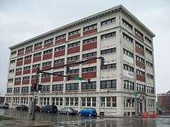 |
(#10000026) |
136 N. Division St. 42°52′59″N 78°52′11″W / 42.883056°N 78.869722°W |
East Side | |
| 7 | American Grain Complex | 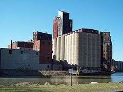 |
(#12000475) |
87 Childs St. 42°51′40″N 78°51′56″W / 42.860979°N 78.865693°W |
South Buffalo | |
| 8 | American Radiator Company Factory Complex | 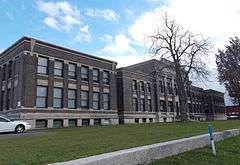 |
(#15000674) |
1801-1809 Elmwood Ave. 42°56′44″N 78°52′43″W / 42.945638°N 78.8784927°W |
Buffalo | Buildings constructed over 40 years starting in the 1890s were a major research facility in addition to factory; recently converted into residential lofts. |
| 9 | Annunciation School | 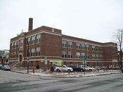 |
(#08001139) |
257 Lafayette Ave. 42°55′11″N 78°53′18″W / 42.919722°N 78.888333°W |
Buffalo | Former parochial school |
| 10 | Berkeley Apartments | 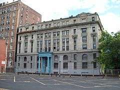 |
(#87001852) |
24 Johnson Park 42°53′31″N 78°52′35″W / 42.891944°N 78.876389°W |
Downtown | Reinforced concrete building built 1894-1897 |
| 11 | Birge-Horton House | 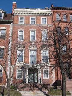 |
(#04000703) |
477 Delaware Ave. 42°53′50″N 78°52′28″W / 42.8972°N 78.8744°W |
Allentown | Rowhouse designed in 1895 and part of "The Midway" |
| 12 | Blessed Trinity Roman Catholic Church Buildings | 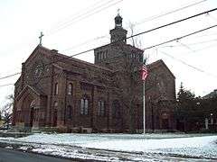 |
(#79001579) |
317 LeRoy Ave 42°55′57″N 78°50′03″W / 42.9325°N 78.834167°W |
Fillmore-Leroy | Church in Lombard-Romanesque style built in 1923-1928 with noted mosaics |
| 13 | Buffalo and Erie County Historical Society Building | 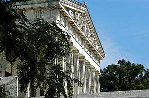 |
(#80002606) |
25 Nottingham Ct. 42°56′07″N 78°52′35″W / 42.935278°N 78.876389°W |
Buffalo | Built for Pan American Exposition in 1901 |
| 14 | Buffalo City Hall | 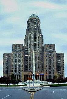 |
(#98001611) |
65 Niagara Sq. 42°53′12″N 78°52′45″W / 42.886667°N 78.879167°W |
Downtown | Classic 32 story Art Deco municipal building completed in 1931 |
| 15 | Buffalo Electric Vehicle Company Building | 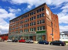 |
(#05000571) |
1219-1247 Main St. 42°54′25″N 78°52′02″W / 42.906944°N 78.867222°W |
Cold Spring | Former automobile factory and showroom constructed in 1910 |
| 16 | Buffalo Gas Light Company Works | 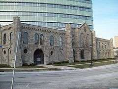 |
(#76001215) |
249 W. Genesee St. 42°53′09″N 78°53′00″W / 42.885833°N 78.883333°W |
Lower West Side | Remains of gas works complex built originally in 1848 |
| 17 | Buffalo Main Light | 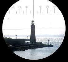 |
(#84002383) |
Buffalo River 42°52′49″N 78°53′45″W / 42.880278°N 78.895833°W |
Buffalo | Lighthouse established and lit in 1833 and deactivated in 1914 |
| 18 | Buffalo Meter Company Building | 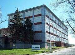 |
(#12000476) |
2917 Main St. 42°56′39″N 78°49′51″W / 42.944155°N 78.830797°W |
Buffalo | |
| 19 | Buffalo North Breakwater South End Light | 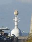 |
(#83001669) |
Buffalo Harbor 42°52′49″N 78°53′45″W / 42.880278°N 78.895833°W |
Buffalo | Beacon lit in 1903 and removed in 1985 |
| 20 | Buffalo Seminary | 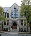 |
(#11000271) |
205 Bidwell Parkway 42°55′28″N 78°52′30″W / 42.924444°N 78.875°W |
Delaware District | Mid-19th-century girls' school housed in 1909 Tudor Revival building |
| 21 | Buffalo Smelting Works |  |
(#11000738) |
23 Austin St. 42°56′07″N 78°54′14″W / 42.935333°N 78.904022°W |
Black Rock | |
| 22 | Buffalo State Asylum for the Insane | 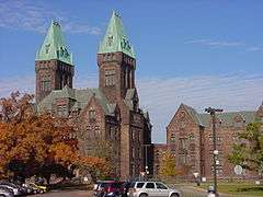 |
(#86003557) |
400 Forest Ave. 42°55′50″N 78°53′03″W / 42.930556°N 78.884167°W |
Elmwood Village | Landmark defining architect H. H. Richardson's Richardsonian Romanesque style, also known as Buffalo State Hospital |
| 23 | Buffalo State Hospital | |
(#73001186) |
400 Forest Ave. 42°55′49″N 78°52′59″W / 42.930278°N 78.883056°W |
Elmwood Village | Landmark defining architect H. H. Richardson's Richardsonian Romanesque style, also known as Buffalo State Asylum for the Insane |
| 24 | Buffalo Tennis and Squash Club | 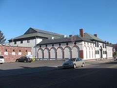 |
(#08001141) |
314 Elmwood Ave. 42°54′20″N 78°52′38″W / 42.905556°N 78.877222°W |
Elmwood Village | Clubhouse building located constructed in 1915-1916 |
| 25 | Buffalo Trunk Manufacturing Company Building |  |
(#10000027) |
125 Cherry St. 42°53′38″N 78°51′40″W / 42.893889°N 78.861111°W |
East Side | |
| 26 | Buffalo Zoo Entrance Court | 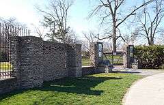 |
(#13000305) |
Parkside Ave. & Amherst St. 42°56′23″N 78°51′06″W / 42.939819°N 78.851742°W |
Surviving work from early 20th century by early African-American architect. | |
| 27 | F.N. Burt Company Factory | 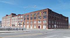 |
(#13000053) |
500 Seneca Street 42°52′40″N 78°51′26″W / 42.877694°N 78.85712°W |
East Side | |
| 28 | The Calumet | 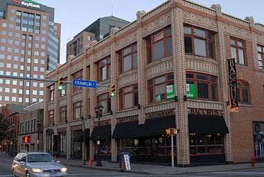 |
(#10000958) |
46-58 W. Chippewa St. / 233 Franklin St. 42°53′25″N 78°52′29″W / 42.890278°N 78.874722°W |
Downtown | |
| 29 | Cazenovia Park-South Park System | |
(#82005028) |
South Park, NW along McKinley Pkwy. to Cazenovia Park, NW along McKinley Pkwy. to Heacock Park 42°50′22″N 78°49′16″W / 42.839444°N 78.821111°W |
South Buffalo, Buffalo, New York | Park and parkways system located in South Buffalo; location of the Buffalo and Erie County Botanical Gardens |
| 30 | CLARA BROWN (sloop) |  |
(#13000098) |
First Buffalo River Marina, 32 Fuhrman Blvd. 42°52′26″N 78°52′52″W / 42.873754°N 78.881091°W |
Buffalo | Distinctive sloop designed for races on Lake Champlain by noted naval architect John G. Alden |
| 31 | Robert T. Coles House and Studio |  |
(#11000594) |
321 Humboldt Pkwy. 42°55′30″N 78°50′50″W / 42.925°N 78.847222°W |
Hamlin Park | Innovative modernist home of prominent African-American architect anticipated expansion of street by putting rear of building to it |
| 32 | Concordia Cemetery | 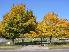 |
(#08000106) |
438 Walden Ave. 42°54′22″N 78°49′11″W / 42.906111°N 78.819722°W |
East Side | German Lutheran Cemetery established in 1859 |
| 33 | Concrete-Central Elevator | .jpg) |
(#03000410) |
175 Buffalo River 42°51′37″N 78°51′20″W / 42.860278°N 78.855556°W |
Buffalo | Grain elevator built between 1915 and 1917 and in operation until 1973 |
| 34 | Connecticut Street Armory | 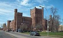 |
(#94001543) |
184 Connecticut St. 42°54′14″N 78°53′39″W / 42.903889°N 78.894167°W |
Buffalo | National Guard armory built in 1899 |
| 35 | Corpus Christi R. C. Church Complex | 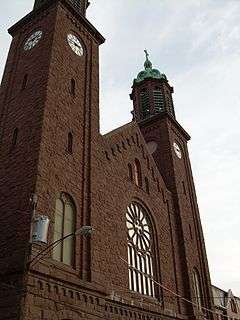 |
(#07000630) |
199 Clark St. 42°53′29″N 78°50′10″W / 42.891389°N 78.836111°W |
East Side | Massive sandstone church built about 1900 |
| 36 | County and City Hall | 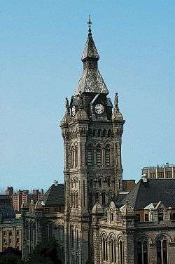 |
(#76001216) |
92 Franklin St. 42°53′03″N 78°52′42″W / 42.884167°N 78.878333°W |
Downtown | Granite courthouse building constructed between 1871 and 1875 |
| 37 | Harlow C. Curtiss Building | 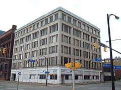 |
(#08001142) |
204-210 Franklin St. 42°53′21″N 78°52′33″W / 42.889167°N 78.875833°W |
Downtown | Office building built in 1912 |
| 38 | Dayton House | 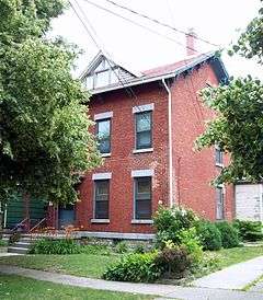 |
(#11000739) |
243 Dearborn St. 42°56′09″N 78°54′05″W / 42.93595°N 78.9015°W |
Black Rock | |
| 39 | Delaware Avenue Historic District | 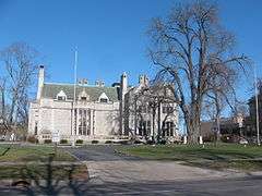 |
(#74001232) |
Western side of Delaware Ave. between North and Bryant Sts. 42°54′20″N 78°52′23″W / 42.905556°N 78.873056°W |
Delaware District | Historic district encompassing area once known as Millionaires' Mile. |
| 40 | Delaware Avenue Methodist Episcopal Church | 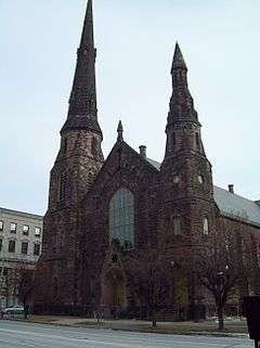 |
(#03001149) |
339 Delaware Ave. 42°53′37″N 78°52′31″W / 42.893611°N 78.875278°W |
Downtown | Church constructed in two phases between 1871 and 1876; now home to Righteous Babe Records |
| 41 | Delaware Park-Front Park System | 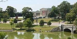 |
(#82005029) |
Front Park, Porter Ave. to Symphony Cir., north along Richmond Ave., Bidwell Pkwy., Gates Cir. and Delaware Park 42°55′10″N 78°52′47″W / 42.919444°N 78.879722°W |
Buffalo | Park and parkway system in north and west Buffalo; connects city neighborhoods and major cultural landmarks such as Albright-Knox Art Gallery, Buffalo and Erie County Historical Society, Buffalo Zoo, and Kleinhans Music Hall |
| 42 | Edward A. Diebolt House | 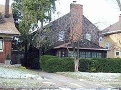 |
(#06000565) |
62 Niagara Falls Blvd. 42°57′53″N 78°49′23″W / 42.964722°N 78.823056°W |
University Heights | Colonial Revival style frame house built in 1922-1923 |
| 43 | William Dorsheimer House | 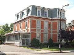 |
(#80002607) |
434 Delaware Ave. 42°53′46″N 78°52′31″W / 42.896111°N 78.875278°W |
Allentown | Brick dwelling designed and built in 1868 by Henry Hobson Richardson (1838-1886) for William Dorsheimer (1832-1888) |
| 44 | Durham Memorial A.M.E. Zion Church | 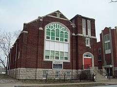 |
(#83001670) |
174 E. Eagle St. 42°53′00″N 78°52′07″W / 42.883333°N 78.868611°W |
East Side | African American brick church constructed in 1920 |
| 45 | Eberz House |  |
(#11000740) |
285 Dearborn St. 42°56′14″N 78°54′08″W / 42.937092°N 78.902144°W |
Black Rock | |
| 46 | EDWARD M. COTTER (fireboat) |  |
(#96000968) |
Junction of Michigan and Ohio Sts. on the Buffalo River 42°51′41″N 78°50′41″W / 42.861389°N 78.844722°W |
Buffalo | Fireboat built in 1900 and rebuilt in 1953 |
| 47 | Elmwood Historic District–East | Upload image | (#16000108) |
Portions of Auburn, Bird, Cleveland, Delaware, Elmwood, Forest & Hodge Aves., Anderson, Atlantic & Berkley Pls. 42°55′03″N 78°52′31″W / 42.9174942°N 78.8752755°W |
Elmwood Village | Early suburban neighborhood that developed along trolley lines |
| 48 | Elmwood Historic District–West | 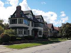 |
(#12000996) |
Roughly Ashland, Auburn, Bird, Claremont, Elmwood, Forest, Highland, Hodge, Lafayette, Lexington, Norwood Aves. 42°55′07″N 78°52′43″W / 42.918679°N 78.878627°W |
Elmwood Village | Early suburban neighborhood that developed along trolley lines |
| 49 | Engine House No. 2 and Hook and Ladder No. 9 | 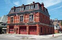 |
(#11000272) |
310 Jersey St. 42°54′08″N 78°53′11″W / 42.902222°N 78.886389°W |
Lower West Side | |
| 50 | Engine House No. 28 | .jpg) |
(#01000554) |
1170 Lovejoy St. 42°53′23″N 78°48′18″W / 42.889722°N 78.805°W |
Bailey-Lovejoy | Queen Anne style firehouse built in 1897 |
| 51 | Fargo Estate Historic District | 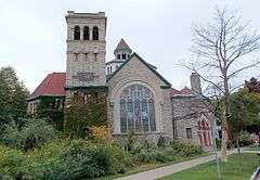 |
(#15001024) |
Portions of Fargo, Normal, Plymouth, Porter, Prospect & West Aves., Jersey & Pennsylvania Sts., Cobb Alley 42°54′03″N 78°53′26″W / 42.9009369°N 78.8905197°W |
Estate demolished at beginning of the 20th century led to rapid development of middle class housing | |
| 52 | First Unitarian Church of Buffalo | 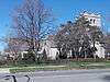 |
(#15000367) |
695 Elmwood Ave. 42°54′56″N 78°52′35″W / 42.9156°N 78.8765°W |
Elmwood Village | |
| 53 | Forest Lawn Cemetery |  |
(#90000688) |
1411 Delaware Ave. 42°55′38″N 78°51′44″W / 42.927222°N 78.862222°W |
Delaware District | Cemetery of 250 acres (1.0 km2) founded in 1849 |
| 54 | Fosdick-Masten Park High School | 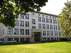 |
(#83001672) |
Masten Ave. and E. North St. 42°54′11″N 78°51′38″W / 42.903056°N 78.860556°W |
Fruit Belt | Public high school building built 1912-1914 |
| 55 | Garret Club |  |
(#06001212) |
91 Cleveland Ave. 42°55′04″N 78°52′22″W / 42.917778°N 78.872778°W |
Delaware District | Former clubhouse building built in 1929 |
| 56 | General Electric Tower | 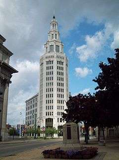 |
(#08000865) |
535 Washington St. 42°53′19″N 78°52′20″W / 42.888611°N 78.872222°W |
Downtown | Beaux-Arts Classical Revival style office building built in 1912 |
| 57 | The Great Atlantic and Pacific Tea Company Warehouse | 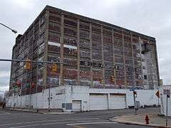 |
(#15000819) |
545 Swan St. 42°52′41″N 78°51′27″W / 42.877975°N 78.8575377°W |
Primary warehouse for the first U.S. nationwide retailer, built in 1917 | |
| 58 | E.M. Hager & Sons Company Building | 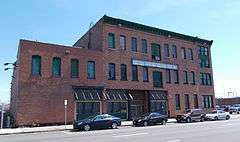 |
(#13000306) |
141 Elm Street 42°53′07″N 78°52′10″W / 42.885169°N 78.869344°W |
Downtown | One of the few planing mills left in city, built in 1878 |
| 59 | Hamlin Park Historic District | 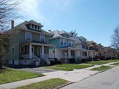 |
(#13000462) |
Beverly, Donaldson, Hamlin, & Lonsdale Rds., Blaine, Butler, E. Delevan, Goulding, Hughes, Jefferson & Loring Aves. 42°55′13″N 78°50′53″W / 42.920201°N 78.84816°W |
Hamlin Park | Early developed neighborhood became home to many middle-class African-Americans |
| 60 | Edmund B. Hayes Hall | 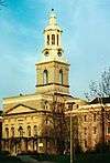 |
(#16000394) |
3435 Main St. 42°57′12″N 78°49′14″W / 42.9533594°N 78.8204393°W |
University Heights | Expanded from an almshouse in 1925–26 to become main building of unified UB campus |
| 61 | Hellenic Orthodox Church of the Annunciation | 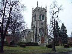 |
(#02001329) |
1000 Delaware Ave. 42°54′39″N 78°52′20″W / 42.910833°N 78.872222°W |
Delaware District | Gothic Revival style church constructed in 1906 as home to North Presbyterian Church |
| 62 | Hotel Lafayette | 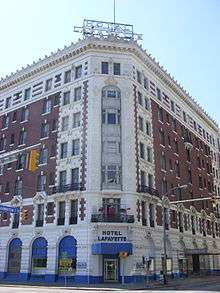 |
(#10000555) |
391 Washington St. 42°53′04″N 78°52′22″W / 42.884444°N 78.872778°W |
Downtown | |
| 63 | Houk Manufacturing Co. |  |
(#14000003) |
300–320 Grote St., 1686–1700 Elmwood Ave. 42°56′32″N 78°52′48″W / 42.942264°N 78.8800479°W |
Black Rock | |
| 64 | House at 218 Dearborn Street |  |
(#11000741) |
218 Dearborn St. 42°56′07″N 78°54′07″W / 42.935203°N 78.901806°W |
Black Rock | |
| 65 | James and Fanny How House |  |
(#97000415) |
41 St. Catherine's Crt. 42°54′59″N 78°52′28″W / 42.916389°N 78.874444°W |
Delaware District | Tudor Revival house designed in 1924 |
| 66 | E. & B. Holmes Machinery Company Building |  |
(#09000376) |
55-59 Chicago St. 42°52′11″N 78°52′08″W / 42.869722°N 78.868889°W |
First Ward | Former barrel machinery manufacturing complex |
| 67 | Edgar W. Howell House | 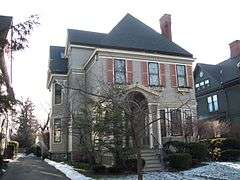 |
(#07001203) |
52 Lexington Ave. 42°54′46″N 78°52′21″W / 42.912778°N 78.8725°W |
Delaware District | Late Victorian Eclectic house dated to 1889 |
| 68 | The Huyler Building | 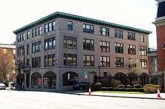 |
(#12000010) |
374 Delaware Ave. 42°53′41″N 78°52′32″W / 42.894606°N 78.875644°W |
Downtown | |
| 69 | Edwin M. and Emily S. Johnston House | 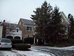 |
(#97000416) |
24 Tudor Pl. 42°55′01″N 78°52′30″W / 42.916944°N 78.875°W |
Delaware District | Colonial Revival house designed in 1934 by Bley & Lyman |
| 70 | The Kamman Building | 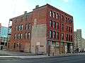 |
(#10000043) |
755 Seneca St. 42°52′33″N 78°50′57″W / 42.875833°N 78.849167°W |
East Side | |
| 71 | Col. William Kelly House |  |
(#97000414) |
36 Tudor Place 42°55′01″N 78°52′30″W / 42.916944°N 78.875°W |
Delaware District | Colonial Revival house constructed in 1937 |
| 72 | Kensington Gardens Apartment Complex |  |
(#10000989) |
1, 2, 3 W. Cleveland Dr. 42°56′30″N 78°47′59″W / 42.941667°N 78.799722°W |
Kensington | |
| 73 | Martin Luther King, Jr. Park | 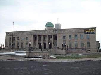 |
(#82005027) |
Roughly bounded by Northampton St., E. Parade Ave., Best St. and Kensington Expressway 42°54′19″N 78°50′26″W / 42.905278°N 78.840556°W |
East Side | Location of the Buffalo Museum of Science; park designed by Frederick Law Olmsted |
| 74 | Kleinhans Music Hall | |
(#89001235) |
Symphony Circle 42°54′06″N 78°53′00″W / 42.901667°N 78.883333°W |
Allentown and contributing structure to Allentown Historic District | Home of the Buffalo Philharmonic Orchestra and designed by Eliel Saarinen with his son Eero Saarinen, built 1938-1940 |
| 75 | Lafayette Avenue Presbyterian Church | 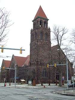 |
(#09000630) |
875 Elmwood Ave. 42°55′15″N 78°52′37″W / 42.920833°N 78.876944°W |
Elmwood Village | |
| 76 | Lafayette High School | 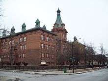 |
(#80002608) |
370 Lafayette Ave. 42°55′15″N 78°53′05″W / 42.920833°N 78.884722°W |
West Side | Public high school building built 1901-1903 |
| 77 | Laurel and Michigan Avenues Row | 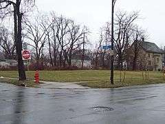 |
(#86000688) |
1335-1345 Michigan Ave. 42°54′36″N 78°51′45″W / 42.91°N 78.8625°W |
East Side | Former frame rowhouse structure demolished in 1997 |
| 78 | Macedonia Baptist Church |  |
(#74001233) |
511 Michigan Ave. 42°53′10″N 78°52′03″W / 42.886111°N 78.8675°W |
East Side | African American Baptist church constructed in 1845 |
| 79 | Market Street Historic District | 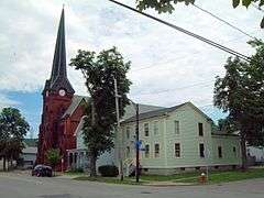 |
(#11000743) |
Amherst St. between Niagara and Tonawanda Sts., and portions of Dearborn and East Sts. 42°56′06″N 78°54′02″W / 42.935°N 78.900433°W |
Black Rock | |
| 80 | D. D. Martin House Complex | |
(#75001185) |
123 Jewett Parkway 42°56′11″N 78°50′53″W / 42.936389°N 78.848056°W |
Parkside | House and related structures designed by Frank Lloyd Wright |
| 81 | Darwin D. Martin House | |
(#86000160) |
125 Jewett Parkway 42°56′11″N 78°50′53″W / 42.936389°N 78.848056°W |
Parkside | House and related structures designed by Frank Lloyd Wright |
| 82 | H. A. Meldrum Company Building | 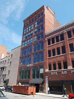 |
(#13000330) |
265–267 Pearl St. 42°53′11″N 78°52′31″W / 42.8864444°N 78.8753322°W |
Downtown | Early 20th-century home of department store |
| 83 | C. W. Miller Livery Stable | 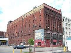 |
(#07001259) |
75 W. Huron St. 42°53′29″N 78°52′34″W / 42.891389°N 78.876111°W |
Downtown | Late 19th century multi-story livery stable |
| 84 | Rev. J. Edward Nash Sr. House | 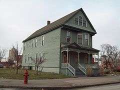 |
(#06001210) |
36 Nash St. 42°53′09″N 78°52′01″W / 42.885833°N 78.866944°W |
East Side | Queen Anne style dwelling constructed in 1892 |
| 85 | New York Central Terminal | 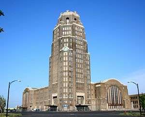 |
(#84002389) |
495 Paderewski Dr. 42°53′18″N 78°49′54″W / 42.888333°N 78.831667°W |
Polonia | Former central passenger terminal for New York Central Railroad |
| 86 | Packard Motor Car Showroom and Storage Facility | 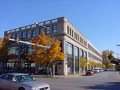 |
(#06000561) |
1325 Main St. 42°54′35″N 78°51′59″W / 42.909722°N 78.866389°W |
Cold Spring | Reinforced concrete automobile showroom designed in 1926 by Albert Kahn |
| 87 | Parke Apartments | 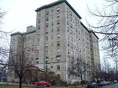 |
(#07000492) |
33 Gates Circle 42°55′14″N 78°52′08″W / 42.920556°N 78.868889°W |
Delaware District | Large apartment building built 1926-1927 |
| 88 | Parkside Candy Shoppe and Factory | 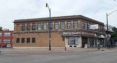 |
(#15000799) |
3208 Main St. 42°57′06″N 78°49′41″W / 42.951695°N 78.8279207°W |
University Heights | Working candy shop built in late 1920s, still making its own product on site |
| 89 | Parkside East Historic District | 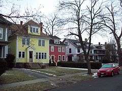 |
(#86002817) |
Roughly bounded by Parkside Ave., Amherst St., Colvin Ave., New York Central RR tracks, Main St., and Humboldt Ave. 42°56′09″N 78°50′59″W / 42.935833°N 78.849722°W |
Parkside | Historic district of 1,769 contributing structures developed primarily from 1876 to 1936, as a middle class residential neighborhood |
| 90 | Parkside West Historic District | 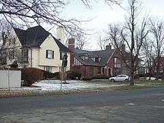 |
(#86003372) |
Roughly bounded by Amherst St., Nottingham Terr., Middlesex Rd., and Delaware Ave. 42°56′15″N 78°52′01″W / 42.9375°N 78.866944°W |
North Park | Historic district of 137 contributing structures developed primarily from 1923 to 1940, as a middle class residential neighborhood |
| 91 | Pierce Arrow Factory Complex | |
(#74001234) |
Elmwood and Great Arrow Aves. 42°56′34″N 78°52′26″W / 42.942778°N 78.873889°W |
North Buffalo, Buffalo, New York | Former Pierce-Arrow automobile factory complex and designed by Albert Kahn in about 1906 |
| 92 | Prospect Hill Historic District |  |
(#16000694) |
Columbus Pkwy., Columbus Park W., Busti & Rhode Island Aves., Niagara & Vermont Sts. 42°54′22″N 78°53′55″W / 42.9062083°N 78.8984774°W |
Streetcar suburb built over a century starting from 1860s on former estate was home to many successful Italian Americans in Buffalo | |
| 93 | Prudential Building | 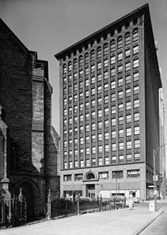 |
(#73001187) |
Church and Pearl Sts. 42°52′58″N 78°52′36″W / 42.882778°N 78.876667°W |
Downtown | Early skyscraper office building designed by Louis Sullivan and Dankmar Adler, and built in 1894 |
| 94 | Public School No. 60 | 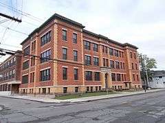 |
(#14000489) |
238 Ontario St. 42°57′04″N 78°54′12″W / 42.95117°N 78.903266°W |
Riverside | Early 20th-century school instrumental in developing the Black Rock neighborhood |
| 95 | Public School No. 63 | 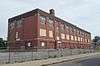 |
(#16000587) |
91 Lisbon Ave. 42°56′51″N 78°49′37″W / 42.9474469°N 78.8269097°W |
LaSalle | 1917 building, expanded eight years later, is excellent surviving example of early 20th-century open-plan standardized school. Soon to be converted into apartments. |
| 96 | Richmond Avenue Methodist-Episcopal Church | 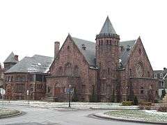 |
(#08001143) |
525 W. Ferry St. 42°54′56″N 78°52′53″W / 42.915556°N 78.881389°W |
West Side | Church complex constructed between 1885 and 1898 built of Medina sandstone; now home to Upper West Side Arts Center |
| 97 | Riverside Park | 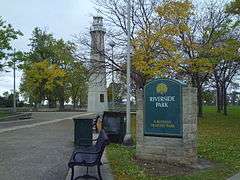 |
(#82005026) |
Roughly bounded by Vulcan, Tonawanda, Crowley, and Niagara St. 42°57′20″N 78°54′32″W / 42.955556°N 78.908889°W |
Riverside, Buffalo, New York | Park located in northwest Buffalo overlooking the Niagara River |
| 98 | Robertson–Cataract Electric Building | 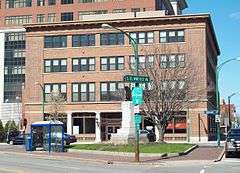 |
(#12000011) |
100, 126 S. Elmwood 42°53′18″N 78°52′46″W / 42.888425°N 78.879403°W |
Downtown | |
| 99 | Theodore Roosevelt Inaugural National Historic Site | 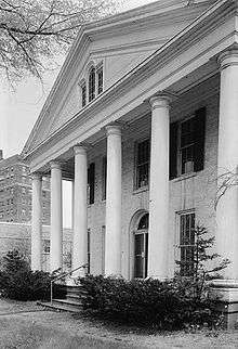 |
(#66000516) |
641 Delaware Ave. 42°57′20″N 78°54′32″W / 42.955556°N 78.908889°W |
Allentown | Home where Theodore Roosevelt took the oath of office as President of the United States on September 14, 1901, following the assassination of William McKinley |
| 100 | Saturn Club | 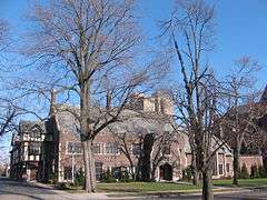 |
(#05000444) |
977 Delaware Ave. 42°54′38″N 78°52′13″W / 42.910556°N 78.870278°W |
Delaware District | Tudor Revival clubhouse structure opened in 1922 |
| 101 | School 13 | 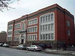 |
(#05000161) |
266-268 Oak St. 42°53′20″N 78°52′13″W / 42.888889°N 78.870278°W |
Downtown | Former school building built in 1915 |
| 102 | Shea's Buffalo Theater | 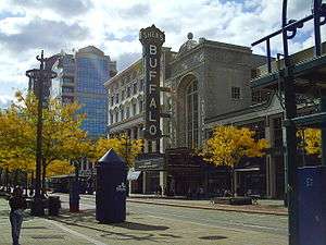 |
(#75001186) |
646 Main St. 42°53′29″N 78°52′25″W / 42.891389°N 78.873611°W |
Downtown | Former movie palace originally called Shea's Buffalo and opened in 1926 |
| 103 | Sibley and Holmwood Candy Factory and Witkop and Holmes Headquarters | 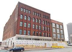 |
(#14000398) |
149 & 145 Swan Street 42°52′50″N 78°52′13″W / 42.880545°N 78.870233°W |
Downtown | Well-preserved factory near downtown recently remodeled into apartments |
| 104 | Sinclair, Rooney & Co. Building | 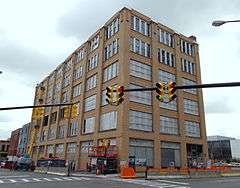 |
(#15001025) |
465 Washington St. 42°53′12″N 78°52′29″W / 42.8867576°N 78.8746728°W |
1909 factory building meant to be flexible and adaptable for different kinds of manufacturing | |
| 105 | South Buffalo North Side Light |  |
(#83001673) |
Buffalo Harbor 42°50′07″N 78°52′03″W / 42.835278°N 78.8675°W |
Buffalo | Former light installed in 1903, removed in 1985, and now located at the Dunkirk Lighthouse and Veterans Park Museum |
| 106 | St. Andrew's Episcopal Church | 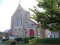 |
(#10000333) |
3105 Main St. 42°50′07″N 78°52′03″W / 42.835278°N 78.8675°W |
Buffalo | |
| 107 | St. Andrew's Evangelical Lutheran Church Complex | 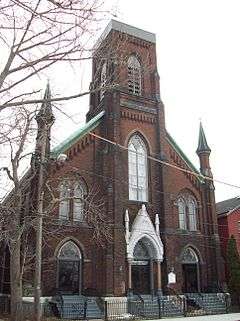 |
(#83001674) |
Sherman and Peckham Sts. 42°53′17″N 78°50′48″W / 42.888056°N 78.846667°W |
East Side | Former Evangelical Lutheran church complex consisting of church, parish house, and school constructed 1859-1892 |
| 108 | St. Francis Xavier Roman Catholic Parish Complex | 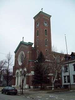 |
(#09000631) |
157 East St. 42°56′09″N 78°54′01″W / 42.935833°N 78.900278°W |
Black Rock, Buffalo, New York | |
| 109 | St. Paul's Cathedral (Buffalo) | 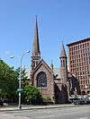 |
(#87002600) |
125 and/or 139 Pearl St. 42°52′58″N 78°52′35″W / 42.882778°N 78.876389°W |
Downtown | The cathedral of the Episcopal Diocese of Western New York; built 1849-1851 and designed by Richard Upjohn |
| 110 | Sts. Peter and Paul Orthodox Church Complex | 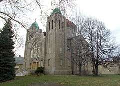 |
(#15000513) |
40 Benzinger St. 42°53′10″N 78°48′25″W / 42.88599°N 78.806937°W |
Lovejoy | Oldest Orthodox church in Buffalo and oldest in use in the Orthodox Diocese of New York and New Jersey. |
| 111 | St. Theresa's Roman Catholic Church Complex | Upload image | (#16000589) |
1970 Seneca St., 17 Mineral Springs Rd. 42°51′28″N 78°48′53″W / 42.8577201°N 78.8146713°W |
South Buffalo | Well-preserved collection of late 19th-century church buildings. |
| 112 | Stone Farmhouse | 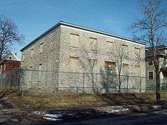 |
(#98001614) |
60 Hedley Pl. 42°55′24″N 78°51′05″W / 42.923333°N 78.851389°W |
Hamlin Park | Greek Revival influenced stone vernacular farmhouse built about 1830-1850 |
| 113 | Taylor Signal Company-General Railway Signal Company | 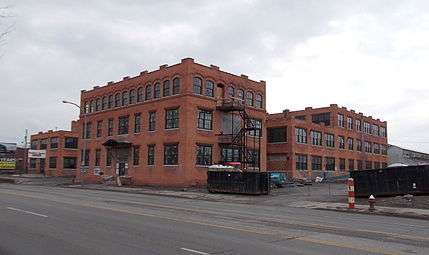 |
(#14000260) |
1738 Elmwood Ave. 42°56′41″N 78°52′42″W / 42.944629°N 78.878363°W |
||
| 114 | Tishman Building | 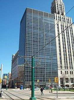 |
(#12000012) |
447 Main St., 10 Lafayette Sq. 42°53′09″N 78°52′26″W / 42.885761°N 78.873826°W |
Downtown | |
| 115 | Trico Plant No. 1 | 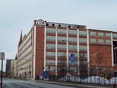 |
(#01000053) |
817 Washington St. 42°53′42″N 78°52′10″W / 42.895°N 78.869444°W |
Downtown | Early and significant example of the "Daylight Factory;" former home to first manufacturer of windshield wipers |
| 116 | Trinity Episcopal Church | 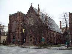 |
(#08000100) |
371 Delaware Ave. 42°53′41″N 78°52′29″W / 42.894722°N 78.874722°W |
Downtown | Main church constructed in 1884-1886 and features stained glass windows designed by John LaFarge and Tiffany studios |
| 117 | Turner Brothers' Building–American Household Storage Company | 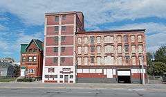 |
(#12001128) |
295 Niagara St. 42°53′34″N 78°53′01″W / 42.892655°N 78.883548°W |
Lower West Side | |
| 118 | University Presbyterian Church | 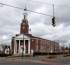 |
(#15000820) |
3330 Main St. 42°57′17″N 78°49′29″W / 42.9546482°N 78.8247778°W |
University Heights | Unusual V-shaped church built in two phases was one of first to reach out to growing suburbs |
| 119 | U.S. Post Office | 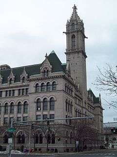 |
(#72000839) |
121 Ellicott St. 42°52′53″N 78°52′22″W / 42.881389°N 78.872778°W |
Downtown | Former post office built 1897-1901; home to city campus of Erie Community College |
| 120 | USS CROAKER (submarine) | 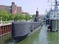 |
(#08000863) |
1 Naval Park Cove 42°52′41″N 78°52′54″W / 42.878056°N 78.881667°W |
Buffalo | Gato class submarine, launched in 1943 |
| 121 | USS THE SULLIVANS (destroyer) | 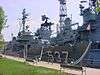 |
(#86000085) |
1 Naval Park Cove 42°52′40″N 78°52′50″W / 42.877778°N 78.880556°W |
Buffalo | Fletcher class destroyer, launched in 1943 |
| 122 | University Park Historic District | 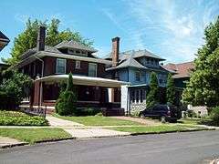 |
(#11000273) |
Portions of Larchmont Rd., Niagara Falls Blvd., Radcliffe Rd., University Ave., Allenhurst Rd., Pellhan Dr 42°57′24″N 78°49′30″W / 42.956667°N 78.825°W |
University Heights | |
| 123 | West Village Historic District | 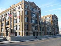 |
(#80002610) |
Roughly bounded by S. Elmwood Ave., Chippewa, Georgia, Prospect, Carolina and Tracy Sts. 42°53′31″N 78°52′50″W / 42.891944°N 78.880556°W |
Lower West Side | District with 102 structures built between 1854 and 1914, most of which are detached single-family dwellings, with about a dozen apartment buildings |
| 124 | The Wayne and The Waldorf Apartments | 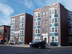 |
(#14000912) |
1106 Main St. 42°54′20″N 78°52′30″W / 42.9056771°N 78.8751365°W |
Downtown | Only remaining apartments meant for middle-class residents from city's early 20th-century expansion |
| 125 | M. Wile and Company Factory Building | 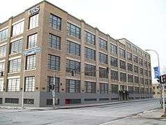 |
(#00001419) |
77 Goodell St. 42°53′40″N 78°52′07″W / 42.894444°N 78.868611°W |
Downtown | Early example of the "Daylight Factory" built in 1924 |
| 126 | Wollenberg Grain and Seed Elevator | 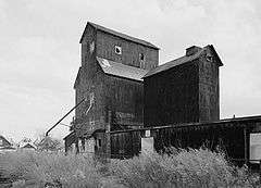 |
(#03000409) |
131 Goodyear Ave. 42°53′59″N 78°49′18″W / 42.899722°N 78.821667°W |
Buffalo | "Country style" grain elevator built in 1912 and destroyed by fire in 2006 |
| 127 | Woodlawn Avenue Row | 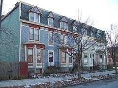 |
(#86000690) |
75-81 Woodlawn Ave. 42°54′49″N 78°51′44″W / 42.913611°N 78.862222°W |
Buffalo | Speculative frame rowhouses built in 1898 |
| 128 | Young Men's Christian Association Central Building | 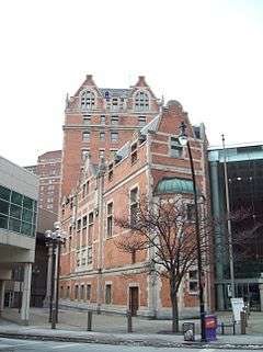 |
(#83001676) |
45 W. Mohawk St. 42°53′15″N 78°52′33″W / 42.8875°N 78.875833°W |
Downtown | Constructed in 1901-1902 and home to the third oldest YMCA chapter in North America until converted to office use in the early 1980s |
| 129 | The Zink Block | 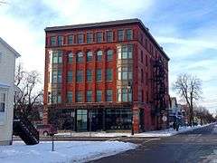 |
(#10000987) |
346 Connecticut St. 42°54′21″N 78°53′17″W / 42.905833°N 78.888056°W |
West Side |
Former listings
| [3] | Name on the Register | Image | Date listed | Date removed | Location | Summary |
|---|---|---|---|---|---|---|
| 1 | 17-21 Emerson Place Row | Upload image | (#86000689) | 17-21 Emerson Place 42°54′47″N 78°51′38″W / 42.9131°N 78.8606°W |
||
| 2 | Niagara Frontier Transit Buildings | Upload image | (#80002609) | 855 Main St. |
See also
| Wikimedia Commons has media related to National Register of Historic Places in Buffalo, New York. |
- National Register of Historic Places listings in New York
- List of National Historic Landmarks in New York
References
- ↑ The latitude and longitude information provided in this table was derived originally from the National Register Information System, which has been found to be fairly accurate for about 99% of listings. For about 1% of NRIS original coordinates, experience has shown that one or both coordinates are typos or otherwise extremely far off; some corrections may have been made. A more subtle problem causes many locations to be off by up to 150 yards, depending on location in the country: most NRIS coordinates were derived from tracing out latitude and longitudes off of USGS topographical quadrant maps created under the North American Datum of 1927, which differs from the current, highly accurate WGS84 GPS system used by most on-line maps. Chicago is about right, but NRIS longitudes in Washington are higher by about 4.5 seconds, and are lower by about 2.0 seconds in Maine. Latitudes differ by about 1.0 second in Florida. Some locations in this table may have been corrected to current GPS standards.
- ↑ "National Register of Historic Places: Weekly List Actions". National Park Service, United States Department of the Interior. Retrieved on December 16, 2016.
- 1 2 Numbers represent an ordering by significant words. Various colorings, defined here, differentiate National Historic Landmarks and historic districts from other NRHP buildings, structures, sites or objects.
- ↑ The eight-digit number below each date is the number assigned to each location in the National Register Information System database, which can be viewed by clicking the number.
| Topics |  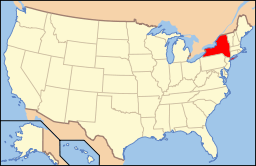 | |
|---|---|---|
| Lists by county |
| |
| Lists by city | ||
| Other lists | ||
| ||
This article is issued from Wikipedia - version of the 11/11/2016. The text is available under the Creative Commons Attribution/Share Alike but additional terms may apply for the media files.