| [3] |
Name on the Register[4] |
Image |
Date listed[5] |
Location |
City or town |
Description |
|---|
| 1 |
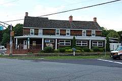
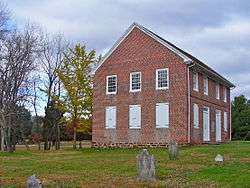
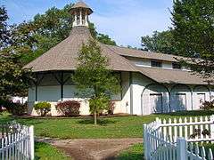
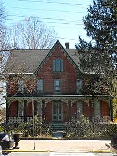
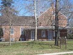
Barnsboro Hotel |
|
000000001973-01-25-0000January 25, 1973
(#73001095) |
Jct. of Pitman and Sewell Rds.
39°45′42″N 75°09′37″W / 39.761667°N 75.160278°W / 39.761667; -75.160278 (Barnsboro Hotel) |
Mantua Township |
|
| 2 |
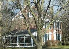
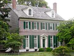
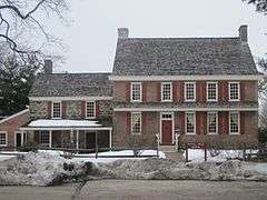
Butler Farm |
|
000000001978-12-01-0000December 1, 1978
(#78001763) |
E of Swedesboro
39°44′09″N 75°16′17″W / 39.735833°N 75.271389°W / 39.735833; -75.271389 (Butler Farm) |
Swedesboro |
|
| 3 |
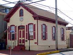
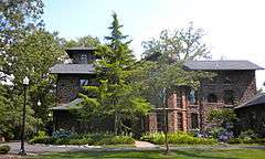
Carpenter Street School |
|
000000001997-08-21-0000August 21, 1997
(#97000934) |
53-55 Carpenter St.
39°49′53″N 75°09′18″W / 39.831389°N 75.155°W / 39.831389; -75.155 (Carpenter Street School) |
Woodbury |
|
| 4 |
Jesse Chew House |
|
000000001972-10-18-0000October 18, 1972
(#72000797) |
611 Mantua Blvd.
39°46′25″N 75°08′58″W / 39.773611°N 75.149444°W / 39.773611; -75.149444 (Jesse Chew House) |
Sewell |
|
| 5 |
Benjamin Clark House |
|
000000001973-01-25-0000January 25, 1973
(#73001099) |
Glassboro Rd.
39°47′07″N 75°08′15″W / 39.785278°N 75.1375°W / 39.785278; -75.1375 (Benjamin Clark House) |
Wenonah |
|
| 6 |
Downer Methodist Episcopal Church |
|
000000002010-10-14-0000October 14, 2010
(#10000835) |
2226 Fries Mill Rd.
39°41′37″N 75°03′08″W / 39.693611°N 75.052222°W / 39.693611; -75.052222 (Downer Methodist Episcopal Church) |
Monroe Township |
|
| 7 |
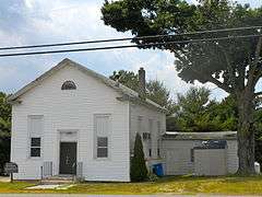
Free Library and Reading Room-Williamstown Memorial Library |
|
000000001987-10-01-0000October 1, 1987
(#87001761) |
405 S. Main St.
39°40′55″N 74°59′29″W / 39.681944°N 74.991389°W / 39.681944; -74.991389 (Free Library and Reading Room-Williamstown Memorial Library) |
Williamstown |
|
| 8 |
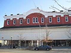
G. G. Green's Block |
|
000000002001-07-25-0000July 25, 2001
(#01000769) |
108 S. Broad St.
39°50′11″N 75°09′16″W / 39.836389°N 75.154444°W / 39.836389; -75.154444 (G. G. Green's Block) |
Woodbury |
|
| 9 |
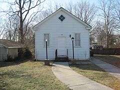
Hall Street School |
|
000000002006-09-27-0000September 27, 2006
(#06000879) |
30 Hall St.
39°41′10″N 74°59′29″W / 39.686111°N 74.991389°W / 39.686111; -74.991389 (Hall Street School) |
Monroe Township |
|
| 10 |
Hunter-Lawrence-Jessup House |
|
000000001972-10-18-0000October 18, 1972
(#72000798) |
58 N. Broad St.
39°50′21″N 75°09′08″W / 39.839167°N 75.152222°W / 39.839167; -75.152222 (Hunter-Lawrence-Jessup House) |
Woodbury |
|
| 11 |
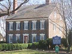
Ladd's Castle |
|
000000001972-10-31-0000October 31, 1972
(#72000794) |
1337 Lafayette Ave.
39°51′28″N 75°08′37″W / 39.857778°N 75.143611°W / 39.857778; -75.143611 (Ladd's Castle) |
Colonial Manor |
|
| 12 |
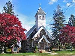
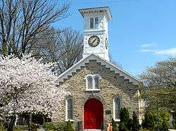
Memorial Presbyterian Church |
|
000000002013-08-07-0000August 7, 2013
(#13000585) |
202 E. Mantua Ave.
39°47′28″N 75°08′48″W / 39.791072°N 75.146621°W / 39.791072; -75.146621 (Memorial Presbyterian Church) |
Wenonah |
|
| 13 |
Moravian Church |
|
000000001973-04-03-0000April 3, 1973
(#73001097) |
Swedesboro-Sharptown Rd.
39°42′05″N 75°19′58″W / 39.701389°N 75.332778°W / 39.701389; -75.332778 (Moravian Church) |
Woolwich Township |
|
| 14 |
Mount Zion African Methodist Episcopal Church and Mount Zion Cemetery |
|
000000002001-07-25-0000July 25, 2001
(#01000768) |
172 Garwin Rd.
39°45′54″N 75°17′50″W / 39.765°N 75.297222°W / 39.765; -75.297222 (Mount Zion African Methodist Episcopal Church and Mount Zion Cemetery) |
Woolwich |
|
| 15 |
Mullica Hill Historic District |
|
000000001991-04-25-0000April 25, 1991
(#91000483) |
Roughly, Main St. from Mullica Hill-Bridgeport Rd. to jct. of Commissioner's Rd. and Bridgeton Pike, Harrison Township
39°44′10″N 75°13′31″W / 39.736111°N 75.225278°W / 39.736111; -75.225278 (Mullica Hill Historic District) |
Mullica Hill |
|
| 16 |
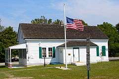
C. A. Nothnagle Log House |
|
000000001976-04-23-0000April 23, 1976
(#76001153) |
Swedesboro-Paulsboro Rd.
39°49′05″N 75°15′59″W / 39.818056°N 75.266389°W / 39.818056; -75.266389 (C. A. Nothnagle Log House) |
Gibbstown |
|
| 17 |
Bodo Otto House |
|
000000001976-12-12-0000December 12, 1976
(#76001154) |
SR 551 and Quaker Rd.
39°47′20″N 75°14′29″W / 39.788889°N 75.241389°W / 39.788889; -75.241389 (Bodo Otto House) |
Mickleton |
|
| 18 |
Pitman Grove |
|
000000001977-08-19-0000August 19, 1977
(#77000870) |
Bounded by Holly, East, Laurel, and West Aves. (both sides)
39°43′50″N 75°07′58″W / 39.730556°N 75.132778°W / 39.730556; -75.132778 (Pitman Grove) |
Pitman |
|
| 19 |
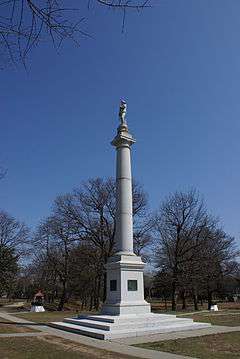
Red Bank Battlefield |
|
000000001972-10-31-0000October 31, 1972
(#72000796) |
E bank of Delaware River and W end of Hessian Ave.
39°52′13″N 75°11′25″W / 39.870278°N 75.190278°W / 39.870278; -75.190278 (Red Bank Battlefield) |
National Park |
|
| 20 |
Richardson Avenue School |
|
000000001998-06-18-0000June 18, 1998
(#98000703) |
Richardson Ave.
39°44′51″N 75°18′49″W / 39.7475°N 75.313611°W / 39.7475; -75.313611 (Richardson Avenue School) |
Swedesboro |
|
| 21 |
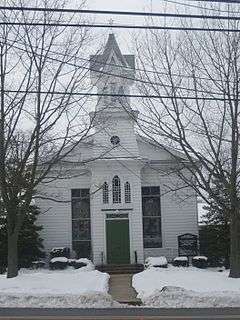
Richwood Methodist Church |
|
000000001979-01-19-0000January 19, 1979
(#79001490) |
Elmer Rd.
39°43′18″N 75°10′01″W / 39.721667°N 75.166944°W / 39.721667; -75.166944 (Richwood Methodist Church) |
Harrison Township |
|
| 22 |
John C. Rulon House |
|
000000002000-11-22-0000November 22, 2000
(#00001404) |
428 Kings Highway
39°44′50″N 75°18′37″W / 39.747222°N 75.310278°W / 39.747222; -75.310278 (John C. Rulon House) |
Swedesboro |
|
| 23 |
Salisbury Farm |
Upload image |
000000001979-03-07-0000March 7, 1979
(#79001489) |
Address Restricted
|
Bridgeport |
|
| 24 |
St. Peter's Episcopal Church |
|
000000001977-08-10-0000August 10, 1977
(#77000869) |
King's Hwy.
39°47′58″N 75°13′28″W / 39.799444°N 75.224444°W / 39.799444; -75.224444 (St. Peter's Episcopal Church) |
Clarksboro |
|
| 25 |
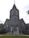
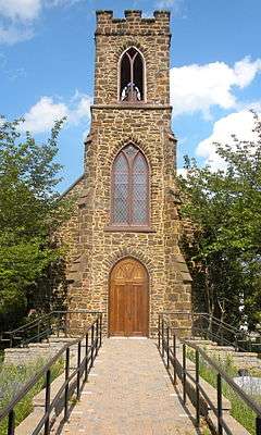
St. Thomas Episcopal Church |
|
000000001975-03-03-0000March 3, 1975
(#75001137) |
SE corner Main and Focer Sts.
39°42′41″N 75°06′54″W / 39.711389°N 75.115°W / 39.711389; -75.115 (St. Thomas Episcopal Church) |
Glassboro |
|
| 26 |
Gov. Charles C. Stratton House |
|
000000001973-01-29-0000January 29, 1973
(#73001101) |
0.5 mi. E of Swedesboro on King's Hwy.
39°45′07″N 75°18′10″W / 39.751944°N 75.302778°W / 39.751944; -75.302778 (Gov. Charles C. Stratton House) |
Woolwich Township |
|
| 27 |
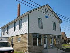
Thompson House |
|
000000001988-07-13-0000July 13, 1988
(#88000996) |
103 Penn St.
39°50′00″N 75°09′35″W / 39.833333°N 75.159722°W / 39.833333; -75.159722 (Thompson House) |
Woodbury |
|
| 28 |
Tinicum Island Range Rear Light Station |
|
000000002005-09-15-0000September 15, 2005
(#05001053) |
250 ft. S o jct. of Beacon Ave. and Second St.
39°50′51″N 75°14′24″W / 39.8475°N 75.24°W / 39.8475; -75.24 (Tinicum Island Range Rear Light Station) |
Billingsport |
|
| 29 |
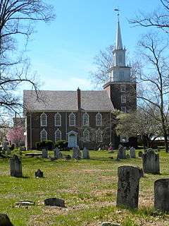
Trinity Church |
|
000000001973-01-29-0000January 29, 1973
(#73001098) |
NW corner of Church St. and King's Hwy.
39°45′01″N 75°18′41″W / 39.750278°N 75.311389°W / 39.750278; -75.311389 (Trinity Church) |
Swedesboro |
|
| 30 |
Upper Greenwich Friends Meetinghouse |
|
000000001997-02-28-0000February 28, 1997
(#97000062) |
413 Kings Hwy., E. Greenwich Township
39°47′35″N 75°14′21″W / 39.793056°N 75.239167°W / 39.793056; -75.239167 (Upper Greenwich Friends Meetinghouse) |
Mickleton |
|
| 31 |
James Whitall, Jr. House |
|
000000001973-02-06-0000February 6, 1973
(#73001096) |
100 Grove Ave.
39°51′52″N 75°10′49″W / 39.864444°N 75.180278°W / 39.864444; -75.180278 (James Whitall, Jr. House) |
National Park |
|
| 32 |
Whitney Mansion |
|
000000001972-12-05-0000December 5, 1972
(#72000795) |
Whitney Ave.
39°42′22″N 75°07′06″W / 39.706111°N 75.118333°W / 39.706111; -75.118333 (Whitney Mansion) |
Glassboro |
|
| 33 |
Woodbury Friends' Meetinghouse |
|
000000001973-02-06-0000February 6, 1973
(#73001100) |
120 N. Broad St.
39°50′26″N 75°09′04″W / 39.840556°N 75.151111°W / 39.840556; -75.151111 (Woodbury Friends' Meetinghouse) |
Woodbury |
|


.JPG)


.JPG)
.JPG)

.JPG)