National Register of Historic Places listings in Hart County, Georgia
This is a list of properties and districts in Hart County, Georgia that are listed on the National Register of Historic Places (NRHP).
- This National Park Service list is complete through NPS recent listings posted December 16, 2016.[1]
Current listings
| [2] | Name on the Register | Image | Date listed[3] | Location | City or town | Description |
|---|---|---|---|---|---|---|
| 1 | Adams-Matheson House | Upload image | (#86002003) |
116 Athens St. 34°21′06″N 82°56′27″W / 34.351667°N 82.940833°W |
Hartwell | |
| 2 | Archibald Mewborn House | Upload image | (#96001556) |
Approximately 1 mi. E of GA 172, 7 mi. S of Hartwell 34°14′43″N 82°57′26″W / 34.245278°N 82.957222°W |
Hartwell | |
| 3 | Benson Street-Forest Avenue Residential Historic District | Upload image | (#86002004) |
Roughly along Benson St. from Forest Ave. to Adams St. and along Forest Ave. from Railroad St. to Garrison Rd. 34°20′52″N 82°55′52″W / 34.347778°N 82.931111°W |
Hartwell | |
| 4 | Allie M. Best House | Upload image | (#86002005) |
122 Athens St. 34°21′02″N 82°56′30″W / 34.350556°N 82.941667°W |
Hartwell | |
| 5 | Bowersville Historic District | Upload image | (#85001975) |
E. and W. Main St. 34°22′22″N 83°05′01″W / 34.372778°N 83.083611°W |
Bowersville | |
| 6 | Chandler-Linder House | Upload image | (#86002006) |
Johnson St. 34°21′19″N 82°56′07″W / 34.355278°N 82.935278°W |
Hartwell | |
| 7 | H. E. Fortson House | Upload image | (#86002007) |
221 Richardson St. 34°21′30″N 82°55′42″W / 34.358333°N 82.928333°W |
Hartwell | |
| 8 | Franklin Light and Power Company Steam Generating Station | Upload image | (#86002009) |
Leard St. at RR track 34°21′20″N 82°56′46″W / 34.355556°N 82.946111°W |
Hartwell | |
| 9 | Franklin Street-College Avenue Residential Historic District | Upload image | (#86002011) |
Roughly bounded by Johnson, Maple, Franklin and First, and Carter Sts. 34°21′09″N 82°55′42″W / 34.3525°N 82.928333°W |
Hartwell | |
| 10 | Gulley-Gurley Farm | Upload image | (#97000334) |
1389 Lou Gurley Road 34°23′54″N 83°02′11″W / 34.398333°N 83.036389°W |
Bowersville | |
| 11 | Gulley-Vickery-Blackwell House | Upload image | (#86002014) |
115 Franklin St. 34°21′13″N 82°55′56″W / 34.353611°N 82.932222°W |
Hartwell | |
| 12 | Hart County Jail | Upload image | (#85002085) |
Johnson St. 34°21′17″N 82°56′00″W / 34.354722°N 82.933333°W |
Hartwell | |
| 13 | Hartwell City School | Upload image | (#86002016) |
College Ave. 34°20′58″N 82°55′44″W / 34.349444°N 82.928889°W |
Hartwell | |
| 14 | Hartwell Commercial Historic District | Upload image | (#86002019) |
Roughly bounded by Franklin St., Forest Ave., Railroad St., and Jackson and Carolina Sts. 34°21′07″N 82°56′00″W / 34.351944°N 82.933333°W |
Hartwell | |
| 15 | Hartwell Methodist Episcopal Church, South | Upload image | (#86002021) |
Howell St. 34°21′10″N 82°56′09″W / 34.352778°N 82.935833°W |
Hartwell | |
| 16 | Horton-Vickery House | Upload image | (#86002024) |
101 Vickery St. 34°21′28″N 82°55′51″W / 34.357778°N 82.930833°W |
Hartwell | |
| 17 | Pearl J. Jones House | 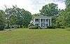 |
(#86002027) |
401 Athens St. 34°20′43″N 82°56′37″W / 34.345278°N 82.943611°W |
Hartwell | |
| 18 | Kendrick-Matheson House | Upload image | (#86002029) |
212 Athens St. 34°20′55″N 82°56′32″W / 34.348611°N 82.942222°W |
Hartwell | |
| 19 | Charles I. Kidd House | Upload image | (#86002032) |
304 W. Howell St. 34°21′12″N 82°56′11″W / 34.353333°N 82.936389°W |
Hartwell | |
| 20 | Roscoe Conklin Linder House | Upload image | (#86002033) |
118 Athens St. 34°21′05″N 82°56′28″W / 34.351389°N 82.941111°W |
Hartwell | |
| 21 | McCurry-Kidd House | Upload image | (#86002035) |
602 W. Howell St. 34°21′17″N 82°56′24″W / 34.354722°N 82.94°W |
Hartwell | |
| 22 | McMullan-Vickery Farm | Upload image | (#86002037) |
602 Forest Ave. 34°21′39″N 82°55′45″W / 34.360833°N 82.929167°W |
Hartwell | |
| 23 | Dr. Owen Meredith House | Upload image | (#86002040) |
605 Benson St. 34°20′42″N 82°55′32″W / 34.345°N 82.925556°W |
Hartwell | |
| 24 | Jackson Morrison House | Upload image | (#86002046) |
439 Rome St. 34°21′44″N 82°55′29″W / 34.362222°N 82.924722°W |
Hartwell | |
| 25 | Patterson-Turner Homeplace | Upload image | (#90001126) |
Smith-McGee Bridge Rd. 34°21′16″N 82°54′27″W / 34.354444°N 82.9075°W |
Hartwell | |
| 26 | Pure Oil Service Station | Upload image | (#86002047) |
Howell St. at Jackson St. 34°21′10″N 82°56′03″W / 34.352778°N 82.934167°W |
Hartwell | |
| 27 | Emory Edward Satterfield House | Upload image | (#86002049) |
504 W. Howell St. 34°21′15″N 82°56′19″W / 34.354167°N 82.938611°W |
Hartwell | |
| 28 | Meyer Saul House | Upload image | (#86002043) |
304 W. Johnson St. 34°21′19″N 82°56′09″W / 34.355278°N 82.935833°W |
Hartwell | |
| 29 | Alexander Stephens Skelton House | Upload image | (#86002050) |
214 Athens St. 34°20′55″N 82°56′33″W / 34.348611°N 82.9425°W |
Hartwell | |
| 30 | Ralph Teasley House | Upload image | (#86002053) |
421 W. Howell St. 34°21′12″N 82°56′19″W / 34.353333°N 82.938611°W |
Hartwell | |
| 31 | Thomas William Teasley House | Upload image | (#86002055) |
417 W. Howell St. 34°21′12″N 82°56′17″W / 34.353333°N 82.938056°W |
Hartwell | |
| 32 | Teasley-Holland House | Upload image | (#86002052) |
416 W. Howell St. 34°21′14″N 82°56′17″W / 34.353889°N 82.938056°W |
Hartwell | |
| 33 | John Roland Temple House | Upload image | (#86002059) |
129 Athens St. 34°21′00″N 82°56′29″W / 34.35°N 82.941389°W |
Hartwell | |
| 34 | Temple-Skelton House | Upload image | (#86002057) |
201 Athens St. 34°20′58″N 82°56′29″W / 34.349444°N 82.941389°W |
Hartwell | |
| 35 | John Underwood House | Upload image | (#86002062) |
825 S. Jackson St. 34°20′33″N 82°56′22″W / 34.3425°N 82.939444°W |
Hartwell | |
| 36 | Witham Cotton Mills Village Historic District | Upload image | (#86002064) |
Along Liberty Circle, Jackson, and Webb Sts. 34°21′00″N 82°56′10″W / 34.35°N 82.936111°W |
Hartwell |
References
- ↑ "National Register of Historic Places: Weekly List Actions". National Park Service, United States Department of the Interior. Retrieved on December 16, 2016.
- ↑ Numbers represent an ordering by significant words. Various colorings, defined here, differentiate National Historic Landmarks and historic districts from other NRHP buildings, structures, sites or objects.
- ↑ The eight-digit number below each date is the number assigned to each location in the National Register Information System database, which can be viewed by clicking the number.
| Wikimedia Commons has media related to National Register of Historic Places in Hart County, Georgia. |
This article is issued from Wikipedia - version of the 6/27/2016. The text is available under the Creative Commons Attribution/Share Alike but additional terms may apply for the media files.