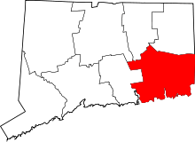
| [3] |
Name on the Register[4] |
Image |
Date listed[5] |
Location |
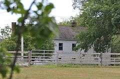
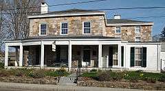
City or town |
Description |
|---|
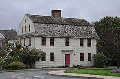
| 1 |
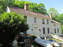
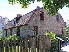
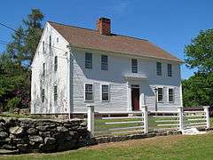
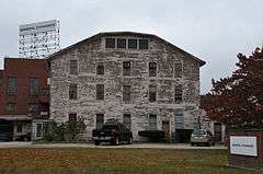
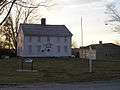
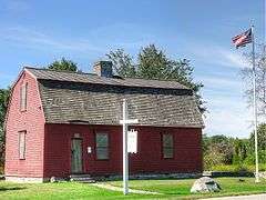
Alden Tavern Site |
|
000000001998-04-13-0000April 13, 1998
(#98000361) |
Town parking lot adjacent to Lebanon Historical Society[6]
41°38′14″N 72°12′47″W / 41.6373°N 72.213°W / 41.6373; -72.213 (Alden Tavern Site) |
Lebanon |
Site of tavern, tied to the whipping of British General Richard Prescott.
|
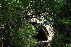
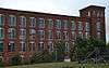
| 2 |
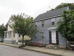
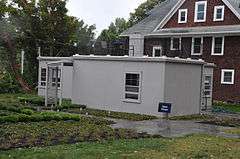
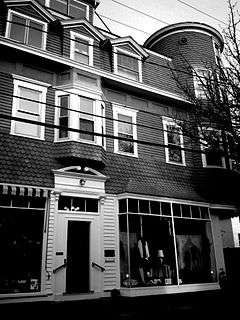
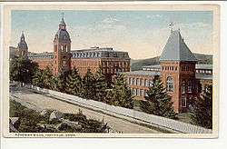
American Thermos Bottle Company Laurel Hill Plant |
|
000000001989-07-17-0000July 17, 1989
(#88003091) |
11 Thermos Ave.
41°30′37″N 72°04′43″W / 41.510278°N 72.078611°W / 41.510278; -72.078611 (American Thermos Bottle Company Laurel Hill Plant) |
Norwich |
The American Thermos Bottle Company plant is significant for the adaptive use of a mill design to modern industry. Now renovated, the property has been modernized for a school.
|
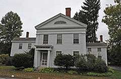
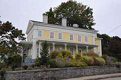
| 3 |
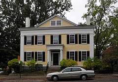
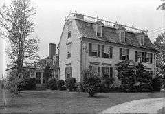
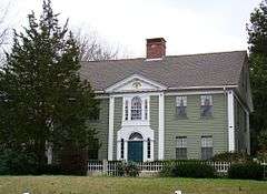
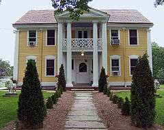
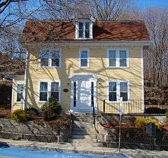
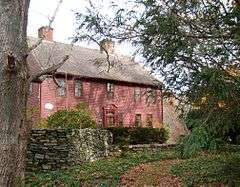
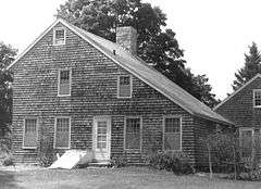
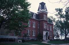
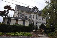
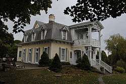
Winslow Ames House |
|
000000001995-03-23-0000March 23, 1995
(#95000283) |
132 Mohegan Ave.
41°22′34″N 72°06′09″W / 41.376111°N 72.1025°W / 41.376111; -72.1025 (Winslow Ames House) |
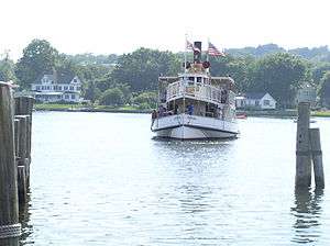
New London |
A 1933 prefabricated Motohome designed by Robert W. McLaughlin, Jr.
|
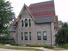
| 4 |
Anshei Israel Synagogue |
|
000000001995-07-21-0000July 21, 1995
(#95000861) |
142 Newent Rd. (CT 138)
41°36′09″N 71°59′38″W / 41.6025°N 71.993889°W / 41.6025; -71.993889 (Anshei Israel Synagogue) |
Lisbon |
A small one-room Orthodox congregational synagogue constructed in 1936.
|
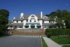
| 5 |
Applewood Farm |
|
000000001987-10-15-0000October 15, 1987
(#87001765) |
528 Colonel Ledyard Highway
41°25′27″N 71°59′41″W / 41.424167°N 71.994722°W / 41.424167; -71.994722 (Applewood Farm) |
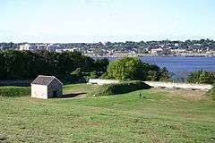
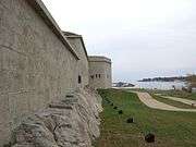
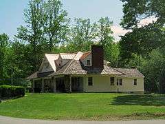
Ledyard |
A farmhouse with Colonial center-chimney design and with Federal style details.
|
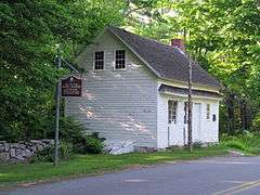
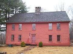
| 7 |
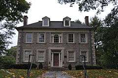
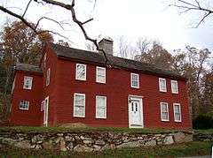
Ashlawn |
|
000000001979-06-04-0000June 4, 1979
(#79002649) |
1 Potash Hill Rd.
41°37′48″N 72°02′27″W / 41.63°N 72.040833°W / 41.63; -72.040833 (Ashlawn) |
Sprague |
A two-story, central-hall frame farmhouse dating from the 18th-century
|
| 8 |
Avery Homestead |
|
000000001992-12-14-0000December 14, 1992
(#92001641) |
20 Avery Hill Rd.
41°27′04″N 72°02′46″W / 41.451111°N 72.046111°W / 41.451111; -72.046111 (Avery Homestead) |
Ledyard |
Built circa 1696, this home is historically significant for its design and the fact that more than twelve generations of the Avery family have resided in the house.
|
| 9 |
Avery House |
|
000000001986-09-04-0000September 4, 1986
(#86001726) |
Northeastern corner of Park and Roode Rds.
41°36′28″N 71°54′50″W / 41.607778°N 71.913889°W / 41.607778; -71.913889 (Avery House) |
Griswold |
Believed to have been constructed around 1770, this structure was once in the thriving mill town of Hopeville. Now it serves as the park manager's residence for Hopeville Pond State Park.
|
| 10 |
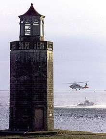
Avery Point Lighthouse |
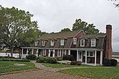
|
000000002002-08-23-0000August 23, 2002
(#02000866) |
On Long Island Sound at 1084 Shennecossett Rd.
41°19′01″N 72°03′49″W / 41.316944°N 72.063611°W / 41.316944; -72.063611 (Avery Point Lighthouse) |
Groton |
A lighthouse dating from 1943, officially listed as the last lighthouse built in Connecticut.
|
| 11 |
Thomas Avery House |
|
000000001979-08-22-0000August 22, 1979
(#79002637) |
Society Rd.
41°20′59″N 72°13′00″W / 41.349722°N 72.216667°W / 41.349722; -72.216667 (Thomas Avery House) |
East Lyme |
A two-and-a-half story clapboarded Greek Revival farmhouse dating to 1845-1846. Also known as the Smith-Harris House.
|
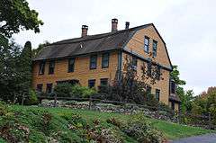
| 12 |
Nathaniel Backus House |
|
000000001970-10-06-0000October 6, 1970
(#70000715) |
44 Rockwell St.
41°32′04″N 72°04′42″W / 41.534444°N 72.078333°W / 41.534444; -72.078333 (Nathaniel Backus House) |
Norwich |
A circa 1750 two-story clapboarded Colonial renovated to a Greek Revival home. Moved to its current location in 1952.
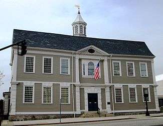
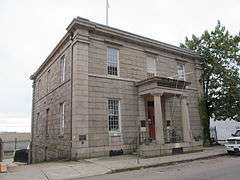
|
| 13 |
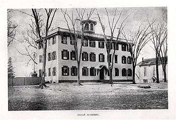
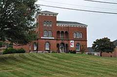
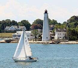
Bacon Academy |
|
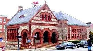
000000001982-04-27-0000April 27, 1982
(#82004364) |
84 Main Street
41°34′24″N 72°19′59″W / 41.573333°N 72.333056°W / 41.573333; -72.333056 (Bacon Academy) |
Colchester |
A utilitarian three-story Flemish bond brick school with Federal style details that was built in 1803.
|
| 14 |
Baltic Historic District |
|
000000001987-08-03-0000August 3, 1987
(#87001247) |
Roughly bounded by 5th Ave., River, High, Main, W. Main, and the Shetucket River
41°37′02″N 72°05′06″W / 41.617222°N 72.085°W / 41.617222; -72.085 (Baltic Historic District) |
Sprague |
|
| 15 |
Acors Barns House |
|
000000001976-04-22-0000April 22, 1976
(#76001992) |
68 Federal St.
41°21′25″N 72°05′56″W / 41.356944°N 72.098889°W / 41.356944; -72.098889 (Acors Barns House) |
New London |
A two-and-one half story Greek Revival house with a gable roof and clapboarded exterior built in 1837.
|
| 16 |
Bean Hill Historic District |
|
000000001982-12-08-0000December 8, 1982
(#82001006) |
Huntington and Vergason Aves., Sylvia Lane, and W. Town St.
41°33′24″N 72°06′36″W / 41.556667°N 72.11°W / 41.556667; -72.11 (Bean Hill Historic District) |
Norwich |
|
| 17 |
Bennett Rockshelter |
Upload image |
000000001987-07-31-0000July 31, 1987
(#87001223) |
Address Restricted
|
Old Lyme |
|
| 18 |
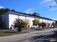
Gurdon Bill Store |
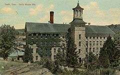
|
000000001982-04-12-0000April 12, 1982
(#82004368) |
15 Church Hill Rd.
41°27′26″N 72°00′51″W / 41.457222°N 72.014167°W / 41.457222; -72.014167 (Gurdon Bill Store) |
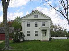
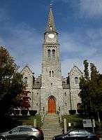
Ledyard |
|
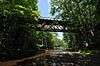
| 19 |
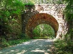
Blackledge River Railroad Bridge |
|
000000001986-07-31-0000July 31, 1986
(#86002109) |
Former Air Line Railroad right-of-way and the Blackledge River
41°35′02″N 72°25′21″W / 41.583889°N 72.4225°W / 41.583889; -72.4225 (Blackledge River Railroad Bridge) |
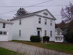
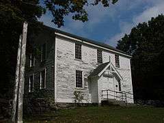
Colchester |
A Warren truss bridge built by the New York, New Haven and Hartford Railroad around 1912.
|
| 20 |
Bozrah Congregational Church and Parsonage |
|
000000001991-07-26-0000July 26, 1991
(#91000952) |
17 and 23 Bozrah St.
41°33′24″N 72°09′56″W / 41.556667°N 72.165556°W / 41.556667; -72.165556 (Bozrah Congregational Church and Parsonage) |
Bozrah |
|
| 21 |
Bradford-Huntington House |
|
000000001970-10-06-0000October 6, 1970
(#70000720) |
16 Huntington Lane
41°33′06″N 72°05′30″W / 41.551667°N 72.091667°W / 41.551667; -72.091667 (Bradford-Huntington House) |
Norwich |
|
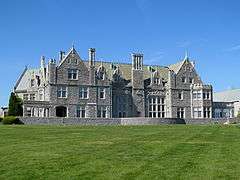
| 22 |
Branford House |
|
000000001984-01-23-0000January 23, 1984
(#84001158) |
Shennecosset and Eastern Point Rds.
41°19′01″N 72°03′52″W / 41.316944°N 72.064444°W / 41.316944; -72.064444 (Branford House) |
Groton |
|
| 23 |
Brewster Homestead |
|
000000002000-12-28-0000December 28, 2000
(#00001561) |
306 Preston Rd.
41°34′25″N 71°58′10″W / 41.573611°N 71.969444°W / 41.573611; -71.969444 (Brewster Homestead) |
Griswold |
|
| 24 |
Bridge No. 1860 |
|
000000001993-07-29-0000July 29, 1993
(#93000644) |
Massapeag Side Rd. (Route 433) over Shantok Brook
41°28′48″N 72°05′12″W / 41.48°N 72.0867°W / 41.48; -72.0867 (Bridge No. 1860) |
Montville |
Formerly in Fort Shantok State Park, now Mohegan tribal land.
|
| 25 |
Broad Street School |
|
000000001984-01-19-0000January 19, 1984
(#84001162) |
100 Broad St.
41°32′05″N 72°04′35″W / 41.534722°N 72.076389°W / 41.534722; -72.076389 (Broad Street School) |
Norwich |
|
| 26 |
William A. Buckingham House |
|
000000001982-04-29-0000April 29, 1982
(#82004379) |
307 Main St.
41°31′27″N 72°04′28″W / 41.524167°N 72.074444°W / 41.524167; -72.074444 (William A. Buckingham House) |
Norwich |
|
| 27 |
Bulkeley School |
|
000000001981-08-13-0000August 13, 1981
(#81000613) |
Huntington St.
41°21′31″N 72°06′03″W / 41.358611°N 72.100833°W / 41.358611; -72.100833 (Bulkeley School) |
New London |
|
| 28 |
Burnett's Corner Historic District |
|
000000001997-12-04-0000December 4, 1997
(#97001468) |
Along Packer Rd., south of CT 184
41°23′17″N 71°58′45″W / 41.388056°N 71.979167°W / 41.388056; -71.979167 (Burnett's Corner Historic District) |
Groton |
|
| 29 |
Carpenter House |
|
000000001970-10-14-0000October 14, 1970
(#70000721) |
55 E. Town St.
41°33′01″N 72°05′43″W / 41.550278°N 72.095278°W / 41.550278; -72.095278 (Carpenter House) |
Norwich |
|
| 30 |
Joseph Carpenter Silversmith Shop |
|
000000001970-10-06-0000October 6, 1970
(#70000722) |
71 E. Town St.
41°32′59″N 72°05′43″W / 41.549722°N 72.095278°W / 41.549722; -72.095278 (Joseph Carpenter Silversmith Shop) |
Norwich |
|
| 31 |
Carroll Building |
|
000000001982-11-14-0000November 14, 1982
(#82001007) |
9-15 Main St., and 14-20 Water St.
41°31′27″N 72°04′48″W / 41.524167°N 72.08°W / 41.524167; -72.08 (Carroll Building) |
Norwich |
|
| 32 |
Central Vermont Railroad Pier |
|
000000002005-01-26-0000January 26, 2005
(#04001551) |
State Pier Rd.
41°21′35″N 72°05′31″W / 41.359722°N 72.091944°W / 41.359722; -72.091944 (Central Vermont Railroad Pier) |
New London |
|
| 33 |
Henry Champion House |
|
000000001972-10-10-0000October 10, 1972
(#72001323) |
Weschester Rd.
41°32′39″N 72°24′50″W / 41.544167°N 72.413889°W / 41.544167; -72.413889 (Henry Champion House) |
Colchester |
Home of Henry Champion.
|
| 34 |
David Chapman Farmstead |
|
000000001992-12-14-0000December 14, 1992
(#92001642) |
128 Stoddards Wharf Rd.
41°26′46″N 72°02′27″W / 41.446111°N 72.040833°W / 41.446111; -72.040833 (David Chapman Farmstead) |
Ledyard |
|
| 35 |
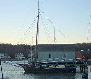
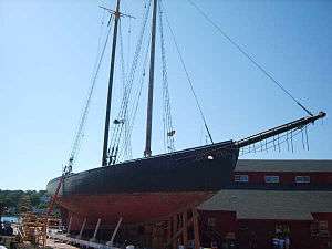
CHARLES W. MORGAN |
|
000000001966-11-13-0000November 13, 1966
(#66000804) |
Mystic seaport
41°21′46″N 71°57′55″W / 41.362778°N 71.965278°W / 41.362778; -71.965278 (CHARLES W. MORGAN) |
Stonington |
In the Mystic section of town
Only surviving wooden ship from the nineteenth-century American whaling fleet.
|
| 36 |
Capt. Richard Charlton House |
|
000000001970-10-15-0000October 15, 1970
(#70000723) |
12 Mediterranean Lane
41°32′55″N 72°05′55″W / 41.548611°N 72.098611°W / 41.548611; -72.098611 (Capt. Richard Charlton House) |
Norwich |
|
| 37 |
Chelsea Parade Historic District |
|
000000001989-05-12-0000May 12, 1989
(#88003215) |
Roughly bounded by Crescent, Broad, Grove, McKinley, Perkins, Slater, Buckingham, Maple Grove, Washington, and Lincoln
41°32′01″N 72°04′55″W / 41.533611°N 72.081944°W / 41.533611; -72.081944 (Chelsea Parade Historic District) |
Norwich |
|
| 38 |
Civic Institutions Historic District |
|
000000001990-04-16-0000April 16, 1990
(#90000602) |
156-158, 171, and 173-175 Garfield Ave., 179 Colman St., 32 Wald Ave.
41°21′15″N 72°06′42″W / 41.354167°N 72.111667°W / 41.354167; -72.111667 (Civic Institutions Historic District) |
New London |
|
| 39 |
Clark Homestead |
|
000000001978-12-01-0000December 1, 1978
(#78002875) |
South of Lebanon on Madley Rd.
41°37′34″N 72°12′54″W / 41.626111°N 72.215°W / 41.626111; -72.215 (Clark Homestead) |
Lebanon |
|
| 40 |
Andrew Clark House |
|
000000001979-06-28-0000June 28, 1979
(#79002636) |
Ross Hill Rd.
41°36′35″N 71°59′57″W / 41.609722°N 71.999167°W / 41.609722; -71.999167 (Andrew Clark House) |
Lisbon |
|
| 41 |
Edward Cogswell House |
|
000000001993-12-15-0000December 15, 1993
(#93001378) |
1429 Hopeville Rd.
41°35′07″N 71°54′08″W / 41.585278°N 71.902222°W / 41.585278; -71.902222 (Edward Cogswell House) |
Griswold |
|
| 42 |
Coit Street Historic District |
|
000000001988-02-19-0000February 19, 1988
(#88000068) |
Roughly bounded by Coit St., Washington, Tilley St., Bank St., and Reed St.
41°21′05″N 72°06′01″W / 41.351389°N 72.100278°W / 41.351389; -72.100278 (Coit Street Historic District) |
New London |
|
| 43 |
Colchester Village Historic District |
|
000000001994-04-04-0000April 4, 1994
(#94000254) |
Roughly along Broadway, Hayward, Linwood and Norwich Aves., Cragin Ct., Pierce Ln., Stebbins Rd., Main and S. Main Sts.
41°34′21″N 72°19′13″W / 41.5725°N 72.320278°W / 41.5725; -72.320278 (Colchester Village Historic District) |
Colchester |
|
| 44 |
Commonwealth Works Site |
|
000000001998-04-13-0000April 13, 1998
(#98000360) |
Near Yantic Falls[7]
|
Norwich |
Early industrial site at Yantic Falls
|
| 45 |
Converse House and Barn |
|
000000001970-10-06-0000October 6, 1970
(#70000716) |
185 Washington St.
41°32′03″N 72°05′00″W / 41.534167°N 72.083333°W / 41.534167; -72.083333 (Converse House and Barn) |
Norwich |
|
| 46 |
Cooper Site |
Upload image |
000000001987-10-15-0000October 15, 1987
(#87001224) |
Address Restricted
|
Lyme |
|
| 47 |
Deshon-Allyn House |
|
000000001970-10-28-0000October 28, 1970
(#70000700) |
613 Williams St.
41°22′21″N 72°06′19″W / 41.3725°N 72.105278°W / 41.3725; -72.105278 (Deshon-Allyn House) |
New London |
|
| 48 |
Downtown New London Historic District |
|
000000001979-04-13-0000April 13, 1979
(#79002665) |
Roughly bounded by State, Bank, Tilley and Washington Sts.
41°21′10″N 72°05′47″W / 41.352778°N 72.096389°W / 41.352778; -72.096389 (Downtown New London Historic District) |
New London |
|
| 49 |
Downtown Norwich Historic District |
|
000000001985-04-04-0000April 4, 1985
(#85000707) |
Roughly bounded by Union Sq., Park, Main and Shetucket Sts., and Washington Sq.
41°31′26″N 72°04′38″W / 41.523889°N 72.077222°W / 41.523889; -72.077222 (Downtown Norwich Historic District) |
Norwich |
|
| 50 |
East District School |
|
000000001970-10-28-0000October 28, 1970
(#70000717) |
365 Washington St.
41°32′46″N 72°05′20″W / 41.546111°N 72.088889°W / 41.546111; -72.088889 (East District School) |
Norwich |
|
| 51 |
EMMA C. BERRY (Fishing Sloop) |
|
000000001994-10-12-0000October 12, 1994
(#94001649) |
Greenmanville Ave.
41°21′35″N 71°58′00″W / 41.359722°N 71.966667°W / 41.359722; -71.966667 (EMMA C. BERRY (Fishing Sloop)) |
Stonington |
In the Mystic section of town
One of the oldest surviving commercial vessels in the United States
|
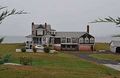
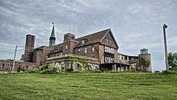
| 52 |
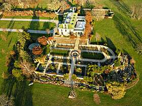
Eolia-Harkness Estate |
|
000000001986-11-20-0000November 20, 1986
(#86003331) |
Great Neck Rd.
41°18′17″N 72°06′47″W / 41.304722°N 72.113056°W / 41.304722; -72.113056 (Eolia-Harkness Estate) |
Waterford |
|
| 53 |
Capt. Thomas Fanning Farmstead |
|
000000001992-12-14-0000December 14, 1992
(#92001643) |
1004 Shewville Rd.
41°28′49″N 71°59′34″W / 41.480278°N 71.992778°W / 41.480278; -71.992778 (Capt. Thomas Fanning Farmstead) |
Ledyard |
|
| 54 |
Abel H. Fish House |
|
000000001982-03-02-0000March 2, 1982
(#82004381) |
Buckley Hill and Rathbun Hill Rds.
41°31′47″N 72°14′55″W / 41.529722°N 72.248611°W / 41.529722; -72.248611 (Abel H. Fish House) |
Salem |
|
| 55 |
Fort Griswold |
|
000000001970-10-06-0000October 6, 1970
(#70000694) |
Bounded by Baker Ave., Smith St., Park Ave., Monument Ave., and the Thames River
41°21′12″N 72°04′54″W / 41.353333°N 72.081667°W / 41.353333; -72.081667 (Fort Griswold) |
Groton |
|
| 56 |
Fort Shantok |
|
000000001986-03-20-0000March 20, 1986
(#86000469) |
Massapeag Side Road (State Route 433)
41°28′40″N 72°04′40″W / 41.4778°N 72.0778°W / 41.4778; -72.0778 (Fort Shantok) |
Montville |
Mohegan settlement and home of the seventeenth century sachem Uncas. Park open to the public.[8]
|
| 57 |
Fort Trumbull |
|
000000001972-09-22-0000September 22, 1972
(#72001333) |
Fort Neck
41°20′40″N 72°05′40″W / 41.344444°N 72.094444°W / 41.344444; -72.094444 (Fort Trumbull) |
New London |
|
| 58 |
Gales Ferry Historic District No. 1 |
|
000000001992-12-14-0000December 14, 1992
(#92001639) |
Junction of Hurlbutt Rd. and Riverside Pl.
41°25′48″N 72°05′34″W / 41.43°N 72.092778°W / 41.43; -72.092778 (Gales Ferry Historic District No. 1) |
Ledyard |
|
| 59 |
Gales Ferry Historic District No. 2 |
|
000000002002-08-22-0000August 22, 2002
(#02000865) |
Roughly along Hurlbutt Rd., from Allyn Rd. to Military Highway
41°25′42″N 72°05′17″W / 41.4283°N 72.088°W / 41.4283; -72.088 (Gales Ferry Historic District No. 2) |
Ledyard |
|
| 60 |
William Gorton Farm |
|
000000001984-04-05-0000April 5, 1984
(#84001166) |
14 West Lane
41°17′24″N 72°12′21″W / 41.289884°N 72.205773°W / 41.289884; -72.205773 (William Gorton Farm) |
East Lyme |
|
| 61 |
Graniteville Historic District |
|
000000002003-08-28-0000August 28, 2003
(#03000812) |
Rope Ferry Rd.
41°20′06″N 72°09′13″W / 41.335097°N 72.153689°W / 41.335097; -72.153689 (Graniteville Historic District) |
Waterford |
Info available at Connecticut Trust for Historic Preservation
|
| 62 |
Greeneville Historic District |
|
000000002005-09-21-0000September 21, 2005
(#05001047) |
Roughly along Boswell and Central Aves., Prospect and N. Main Sts., between Hickory and 14th Sts.
41°32′05″N 72°03′31″W / 41.534722°N 72.058611°W / 41.534722; -72.058611 (Greeneville Historic District) |
Norwich |
Info available at Connecticut Trust for Historic Preservation
|
| 63 |
Florence Griswold House and Museum |
|
000000001993-04-19-0000April 19, 1993
(#93001604) |
96 Lyme St.
41°19′31″N 72°19′39″W / 41.325278°N 72.3275°W / 41.325278; -72.3275 (Florence Griswold House and Museum) |
Old Lyme |
Boarding house frequented by American impressionist artists such as Henry Ward Ranger, Childe Hassam, and Willard Metcalf.
|
| 64 |
Groton Bank Historic District |
|
000000001983-03-24-0000March 24, 1983
(#83001287) |
Roughly bounded by the Thames River, Broad, Cottage, and Latham Sts.
41°21′24″N 72°04′55″W / 41.356667°N 72.081944°W / 41.356667; -72.081944 (Groton Bank Historic District) |
Groton |
|
| 65 |
Hadlyme North Historic District |
|
000000001988-12-08-0000December 8, 1988
(#88002686) |
Roughly bounded by CT 82, Town St., Banning Rd., and Old Town St.
41°25′45″N 72°24′25″W / 41.429167°N 72.406944°W / 41.429167; -72.406944 (Hadlyme North Historic District) |
Lyme |
|
| 66 |
Hadlyme Ferry Historic District |
|
000000001994-12-21-0000December 21, 1994
(#94001444) |
150, 151, 158, 159, 162-1, 162-2 Ferry Rd. and ferry slip
41°25′09″N 72°25′41″W / 41.419167°N 72.428056°W / 41.419167; -72.428056 (Hadlyme Ferry Historic District) |
Lyme |
It is located in the area of, and may include, the Chester–Hadlyme Ferry
|
| 67 |
Hallville Mill Historic District |
|
000000001996-08-22-0000August 22, 1996
(#96000913) |
Hallville Rd., Hall's Mill Rd., and CT 2A on Hallville Pond
41°29′40″N 72°02′00″W / 41.494444°N 72.033333°W / 41.494444; -72.033333 (Hallville Mill Historic District) |
Preston |
|
| 68 |
Hamburg Bridge Historic District |
|
000000001983-03-10-0000March 10, 1983
(#83001288) |
Joshuatown Rd. and Old Hamburg Rd.
41°23′36″N 72°21′09″W / 41.393333°N 72.3525°W / 41.393333; -72.3525 (Hamburg Bridge Historic District) |
Lyme |
|
| 69 |
Hamburg Cove Site |
Upload image |
000000001987-10-15-0000October 15, 1987
(#87001225) |
Address Restricted
|
Lyme |
|
| 70 |
Jonathan Newton Harris House |
|
000000001982-04-27-0000April 27, 1982
(#82004375) |
130 Broad St.
41°21′27″N 72°06′17″W / 41.3575°N 72.104722°W / 41.3575; -72.104722 (Jonathan Newton Harris House) |
New London |
|
| 71 |
Hartford Colony |
|
000000002005-07-01-0000July 1, 2005
(#04000414) |
Roughly Leonard Court, New Shore Rd., and Shore Rd.
41°18′19″N 72°08′26″W / 41.305278°N 72.140556°W / 41.305278; -72.140556 (Hartford Colony) |
Waterford |
|
| 72 |
Hayward House |
|
000000001972-10-18-0000October 18, 1972
(#72001325) |
9 Hayward Ave.
41°34′29″N 72°19′53″W / 41.574722°N 72.331389°W / 41.574722; -72.331389 (Hayward House) |
Colchester |
|
| 73 |
Hempstead Historic District |
|
000000001986-07-31-0000July 31, 1986
(#86002112) |
Roughly bounded by Franklin St., Jay St., and Mountain Ave.
41°21′13″N 72°06′13″W / 41.353611°N 72.103611°W / 41.353611; -72.103611 (Hempstead Historic District) |
New London |
|
| 74 |
Joshua Hempstead House |
|
000000001970-10-15-0000October 15, 1970
(#70000701) |
11 Hempstead St.
41°21′09″N 72°06′08″W / 41.3525°N 72.102222°W / 41.3525; -72.102222 (Joshua Hempstead House) |
New London |
|
| 75 |
Nathaniel Hempstead House |
|
000000001970-12-02-0000December 2, 1970
(#70000702) |
Corner of Jay, Hempstead, Coit, and Truman Sts.
41°21′06″N 72°06′09″W / 41.351667°N 72.1025°W / 41.351667; -72.1025 (Nathaniel Hempstead House) |
New London |
Also known as the Old Huguenot House.
|
| 76 |
House at 130 Mohegan Avenue |
|
000000002009-10-28-0000October 28, 2009
(#08001379) |
130 Mohegan Ave.
41°22′29″N 72°06′09″W / 41.374831°N 72.102483°W / 41.374831; -72.102483 (House at 130 Mohegan Avenue) |
New London |
|
| 77 |
Huntington Street Baptist Church |
|
000000001982-04-12-0000April 12, 1982
(#82004377) |
29 Huntington St.
41°21′12″N 72°05′57″W / 41.353333°N 72.099167°W / 41.353333; -72.099167 (Huntington Street Baptist Church) |
New London |
|
| 78 |
Col. Joshua Huntington House |
|
000000001972-02-23-0000February 23, 1972
(#72001343) |
11 Huntington Lane
41°33′04″N 72°05′27″W / 41.551111°N 72.090833°W / 41.551111; -72.090833 (Col. Joshua Huntington House) |
Norwich |
|
| 79 |
Gen. Jedidiah Huntington House |
|
000000001970-10-06-0000October 6, 1970
(#70000724) |
23 E. Town St.
41°33′01″N 72°05′28″W / 41.550278°N 72.091111°W / 41.550278; -72.091111 (Gen. Jedidiah Huntington House) |
Norwich |
|
| 80 |
Gov. Samuel Huntington House |
|
000000001970-10-06-0000October 6, 1970
(#70000725) |
34 E. Town St.
41°33′01″N 72°05′31″W / 41.550278°N 72.091944°W / 41.550278; -72.091944 (Gov. Samuel Huntington House) |
Norwich |
|
| 81 |
Jail Hill Historic District |
|
000000001999-04-19-0000April 19, 1999
(#99000431) |
Roughly along Cedar, School, Fountain, Happy, and John Sts.
41°31′38″N 72°04′47″W / 41.527222°N 72.079722°W / 41.527222; -72.079722 (Jail Hill Historic District) |
Norwich |
|
| 82 |
Jordan Village Historic District |
|
000000001990-08-23-0000August 23, 1990
(#90001289) |
Junction of North Rd. and Avery Ln. with Rope Ferry Rd.
41°20′23″N 72°08′33″W / 41.339722°N 72.1425°W / 41.339722; -72.1425 (Jordan Village Historic District) |
Waterford |
|
| 83 |
Kinne Cemetery |
|
000000002001-04-12-0000April 12, 2001
(#01000351) |
Jarvis Rd.
41°33′24″N 71°53′15″W / 41.556667°N 71.8875°W / 41.556667; -71.8875 (Kinne Cemetery) |
Griswold |
|
| 84 |
L.A. DUNTON |
|
000000001993-11-04-0000November 4, 1993
(#93001612) |
Mystic Seaport Museum
41°21′30″N 71°57′58″W / 41.358333°N 71.966111°W / 41.358333; -71.966111 (L.A. DUNTON) |
Stonington |
In the Mystic section of town
Classic fishing schooner and one of the last sail-powered fishing vessels built.
|
| 85 |
Lamb Homestead |
|
000000001991-09-03-0000September 3, 1991
(#91001175) |
47 Lambtown Rd.
41°24′21″N 72°00′47″W / 41.405833°N 72.013056°W / 41.405833; -72.013056 (Lamb Homestead) |
Ledyard |
|
| 86 |
Dr. Daniel Lathrop School |
|
000000001970-12-29-0000December 29, 1970
(#70000726) |
69 E. Town St.
41°32′59″N 72°05′43″W / 41.549722°N 72.095278°W / 41.549722; -72.095278 (Dr. Daniel Lathrop School) |
Norwich |
|
| 87 |
Dr. Joshua Lathrop House |
|
000000001970-12-29-0000December 29, 1970
(#70000727) |
377 Washington St.
41°32′48″N 72°05′18″W / 41.546667°N 72.088333°W / 41.546667; -72.088333 (Dr. Joshua Lathrop House) |
Norwich |
|
| 88 |
Lathrop-Mathewson-Ross House |
|
000000001982-04-15-0000April 15, 1982
(#82004370) |
Ross Hill Rd.
41°37′19″N 71°59′27″W / 41.621944°N 71.990833°W / 41.621944; -71.990833 (Lathrop-Mathewson-Ross House) |
Lisbon |
|
| 89 |
Laurel Hill Historic District |
|
000000001987-10-26-0000October 26, 1987
(#87000516) |
Roughly bounded by Spruce St., Rogers and River Aves., and Talman St.
41°31′04″N 72°04′29″W / 41.517778°N 72.074722°W / 41.517778; -72.074722 (Laurel Hill Historic District) |
Norwich |
|
| 90 |
Lebanon Green Historic District |
|
000000001979-06-04-0000June 4, 1979
(#79002666) |
CT 87 and W. Town St.
41°38′26″N 72°13′08″W / 41.640556°N 72.218889°W / 41.640556; -72.218889 (Lebanon Green Historic District) |
Lebanon |
|
| 91 |
Thomas Lee House |
|
000000001970-10-06-0000October 6, 1970
(#70000693) |
CT 156 and Giant's Neck Rd.
41°19′03″N 72°14′20″W / 41.3175°N 72.238889°W / 41.3175; -72.238889 (Thomas Lee House) |
East Lyme |
|
| 92 |
Leffingwell Inn |
|
000000001970-12-29-0000December 29, 1970
(#70000728) |
348 Washington St.
41°32′32″N 72°05′17″W / 41.542222°N 72.088056°W / 41.542222; -72.088056 (Leffingwell Inn) |
Norwich |
|
| 93 |
Nathan Lester House |
|
000000001972-06-30-0000June 30, 1972
(#72001328) |
Vinegar Hill Rd.
41°25′24″N 72°03′08″W / 41.423333°N 72.052222°W / 41.423333; -72.052222 (Nathan Lester House) |
Ledyard |
|
| 94 |
Timothy Lester Farmstead |
|
000000001998-12-04-0000December 4, 1998
(#98001441) |
Junction of Crary, Browning and Terry Rds.
41°34′03″N 71°57′32″W / 41.5675°N 71.958889°W / 41.5675; -71.958889 (Timothy Lester Farmstead) |
Griswold |
|
| 95 |
Lieutenant River III Site |
Upload image |
000000001987-07-31-0000July 31, 1987
(#87001227) |
Address Restricted
|
Old Lyme |
|
| 96 |
Lieutenant River IV Site |
Upload image |
000000001987-07-31-0000July 31, 1987
(#87001228) |
Address Restricted
|
Old Lyme |
|
| 97 |
Lieutenant River No. 2 |
Upload image |
000000001987-07-31-0000July 31, 1987
(#87001226) |
Address Restricted
|
Old Lyme |
|
| 98 |
Lighthouse Inn |
|
000000001996-08-01-0000August 1, 1996
(#96000822) |
6 Guthrie Pl.
41°19′00″N 72°05′39″W / 41.316667°N 72.094167°W / 41.316667; -72.094167 (Lighthouse Inn) |
New London |
|
| 99 |
Little Plain Historic District |
|
000000001970-10-15-0000October 15, 1970
(#86003541) |
Both sides of Union, Broadway, and Huntington Pl. in irregular pattern
41°31′47″N 72°04′37″W / 41.529722°N 72.076944°W / 41.529722; -72.076944 (Little Plain Historic District) |
Norwich |
|
| 100 |
Long Society Meetinghouse |
|
000000001976-04-22-0000April 22, 1976
(#76001996) |
East of Norwich off CT 165 on Long Society Rd.
41°32′04″N 72°02′09″W / 41.534444°N 72.035833°W / 41.534444; -72.035833 (Long Society Meetinghouse) |
Preston |
|
| 101 |
Lord Cove Site |
Upload image |
000000001987-10-15-0000October 15, 1987
(#87001229) |
Address Restricted
|
Lyme |
|
| 102 |
Capt. Enoch Lord House |
|
000000002007-05-16-0000May 16, 2007
(#07000418) |
17 Tantummaheag Rd.
41°20′30″N 72°20′35″W / 41.34173°N 72.343125°W / 41.34173; -72.343125 (Capt. Enoch Lord House) |
Old Lyme |
|
| 103 |
Lyman Viaduct |
|
000000001986-08-21-0000August 21, 1986
(#86002729) |
Dickinson Creek and former Boston and New York Air-Line Railroad right-of-way
41°33′49″N 72°27′08″W / 41.563611°N 72.452222°W / 41.563611; -72.452222 (Lyman Viaduct) |
Colchester |
|
| 104 |
Main Sawmill |
|
000000001972-04-26-0000April 26, 1972
(#72001332) |
Iron St.
41°26′49″N 71°59′14″W / 41.446944°N 71.987222°W / 41.446944; -71.987222 (Main Sawmill) |
Ledyard |
|
| 105 |
Mashantucket Pequot Reservation |
|
000000001986-06-11-0000June 11, 1986
(#86001323) |
Northeastern Ledyard
41°27′32″N 71°58′21″W / 41.4589°N 71.9724°W / 41.4589; -71.9724 (Mashantucket Pequot Reservation) |
Ledyard |
Encompasses much of the Pequot Reservation lands.
|
| 106 |
Mechanic Street Historic District |
|
000000001988-06-07-0000June 7, 1988
(#88000653) |
Roughly bounded by W. Broad St., Pawcatuck River, Cedar St., and Courtland St.
41°22′23″N 71°49′59″W / 41.373056°N 71.833056°W / 41.373056; -71.833056 (Mechanic Street Historic District) |
Stonington |
|
| 107 |
James Merrill House |
|
000000002013-08-28-0000August 28, 2013
(#13000618) |
107 Water St.
41°20′01″N 71°54′24″W / 41.333704°N 71.906623°W / 41.333704; -71.906623 (James Merrill House) |
Stonington |
Designated a National Historic Landmark on October 31, 2016.
|
| 108 |
Mill Brook Bridge |
|
000000001997-01-02-0000January 2, 1997
(#96001498) |
Blissville Rd., junction of Mill Brook
41°33′30″N 72°02′25″W / 41.558333°N 72.040278°W / 41.558333; -72.040278 (Mill Brook Bridge) |
Lisbon |
|
| 109 |
Samuel Miner House |
|
000000001976-06-18-0000June 18, 1976
(#76001995) |
North of North Stonington off CT 2 on Hewitt Rd.
41°26′57″N 71°53′26″W / 41.449167°N 71.890556°W / 41.449167; -71.890556 (Samuel Miner House) |
North Stonington |
Destroyed by fire in 2003.
|
| 110 |
Montauk Avenue Historic District |
|
000000001990-12-18-0000December 18, 1990
(#90001910) |
Roughly bounded by Ocean, Willets, and Riverview Aves. and Faire Harbor
41°20′20″N 72°06′22″W / 41.338889°N 72.106111°W / 41.338889; -72.106111 (Montauk Avenue Historic District) |
New London |
|
| 111 |
Monte Cristo Cottage |
|
000000001971-07-17-0000July 17, 1971
(#71001010) |
325 Pequot Ave.
41°19′55″N 72°05′47″W / 41.331944°N 72.096389°W / 41.331944; -72.096389 (Monte Cristo Cottage) |
New London |
Summer home of playwright Eugene O'Neill
|
| 112 |
Mystic Bank |
|
000000002014-08-08-0000August 8, 2014
(#14000476) |
39 Main St.
41°23′25″N 71°57′36″W / 41.3903°N 71.9600°W / 41.3903; -71.9600 (Mystic Bank) |
Old Mystic |
|
| 113 |
Mystic Bridge Historic District |
|
000000001979-08-31-0000August 31, 1979
(#79002671) |
U.S. Route 1 and CT 27
41°21′25″N 71°57′51″W / 41.356944°N 71.964167°W / 41.356944; -71.964167 (Mystic Bridge Historic District) |
Stonington |
In the Mystic section of town
|
| 114 |
Mystic River Historic District |
|
000000001979-08-24-0000August 24, 1979
(#79002728) |
U.S. Route 1 and CT 215
41°21′15″N 71°58′30″W / 41.354167°N 71.975°W / 41.354167; -71.975 (Mystic River Historic District) |
Groton |
In the Mystic section of town (West Mystic)
|
| 115 |
Natcon Site |
Upload image |
000000001987-07-31-0000July 31, 1987
(#87001230) |
Address Restricted
|
Old Lyme |
|
| 116 |
New England Hebrew Farmers of the Emanuel Society Synagogue and Creamery Site |
|
000000002012-02-28-0000February 28, 2012
(#12000039) |
Junction of CT 161 & CT 85
41°25′40″N 72°12′55″W / 41.427798°N 72.215175°W / 41.427798; -72.215175 (New England Hebrew Farmers of the Emanuel Society Synagogue and Creamery Site) |
Montville |
|
| 117 |
New London County Courthouse |
|
000000001970-10-15-0000October 15, 1970
(#70000705) |
70 Hunting St.
41°21′18″N 72°06′01″W / 41.355°N 72.100278°W / 41.355; -72.100278 (New London County Courthouse) |
New London |
|
| 118 |
New London Customhouse |
|
000000001970-10-15-0000October 15, 1970
(#70000706) |
150 Bank St.
41°21′08″N 72°05′46″W / 41.352222°N 72.096111°W / 41.352222; -72.096111 (New London Customhouse) |
New London |
|
| 119 |
New London Harbor Lighthouse |
|
000000001990-05-29-0000May 29, 1990
(#89001470) |
Lower Pequot Ave.
41°18′59″N 72°05′25″W / 41.316389°N 72.090278°W / 41.316389; -72.090278 (New London Harbor Lighthouse) |
New London |
|
| 120 |
New London Ledge Lighthouse |
|
000000001990-05-29-0000May 29, 1990
(#89001471) |
Entrance to New London Harbor on the eastern side of the main channel
41°18′20″N 72°04′41″W / 41.305556°N 72.078056°W / 41.305556; -72.078056 (New London Ledge Lighthouse) |
Groton |
|
| 121 |
New London Public Library |
|
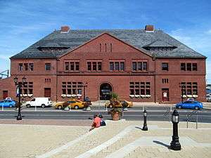
000000001970-10-15-0000October 15, 1970
(#70000712) |
63 Huntington St.
41°21′18″N 72°06′00″W / 41.355°N 72.1°W / 41.355; -72.1 (New London Public Library) |
New London |
|
| 122 |
New London Railroad Station |
|
000000001971-06-28-0000June 28, 1971
(#71000913) |
State St.
41°21′15″N 72°05′36″W / 41.354167°N 72.093333°W / 41.354167; -72.093333 (New London Railroad Station) |
New London |
|
| 123 |
Noank Historic District |
|
000000001979-08-10-0000August 10, 1979
(#79002656) |
CT 215
41°19′28″N 71°59′20″W / 41.324444°N 71.988889°W / 41.324444; -71.988889 (Noank Historic District) |
Groton |
|
| 124 |
North Stonington Village Historic District |
|
000000001983-03-17-0000March 17, 1983
(#83001289) |
CT 2, Main St., Wyassup, Babcock, Caswell, and Rocky Hollow Rds.
41°26′26″N 71°52′59″W / 41.440556°N 71.883056°W / 41.440556; -71.883056 (North Stonington Village Historic District) |
North Stonington |
|
| 125 |
Norwich Hospital District |
|
000000001988-01-22-0000January 22, 1988
(#87002424) |
CT 12
41°29′22″N 72°04′26″W / 41.489444°N 72.073889°W / 41.489444; -72.073889 (Norwich Hospital District) |
Norwich-Preston |
|
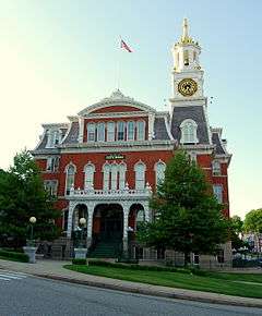
| 126 |
Norwich Town Hall |
|
000000001983-12-22-0000December 22, 1983
(#83003589) |
Union St. and Broadway
41°31′36″N 72°04′51″W / 41.526667°N 72.080833°W / 41.526667; -72.080833 (Norwich Town Hall) |
Norwich |
|
| 127 |
Norwichtown Historic District |
|
000000001973-01-17-0000January 17, 1973
(#73001951) |
Roughly bounded by Huntington Ln., Scotland Rd., and Washington, Town and E. Town Sts.
41°32′52″N 72°05′33″W / 41.547778°N 72.0925°W / 41.547778; -72.0925 (Norwichtown Historic District) |
Norwich |
|
| 128 |
William Noyes Farmstead |
|
000000001992-12-14-0000December 14, 1992
(#92001644) |
340 Gallup Hill Rd.
41°23′24″N 71°57′17″W / 41.39°N 71.954722°W / 41.39; -71.954722 (William Noyes Farmstead) |
Ledyard |
|
| 129 |
Occum Hydroelectric Plant and Dam |
|
000000001996-12-06-0000December 6, 1996
(#96001459) |
North of Bridge St., on the western side of the Shetucket River
41°35′49″N 72°03′01″W / 41.596944°N 72.050278°W / 41.596944; -72.050278 (Occum Hydroelectric Plant and Dam) |
Norwich and Sprague |
|
| 130 |
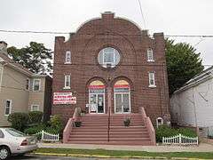
Ohev Sholem Synagogue |
|
000000001995-05-11-0000May 11, 1995
(#95000562) |
109 Blinman St.
41°21′04″N 72°05′59″W / 41.351111°N 72.099722°W / 41.351111; -72.099722 (Ohev Sholem Synagogue) |
New London |
|
| 131 |
Old Lyme Historic District |
|
000000001971-10-14-0000October 14, 1971
(#71000916) |
Lyme St. from Shore Rd. to Sill Lane, Old Boston Post Rd. from Sill Lane to Rose Lane
41°19′18″N 72°19′40″W / 41.321667°N 72.327778°W / 41.321667; -72.327778 (Old Lyme Historic District) |
Old Lyme |
|
| 132 |
Oswegatchie Historic District |
|
000000002005-09-15-0000September 15, 2005
(#05001043) |
East St., Riverside, Plant, Park Drs., and Sharwandassee and Oswegatchie Rds.
41°21′07″N 72°11′05″W / 41.351992°N 72.184618°W / 41.351992; -72.184618 (Oswegatchie Historic District) |
Waterford |
|
| 133 |
Capt. Nathaniel B. Palmer House |
|
000000001996-06-19-0000June 19, 1996
(#96000971) |
40 Palmer St.
41°20′34″N 71°54′28″W / 41.342778°N 71.907778°W / 41.342778; -71.907778 (Capt. Nathaniel B. Palmer House) |
Stonington |
Home of pioneering Antarctic explorer and seal hunter Nathaniel Palmer.
|
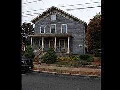
| 134 |
John Palmer House |
|
000000002005-01-12-0000January 12, 2005
(#04001461) |
291 N. Burnham Highway
41°37′51″N 72°00′21″W / 41.630833°N 72.005833°W / 41.630833; -72.005833 (John Palmer House) |
Lisbon |
|
| 135 |
William Park House |
|
000000002007-03-07-0000March 7, 2007
(#07000106) |
330 Main St.
41°38′42″N 72°03′57″W / 41.645°N 72.065833°W / 41.645; -72.065833 (William Park House) |
Sprague |
|
| 136 |
Peck Tavern |
|
000000001982-04-12-0000April 12, 1982
(#82004380) |
1 Sill Lane
41°19′49″N 72°19′30″W / 41.330278°N 72.325°W / 41.330278; -72.325 (Peck Tavern) |
Old Lyme |
|
| 137 |
Pequot Fort |
|
000000001990-01-19-0000January 19, 1990
(#89002294) |
Pequot Ave.
41°21′46″N 71°58′41″W / 41.3627°N 71.9780°W / 41.3627; -71.9780 (Pequot Fort) |
Groton |
|
| 138 |
Pequotsepos Manor |
|
000000001979-06-15-0000June 15, 1979
(#79002650) |
Pequotsepos Rd.
41°21′46″N 71°56′54″W / 41.362778°N 71.948333°W / 41.362778; -71.948333 (Pequotsepos Manor) |
Stonington |
In the Mystic section of town
|
| 139 |
Perkins-Bill House |
|
000000002000-07-20-0000July 20, 2000
(#00000817) |
1040 Long Cove Rd.
41°23′59″N 72°05′19″W / 41.399722°N 72.088611°W / 41.399722; -72.088611 (Perkins-Bill House) |
Ledyard |
|
| 140 |
Perkins-Rockwell House |
|
000000001985-10-17-0000October 17, 1985
(#85003144) |
42 Rockwell St.
41°32′05″N 72°04′45″W / 41.534722°N 72.079167°W / 41.534722; -72.079167 (Perkins-Rockwell House) |
Norwich |
|
| 141 |
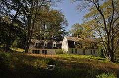
Morton Freeman Plant Hunting Lodge |
|
000000001988-12-12-0000December 12, 1988
(#88002691) |
56 Stone Ranch Rd.
41°21′25″N 72°15′59″W / 41.356944°N 72.266389°W / 41.356944; -72.266389 (Morton Freeman Plant Hunting Lodge) |
East Lyme |
|
| 142 |
Poquetanuck Village Historic District |
|
000000001996-08-22-0000August 22, 1996
(#96000912) |
Roughly along Main St. between CT 117 and Middle Rd. and along School House and Cider Mill Rd.
41°29′14″N 72°02′31″W / 41.487222°N 72.041944°W / 41.487222; -72.041944 (Poquetanuck Village Historic District) |
Preston |
Poquetanuck is a populated place with a long history as a "typical small New England village"[9]
|
| 143 |
Post Hill Historic District |
|
000000001993-08-05-0000August 5, 1993
(#93000812) |
Roughly bounded by Broad, Center, Vauxhall, Berkeley, Fremont, and Walker Sts.
41°21′37″N 72°06′17″W / 41.360278°N 72.104722°W / 41.360278; -72.104722 (Post Hill Historic District) |
New London |
|
| 144 |
Preston City Historic District |
|
000000001987-07-31-0000July 31, 1987
(#87000452) |
Amos and Old Shetucket Rds., Northwest Corner Rd., and CT 164
41°31′38″N 71°58′33″W / 41.527222°N 71.975833°W / 41.527222; -71.975833 (Preston City Historic District) |
Preston |
|
| 145 |
Prospect Street Historic District |
|
000000001986-07-31-0000July 31, 1986
(#86002114) |
Roughly bounded by Bulkeley Pl., Huntington, Federal, and Hempstead Sts.
41°21′27″N 72°06′02″W / 41.3575°N 72.100556°W / 41.3575; -72.100556 (Prospect Street Historic District) |
New London |
|
| 146 |
Quaker Hill Historic District |
|
000000002002-04-11-0000April 11, 2002
(#02000337) |
Roughly along Old Norwich Rd. from Richards Grove Rd. to Mohegan Ave. Parkway
41°24′12″N 72°06′35″W / 41.403333°N 72.109722°W / 41.403333; -72.109722 (Quaker Hill Historic District) |
Waterford |
|
| 147 |
John Randall House |
|
000000001978-12-01-0000December 1, 1978
(#78002877) |
Southeast of North Stonington on CT 2
41°24′59″N 71°51′37″W / 41.416389°N 71.860278°W / 41.416389; -71.860278 (John Randall House) |
North Stonington |
|
| 148 |
Raymond-Bradford Homestead |
|
000000001982-04-16-0000April 16, 1982
(#82004372) |
Raymond Hill Rd.
41°29′00″N 72°09′43″W / 41.483333°N 72.161944°W / 41.483333; -72.161944 (Raymond-Bradford Homestead) |
Montville |
|
| 149 |
River Road Stone Arch Railroad Bridge |
|
000000001986-08-21-0000August 21, 1986
(#86002727) |
River Rd. and former Air Line Railroad right-of-way
41°34′49″N 72°25′32″W / 41.580278°N 72.425556°W / 41.580278; -72.425556 (River Road Stone Arch Railroad Bridge) |
Colchester |
|
| 150 |
Rocky Neck Pavilion |
|
000000001986-09-04-0000September 4, 1986
(#86001745) |
Lands End Point, Rocky Neck State Park
41°17′56″N 72°14′48″W / 41.298889°N 72.246667°W / 41.298889; -72.246667 (Rocky Neck Pavilion) |
East Lyme |
|
| 151 |
Rossie Velvet Mill Historic District |
|
000000002007-03-09-0000March 9, 2007
(#07000110) |
Roughly along Bruggerman Court, Bruggerman Place, Greenmanville Ave., Hinckly St., Pleasant St., Rossie St., and Velvet St.
41°21′44″N 71°57′48″W / 41.362348°N 71.963239°W / 41.362348; -71.963239 (Rossie Velvet Mill Historic District) |
Stonington |
In the Mystic section of town
|
| 152 |
SABINO (steamer) |
|
000000001992-10-05-0000October 5, 1992
(#92001887) |
Mystic Seaport Museum
41°21′39″N 71°58′02″W / 41.360833°N 71.967222°W / 41.360833; -71.967222 (SABINO (steamer)) |
Stonington |
In the Mystic section of town
One of only two surviving members of the American "mosquito fleet", small steamers that served the inland waters of the United States.
|
| 153 |
St. James Episcopal Church |
|
000000002004-07-21-0000July 21, 2004
(#90001098) |
125 Huntington St.
41°21′26″N 72°05′58″W / 41.357169°N 72.099383°W / 41.357169; -72.099383 (St. James Episcopal Church) |
New London |
|
| 154 |
Salem Historic District |
|
000000001980-09-22-0000September 22, 1980
(#80004063) |
CT 85
41°29′13″N 72°16′27″W / 41.486944°N 72.274167°W / 41.486944; -72.274167 (Salem Historic District) |
Salem |
|
| 155 |
Selden Island Site |
Upload image |
000000001987-10-15-0000October 15, 1987
(#87001231) |
Address Restricted
|
Lyme |
|
| 156 |
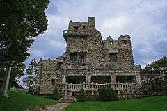
Seventh Sister |
|
000000001986-07-31-0000July 31, 1986
(#86002103) |
67 River Rd.
41°25′25″N 72°25′53″W / 41.423611°N 72.431389°W / 41.423611; -72.431389 (Seventh Sister) |
Lyme |
Now known as Gillette Castle.
|
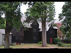
| 157 |
Shaw Mansion |
|
000000001970-12-29-0000December 29, 1970
(#70000713) |
11 Blinman St.
41°21′02″N 72°06′06″W / 41.350556°N 72.101667°W / 41.350556; -72.101667 (Shaw Mansion) |
New London |
|
| 158 |
Slater Library and Fanning Annex |
|
000000002002-01-28-0000January 28, 2002
(#01001529) |
26 Main St.
41°36′30″N 71°59′03″W / 41.608333°N 71.984167°W / 41.608333; -71.984167 (Slater Library and Fanning Annex) |
Griswold |
|
| 159 |
Jabez Smith House |
|
000000001981-05-15-0000May 15, 1981
(#81000615) |
North Rd.
41°21′11″N 72°01′46″W / 41.353056°N 72.029444°W / 41.353056; -72.029444 (Jabez Smith House) |
Groton |
|
| 160 |
Samuel Smith House |
|
000000001979-06-04-0000June 4, 1979
(#79002668) |
82 Plants Dam Rd.
41°20′28″N 72°14′52″W / 41.341111°N 72.247778°W / 41.341111; -72.247778 (Samuel Smith House) |
East Lyme |
|
| 161 |
Shubel Smith House |
|
000000001996-12-20-0000December 20, 1996
(#96001462) |
515 Pumpkin Hill Rd.
41°25′23″N 71°59′08″W / 41.423056°N 71.985556°W / 41.423056; -71.985556 (Shubel Smith House) |
Ledyard |
|
| 162 |
Springbank |
|
000000002001-08-17-0000August 17, 2001
(#01000880) |
69 Neck Rd.
41°19′54″N 72°20′16″W / 41.331667°N 72.337778°W / 41.331667; -72.337778 (Springbank) |
Old Lyme |
|
| 163 |
Robert Stanton House |
|
000000001979-06-04-0000June 4, 1979
(#79002648) |
Green Haven Rd.
41°20′03″N 71°51′02″W / 41.334167°N 71.850556°W / 41.334167; -71.850556 (Robert Stanton House) |
Stonington |
|
| 164 |
Capt. Mark Stoddard Farmstead |
|
000000001992-12-14-0000December 14, 1992
(#92001640) |
24 Vinegar Hill Rd.
41°26′09″N 72°03′22″W / 41.435833°N 72.056111°W / 41.435833; -72.056111 (Capt. Mark Stoddard Farmstead) |
Ledyard |
|
| 165 |
Stonington Harbor Lighthouse |
|
000000001976-01-01-0000January 1, 1976
(#76002000) |
7 Water St.
41°19′42″N 71°54′21″W / 41.328333°N 71.905833°W / 41.328333; -71.905833 (Stonington Harbor Lighthouse) |
Stonington |
|
| 166 |
Stonington High School |
|
000000001978-08-17-0000August 17, 1978
(#78002880) |
Church St.
41°20′04″N 71°54′10″W / 41.334505°N 71.902779°W / 41.334505; -71.902779 (Stonington High School) |
Stonington |
|
| 167 |
Taftville |
|
000000001978-12-01-0000December 1, 1978
(#78002878) |
North of Norwich at CT 93 and CT 97
41°34′04″N 72°02′57″W / 41.567778°N 72.049167°W / 41.567778; -72.049167 (Taftville) |
Norwich |
|
| 168 |
Telephone Exchange Building |
|
000000001983-11-28-0000November 28, 1983
(#83003590) |
23 Union St.
41°31′37″N 72°05′11″W / 41.526944°N 72.086389°W / 41.526944; -72.086389 (Telephone Exchange Building) |
Norwich |
|
| 169 |
Thames Shipyard |
|
000000001975-04-17-0000April 17, 1975
(#75001939) |
Farnsworth St.
41°22′43″N 72°05′53″W / 41.378611°N 72.098056°W / 41.378611; -72.098056 (Thames Shipyard) |
New London |
|
| 170 |
The Seaside |
|
000000001995-08-15-0000August 15, 1995
(#95001007) |
36 Shore Rd.
41°18′08″N 72°07′55″W / 41.302222°N 72.131944°W / 41.302222; -72.131944 (The Seaside) |
Waterford |
|
| 171 |
Simon Tiffany House |
|
000000001983-06-30-0000June 30, 1983
(#83001290) |
Darling Rd.
41°26′37″N 72°18′16″W / 41.443611°N 72.304444°W / 41.443611; -72.304444 (Simon Tiffany House) |
Salem |
|
| 172 |
John Trumbull Birthplace |
|
000000001966-10-15-0000October 15, 1966
(#66000883) |
The Common
41°38′10″N 72°12′56″W / 41.636111°N 72.215556°W / 41.636111; -72.215556 (John Trumbull Birthplace) |
Lebanon |
Home of Connecticut governor Joseph Trumbull and birthplace of his son John Trumbull, the "painter of the Revolution"
|
| 173 |
Dr. Philip Turner House |
|
000000001970-10-15-0000October 15, 1970
(#70000729) |
29 W. Town St.
41°32′55″N 72°05′55″W / 41.548611°N 72.098611°W / 41.548611; -72.098611 (Dr. Philip Turner House) |
Norwich |
|
| 174 |
U.S.S. NAUTILUS (submarine) |
|
000000001979-05-16-0000May 16, 1979
(#79002653) |
Naval Submarine Base
41°23′39″N 72°05′34″W / 41.394167°N 72.092778°W / 41.394167; -72.092778 (U.S.S. NAUTILUS (submarine)) |
Groton |
The world's first operational nuclear-powered submarine.
|
| 175 |
Uncasville School |
|
000000002001-02-23-0000February 23, 2001
(#00001327) |
310 Norwich-New London Turnpike
41°26′04″N 72°06′42″W / 41.434444°N 72.111667°W / 41.434444; -72.111667 (Uncasville School) |
Montville |
|
| 176 |
United States Housing Corporation Historic District |
|
000000001990-04-16-0000April 16, 1990
(#90000603) |
Roughly bounded by Colman, Fuller, and W. Pleasant Sts., and Jefferson Ave.
41°21′17″N 72°06′49″W / 41.354722°N 72.113611°W / 41.354722; -72.113611 (United States Housing Corporation Historic District) |
New London |
|
| 177 |
US Post Office-New London Main |
|
000000001986-01-21-0000January 21, 1986
(#86000124) |
27 Masonic St.
41°21′19″N 72°05′48″W / 41.355278°N 72.096667°W / 41.355278; -72.096667 (US Post Office-New London Main) |
New London |
|
| 178 |
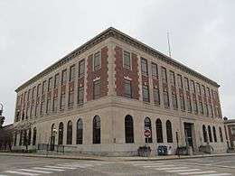
US Post Office-Norwich Main |
|
000000001986-07-17-0000July 17, 1986
(#86002271) |
340 Main St.
41°31′28″N 72°04′19″W / 41.524444°N 72.071944°W / 41.524444; -72.071944 (US Post Office-Norwich Main) |
Norwich |
|
| 179 |
Edward Waldo House |
|
000000001978-11-21-0000November 21, 1978
(#78002879) |
South of Scotland on Waldo Rd.
41°39′33″N 72°06′05″W / 41.659167°N 72.101389°W / 41.659167; -72.101389 (Edward Waldo House) |
Scotland and Sprague |
Saltbox home of Waldo family from 1715-1971. House located in Windham County, while property extends into New London County.
|
| 180 |
Walnut Grove |
|
000000002005-09-21-0000September 21, 2005
(#05001044) |
305 Great Neck Rd.
41°18′35″N 72°06′39″W / 41.309825°N 72.110868°W / 41.309825; -72.110868 (Walnut Grove) |
Waterford |
|
| 181 |
War Office |
|
000000001970-10-06-0000October 6, 1970
(#70000695) |
W. Town St.
41°38′13″N 72°12′55″W / 41.636944°N 72.215278°W / 41.636944; -72.215278 (War Office) |
Lebanon |
|
| 182 |
Whale Oil Row |
|
000000001970-12-29-0000December 29, 1970
(#70000714) |
105-119 Huntington St.
41°21′22″N 72°06′00″W / 41.356111°N 72.1°W / 41.356111; -72.1 (Whale Oil Row) |
New London |
|
| 183 |
Wheeler Block |
|
000000001993-04-16-0000April 16, 1993
(#93000312) |
40 Norwich Ave.
41°34′24″N 72°19′53″W / 41.573333°N 72.331389°W / 41.573333; -72.331389 (Wheeler Block) |
Colchester |
|
| 184 |
Whitehall Mansion |
|
000000001979-04-12-0000April 12, 1979
(#79002647) |
Off CT 27
41°22′37″N 71°57′20″W / 41.376944°N 71.955556°W / 41.376944; -71.955556 (Whitehall Mansion) |
Stonington |
|
| 185 |
Williams Clark Company Thread Mill |
|
000000002008-12-16-0000December 16, 2008
(#08001190) |
21 Pawcatuck Ave., 12 and 22 River Rd.
41°21′37″N 71°50′25″W / 41.3604°N 71.840272°W / 41.3604; -71.840272 (Williams Clark Company Thread Mill) |
Stonington |
|
| 186 |
Williams Memorial Institute |
|
000000001978-01-30-0000January 30, 1978
(#78002876) |
110 Broad St.
41°21′26″N 72°06′13″W / 41.357222°N 72.103611°W / 41.357222; -72.103611 (Williams Memorial Institute) |
New London |
|
| 187 |
Williams Memorial Park Historic District |
|
000000001987-12-03-0000December 3, 1987
(#87002057) |
Roughly bounded by Hempstead & Broad Sts., Williams Memorial Parkway, and Mercer
41°21′22″N 72°06′07″W / 41.356111°N 72.101944°W / 41.356111; -72.101944 (Williams Memorial Park Historic District) |
New London |
|
| 188 |
William Williams House |
|
000000001971-11-11-0000November 11, 1971
(#71001012) |
Junction of CT 87 and 207
41°38′10″N 72°12′46″W / 41.636111°N 72.212778°W / 41.636111; -72.212778 (William Williams House) |
Lebanon |
Home of William Williams, Connecticut delegate to the Continental Congress and signer of the Declaration of Independence
|
| 189 |
John Wilson House |
|
000000001985-08-23-0000August 23, 1985
(#85001827) |
11 Ashland St.
41°36′21″N 71°58′50″W / 41.605833°N 71.980556°W / 41.605833; -71.980556 (John Wilson House) |
Griswold |
|
| 190 |
Winthrop Mill |
|
000000001982-11-30-0000November 30, 1982
(#82001008) |
Mill St.
41°21′47″N 72°06′00″W / 41.363056°N 72.1°W / 41.363056; -72.1 (Winthrop Mill) |
New London |
|
| 191 |
Woodbridge Farm |
|
000000001997-12-01-0000December 1, 1997
(#97001467) |
29, 30, and 90 Woodbridge Rd.
41°27′42″N 72°18′22″W / 41.461667°N 72.306111°W / 41.461667; -72.306111 (Woodbridge Farm) |
Salem |
|
| 192 |
Ashbel Woodward House |
|
000000001992-04-08-0000April 8, 1992
(#92000264) |
387 CT 32
41°36′17″N 72°08′12″W / 41.604722°N 72.136667°W / 41.604722; -72.136667 (Ashbel Woodward House) |
Franklin |
|
| 193 |
Nathan A. Woodworth House |
|
000000001982-06-01-0000June 1, 1982
(#82004378) |
28 Channing St.
41°21′33″N 72°06′20″W / 41.359167°N 72.105556°W / 41.359167; -72.105556 (Nathan A. Woodworth House) |
New London |
|
| 194 |
Wylie School |
|
000000001991-12-19-0000December 19, 1991
(#91001742) |
Junction of Ekonk Hill and Wylie School Rds.
41°36′34″N 71°50′38″W / 41.609444°N 71.843889°W / 41.609444; -71.843889 (Wylie School) |
Voluntown |
|
| 195 |
Yantic Falls Historic District |
|
000000001972-06-28-0000June 28, 1972
(#72001344) |
Yantic St.
41°32′01″N 72°05′19″W / 41.533611°N 72.088611°W / 41.533611; -72.088611 (Yantic Falls Historic District) |
Norwich |
|
| 196 |
Yantic Woolen Company Mill |
|
000000001996-07-25-0000July 25, 1996
(#96000780) |
6 Franklin Rd.
41°33′38″N 72°07′30″W / 41.560556°N 72.125°W / 41.560556; -72.125 (Yantic Woolen Company Mill) |
Norwich |
|
| 197 |
Edward Yeomans House |
|
000000001978-12-22-0000December 22, 1978
(#78002874) |
East of Groton on Brook St.
41°19′49″N 72°00′12″W / 41.330278°N 72.003333°W / 41.330278; -72.003333 (Edward Yeomans House) |
Groton |
|
.jpg)
_-_New_London_County_CT.jpg)
_-_New_London_County_CT.jpg)
.jpg)
.jpg)

.jpg)
.jpg)
.jpg)
.jpg)

.jpg)
.jpg)
.jpg)
.jpg)
.jpg)

.jpg)


.jpg)
.jpg)
.jpg)

.jpg)
.jpg)
.jpg)

.jpg)
.jpg)


.jpg)


.jpg)


.jpg)


.jpg)

.jpg)
.jpg)
.jpg)
.jpg)
.jpg)
.jpg)

.jpg)
.jpg)