| [3] |
Name on the Register[4] |
Image |
Date listed[5] |
Location |
City or town |
Description |
|---|
| 1 |
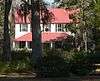
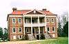
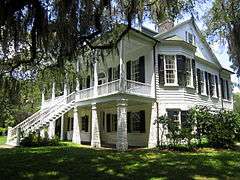
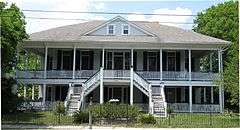
Ashley Hall Plantation |
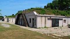
|
000000001975-06-05-0000June 5, 1975
(#75001691) |
Address Restricted
|
West Ashley |
|
| 2 |
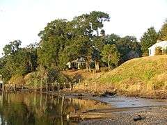
Ashley River Historic District |
|
000000001994-09-12-0000September 12, 1994
(#93001514) |
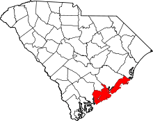
Roughly along the Ashley River from just east of South Carolina Highway 165, near Watson Hill (North Charleston), to the Seaboard Coast Line Railroad bridge
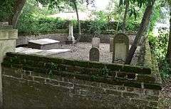
32°53′58″N 80°07′00″W / 32.8994°N 80.1167°W / 32.8994; -80.1167 (Ashley River Historic District) |
Charleston, North Charleston |
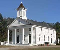
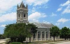
Extends into Charleston and Dorchester County
|
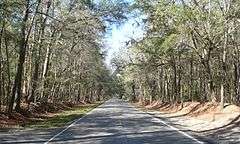
| 3 |
Ashley River Road |
|
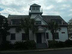
000000001983-11-21-0000November 21, 1983
(#83003831) |
South Carolina Highway 61 between Church Creek and South Carolina Highway 165
32°53′43″N 80°08′08″W / 32.8953°N 80.1356°W / 32.8953; -80.1356 (Ashley River Road) |
Summerville |
Extends into Charleston and Dorchester County
|
| 4 |
Atlanticville Historic District |
Upload image |
000000002007-09-06-0000September 6, 2007
(#07000927) |
Middle St., Jasper Boulevard, and Myrtle Ave. between Stations 22½ and 26
32°45′55″N 79°49′57″W / 32.7653°N 79.8325°W / 32.7653; -79.8325 (Atlanticville Historic District) |
Sullivan's Island |
|
| 5 |
Auld Mound |
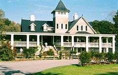
|
000000001970-10-15-0000October 15, 1970
(#70000583) |
Address Restricted
|
Mount Pleasant |
|
| 6 |
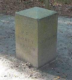
Alexander Bache U.S. Coast Survey Line |
|
000000002007-10-05-0000October 5, 2007
(#07001082) |
8377 State Cabin Rd.
32°30′20″N 80°18′37″W / 32.5056°N 80.3103°W / 32.5056; -80.3103 (Alexander Bache U.S. Coast Survey Line) |
Edisto Island |
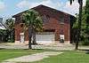
|
| 7 |
Bailey's Store |
|
000000001986-11-28-0000November 28, 1986
(#86003204) |
1444 South Carolina Highway 174
32°33′36″N 80°16′47″W / 32.56009°N 80.27961°W / 32.56009; -80.27961 (Bailey's Store) |
Edisto Island |
Now occupied by With These Hands Gallery.[6]
|
| 8 |
Barnwell House |
Upload image |
000000001980-11-25-0000November 25, 1980
(#80003657) |
South of Charleston
32°41′54″N 80°24′22″W / 32.6983°N 80.4061°W / 32.6983; -80.4061 (Barnwell House) |
Adams Run |
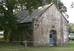
|
| 9 |
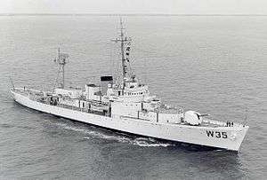
Bass Pond Site |
|
000000001979-04-24-0000April 24, 1979
(#79002379) |
Address Restricted
|
Kiawah Island |
|
| 10 |
Battery Gadsden |
|
000000001974-06-25-0000June 25, 1974
(#74001842) |
2017 Ion Ave.
32°45′36″N 79°50′23″W / 32.76°N 79.8397°W / 32.76; -79.8397 (Battery Gadsden) |
Sullivan's Island |
Now houses the Edgar Allan Poe Branch of the Charleston County Library
|
| 11 |
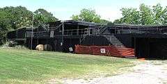
Battery Thomson |
|
000000001974-06-25-0000June 25, 1974
(#74001843) |
2013 Ion Ave.
32°45′33″N 79°50′28″W / 32.7592°N 79.8411°W / 32.7592; -79.8411 (Battery Thomson) |
Sullivan's Island |
|
| 12 |
Bethel African Methodist Episcopal Church |
|
000000002004-06-22-0000June 22, 2004
(#04000651) |
369 Drayton St.
33°05′21″N 79°27′26″W / 33.0893°N 79.4571°W / 33.0893; -79.4571 (Bethel African Methodist Episcopal Church) |
McClellanville |
|
| 13 |
Bleak Hall Plantation Outbuildings |
|
000000001973-03-07-0000March 7, 1973
(#73001698) |
4 miles southeast of Edisto Island off South Carolina Highway 174
32°33′10″N 80°14′05″W / 32.5528°N 80.2347°W / 32.5528; -80.2347 (Bleak Hall Plantation Outbuildings) |
Edisto Island |
|
| 14 |
Brick House Ruin |
|
000000001970-04-15-0000April 15, 1970
(#70000580) |
South of Edisto Island
32°36′05″N 80°19′32″W / 32.6014°N 80.3256°W / 32.6014; -80.3256 (Brick House Ruin) |
Edisto Island |
|
| 15 |
Brooklands Plantation |
|
000000001987-05-05-0000May 5, 1987
(#86003198) |
Off Laurel Hill Rd. on Scanawah Island
32°34′19″N 80°21′19″W / 32.5719°N 80.3553°W / 32.5719; -80.3553 (Brooklands Plantation) |
Edisto Island |
|
| 16 |
Buzzard's Island Site |
|
000000001970-10-15-0000October 15, 1970
(#70000584) |
Address Restricted
|
Mount Pleasant |
|
| 17 |
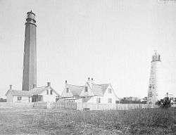
Cape Romain Lighthouses |
|
000000001981-11-12-0000November 12, 1981
(#81000563) |
Southeast of McClellanville on Lighthouse Island
33°01′06″N 79°22′27″W / 33.0183°N 79.3742°W / 33.0183; -79.3742 (Cape Romain Lighthouses) |
McClellanville |
|
| 18 |
Cassina Point |
|
000000001986-11-28-0000November 28, 1986
(#86003210) |
1642 Clark Road, Edisto, South Carolina
32°35′29″N 80°15′03″W / 32.5914°N 80.2508°W / 32.5914; -80.2508 (Cassina Point) |
Edisto Island |
|
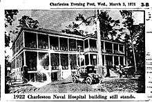
| 19 |
Charleston Naval Hospital Historic District |
|
000000002010-10-22-0000October 22, 2010
(#10000851) |
Former Charleston Navy Base including portions of Turnbull Avenue, Hobby Street, Avenue F, Avenue G, Avenue H, Avenue I, Truxton Avenue, and Marine Avenue
[7]
32°51′51″N 79°58′02″W / 32.86416666666667°N 79.96722222222222°W / 32.86416666666667; -79.96722222222222 (Charleston Naval Hospital Historic District) |
North Charleston |
|
| 20 |
Charleston Navy Yard Historic District |
|
000000002006-08-09-0000August 9, 2006
(#06000699) |
Roughly bounded by 1st St., Hobson Ave., Ave. D, 4th and 5th Sts., and the drydocks between 1st and 13th Sts.
32°51′43″N 79°57′46″W / 32.8619°N 79.9628°W / 32.8619; -79.9628 (Charleston Navy Yard Historic District) |
North Charleston |
|
| 21 |
Charleston Navy Yard Officers' Quarters Historic District |
Upload image |
000000002007-03-02-0000March 2, 2007
(#07000100) |
Turnbull Ave., Everglades Dr., Navy Way, and portions of Hobson Ave. and Blackstop Dr.
32°52′08″N 79°58′09″W / 32.8689°N 79.9692°W / 32.8689; -79.9692 (Charleston Navy Yard Officers' Quarters Historic District) |
North Charleston |
|
| 22 |
Christ Church |
|
000000001972-11-27-0000November 27, 1972
(#72001201) |
2304 Highway 17N[8]
32°50′38″N 79°48′50″W / 32.8439°N 79.8139°W / 32.8439; -79.8139 (Christ Church) |
Mount Pleasant |
|
| 23 |
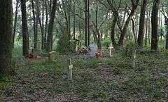
Cook's Old Field Cemetery |
Upload image |
000000002003-05-09-0000May 9, 2003
(#01000679) |
0.5 miles north of Rifle Range Rd.
32°50′20″N 79°48′13″W / 32.8389°N 79.8036°W / 32.8389; -79.8036 (Cook's Old Field Cemetery) |
Mount Pleasant |
|
| 24 |
Crawford's Plantation House |
Upload image |
000000001993-06-08-0000June 8, 1993
(#93000475) |
8202 Oyster Factory Rd.
32°32′15″N 80°18′16″W / 32.5375°N 80.3044°W / 32.5375; -80.3044 (Crawford's Plantation House) |
Edisto Island |
|
| 25 |
Edisto Island Baptist Church |
|
000000001982-04-01-0000April 1, 1982
(#82003839) |
1644 South Carolina Highway 174[9]
32°34′22″N 80°17′03″W / 32.57279°N 80.28416°W / 32.57279; -80.28416 (Edisto Island Baptist Church) |
Edisto Island |
|
| 26 |
Edisto Island Presbyterian Church |
|
000000001971-06-24-0000June 24, 1971
(#71000754) |
1.9 miles north of Edisto Island on South Carolina Highway 174
32°34′44″N 80°17′49″W / 32.5789°N 80.2969°W / 32.5789; -80.2969 (Edisto Island Presbyterian Church) |
Edisto Island |
|
| 27 |
Fairfield Plantation |
|
000000001974-07-25-0000July 25, 1974
(#74001838) |
North of McClellanville
33°10′58″N 79°24′18″W / 33.1828°N 79.405°W / 33.1828; -79.405 (Fairfield Plantation) |
McClellanville |
|
| 28 |
Fig Island Site |
|
000000001970-10-15-0000October 15, 1970
(#70000585) |
Address Restricted
|
Edisto Island |
|
| 29 |
Folly North Site-38CH1213 |
|
000000002003-10-02-0000October 2, 2003
(#03001001) |
Address Restricted
|
Folly Beach |
|
| 30 |
Fort Johnson/Powder Magazine |
|
000000001972-09-14-0000September 14, 1972
(#72001197) |
East end of Ft. Johnson Road, in South Carolina Department of Natural Resources compound
32°45′08″N 79°53′55″W / 32.7522°N 79.8986°W / 32.7522; -79.8986 (Fort Johnson/Powder Magazine) |
James Island |
|
| 31 |
Fort Moultrie Quartermaster and Support Facilities Historic District |
|
000000002007-09-06-0000September 6, 2007
(#07000925) |
Middle St. and Thompson Ave., between Stations 14 and 16.5
32°45′35″N 79°51′11″W / 32.7597°N 79.8531°W / 32.7597; -79.8531 (Fort Moultrie Quartermaster and Support Facilities Historic District) |
Sullivan's Island |
|
| 32 |
Fort Palmetto |
Upload image |
000000001982-08-11-0000August 11, 1982
(#82003842) |
Christ Church Parish
32°49′23″N 79°45′56″W / 32.8231°N 79.7656°W / 32.8231; -79.7656 (Fort Palmetto) |
Hamlin Sound |
|
| 33 |
Fort Pemberton Site |
Upload image |
000000001978-11-21-0000November 21, 1978
(#78002498) |
Shoreline of the Stono River on the northwestern corner of James Island[10]
32°45′35″N 80°00′03″W / 32.7597°N 80.0008°W / 32.7597; -80.0008 (Fort Pemberton Site) |
James Island |
|
| 34 |
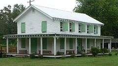
Frogmore |
Upload image |
000000001987-05-05-0000May 5, 1987
(#86003203) |
South of Pine Landing Rd. near the intersection of South Carolina Highway 174 and Laurel Hill Rd.
32°35′16″N 80°21′21″W / 32.5878°N 80.3558°W / 32.5878; -80.3558 (Frogmore) |
Edisto Island |
|
| 35 |
Paul Grimball House Ruins |
|
000000001986-11-28-0000November 28, 1986
(#86003190) |
Address Restricted
|
Edisto Island |
|
| 36 |
Grove Plantation |
|
000000001978-08-25-0000August 25, 1978
(#78002495) |
Southwest of Adams Run off South Carolina Highway 174
32°39′54″N 80°23′37″W / 32.665°N 80.3936°W / 32.665; -80.3936 (Grove Plantation) |
Adams Run |
|
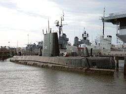
| 37 |
H.L. HUNLEY (submarine) |
|
000000001978-12-29-0000December 29, 1978
(#78003412) |
Located on the old Naval base in North Charleston
32°44′00″N 79°46′00″W / 32.7333°N 79.7667°W / 32.7333; -79.7667 (H.L. HUNLEY (submarine)) |
North Charleston |
|
| 38 |
Hampton Plantation |
|
000000001970-04-15-0000April 15, 1970
(#70000582) |
1950 Rutledge Rd.
33°12′01″N 79°26′09″W / 33.2003°N 79.4358°W / 33.2003; -79.4358 (Hampton Plantation) |
McClellanville |
|
| 39 |
Hanckel Mound |
|
000000001970-10-15-0000October 15, 1970
(#70000586) |
Address Restricted
|
Rockville |
|
| 40 |
Harrietta Plantation |
|
000000001975-09-18-0000September 18, 1975
(#75001695) |
5 miles east of McClellanville off U.S. Route 17
33°10′10″N 79°23′37″W / 33.1694°N 79.3936°W / 33.1694; -79.3936 (Harrietta Plantation) |
McClellanville |
|
| 41 |
Horse Island |
|
000000001970-11-10-0000November 10, 1970
(#70000587) |
Address Restricted
|
Rockville |
|
| 42 |
Hutchinson House |
|
000000001987-05-05-0000May 5, 1987
(#86003218) |
7666 Point of Pines Rd.
32°34′11″N 80°15′25″W / 32.56972°N 80.25707°W / 32.56972; -80.25707 (Hutchinson House) |
Edisto Island |
|
| 43 |
John's Island Presbyterian Church |
Upload image |
000000001975-11-03-0000November 3, 1975
(#75001692) |
10 miles west of Charleston on South Carolina Highway 20
32°41′12″N 80°04′56″W / 32.6867°N 80.0822°W / 32.6867; -80.0822 (John's Island Presbyterian Church) |
Johns Island |
|
| 44 |
King Cemetery |
Upload image |
000000002000-06-13-0000June 13, 2000
(#00000586) |
1.1 miles northeast of the junction of U.S. Route 17 and S-19-38
32°46′10″N 80°22′51″W / 32.7694°N 80.3808°W / 32.7694; -80.3808 (King Cemetery) |
Adams Run |
|
| 45 |
Lighthouse Point Shell Ring (38CH12) |
|
000000001990-10-14-0000October 14, 1990
(#90001505) |
Address Restricted
|
James Island |
|
| 46 |
Long Point Plantation (38CH321) |
|
000000001986-03-20-0000March 20, 1986
(#86000468) |
Address Restricted
|
Mount Pleasant |
|
| 47 |
Lucas Family Cemetery |
|
000000001998-05-18-0000May 18, 1998
(#98000425) |
Ellen Dr.
32°47′45″N 79°52′18″W / 32.7958°N 79.8717°W / 32.7958; -79.8717 (Lucas Family Cemetery) |
Mount Pleasant |
|
| 48 |
Magnolia Plantation and Gardens |
|
000000001972-12-11-0000December 11, 1972
(#72001198) |
10 miles northwest of Charleston on South Carolina Highway 61
32°52′29″N 80°05′21″W / 32.8747°N 80.0892°W / 32.8747; -80.0892 (Magnolia Plantation and Gardens) |
West Ashley |
|
| 49 |
Marshlands Plantation House |
|
000000001973-03-30-0000March 30, 1973
(#73001700) |
Northern side of Fort Sumter Dr.
32°45′01″N 79°54′03″W / 32.7503°N 79.9008°W / 32.7503; -79.9008 (Marshlands Plantation House) |
James Island |
The house was moved from its original location at the old Naval Base in North Charleston for preservation.
|
| 50 |
McClellanville Historic District |
Upload image |
000000001982-03-23-0000March 23, 1982
(#82003845) |
Pinckney, Lofton, Charlotte, Church, Water, Oak, Venning, Legare, Morrison, and Scotia Sts.
33°05′06″N 79°27′43″W / 33.085°N 79.4619°W / 33.085; -79.4619 (McClellanville Historic District) |
McClellanville |
|
| 51 |
Middleton's Plantation |
Upload image |
000000001971-05-06-0000May 6, 1971
(#71000755) |
3.5 miles north of Edisto Island off South Carolina Highway 174
32°33′25″N 80°19′48″W / 32.5569°N 80.33°W / 32.5569; -80.33 (Middleton's Plantation) |
Edisto Island |
Not to be confused with Middleton Place in nearby Dorchester County
|
| 52 |
Moultrieville Historic District |
|
000000002007-09-06-0000September 6, 2007
(#07000928) |
Middle St. and Osceola Ave., between stations 11 and 12
32°45′39″N 79°51′33″W / 32.7608°N 79.8592°W / 32.7608; -79.8592 (Moultrieville Historic District) |
Sullivan's Island |
Includes several late-19th and early-20th century beach houses and Stella Maris Church designed by John Henry Devereux
|
| 53 |
Mount Pleasant Historic District |
|
000000001973-03-30-0000March 30, 1973
(#73001701) |
Bounded by Charleston Harbor, Shem Creek, Royall Ave., and McCants Dr.
32°47′10″N 79°52′33″W / 32.7861°N 79.8758°W / 32.7861; -79.8758 (Mount Pleasant Historic District) |
Mount Pleasant |
|
| 54 |
Moving Star Hall |
Upload image |
000000001982-06-17-0000June 17, 1982
(#82003843) |
River Rd.
32°40′55″N 80°01′33″W / 32.6819°N 80.0258°W / 32.6819; -80.0258 (Moving Star Hall) |
Johns Island |
|
| 55 |
Oak Island |
|
000000001986-11-28-0000November 28, 1986
(#86003202) |
1 mile off Oak Island Rd. on Westbank Creek
32°35′39″N 80°15′05″W / 32.5942°N 80.2514°W / 32.5942; -80.2514 (Oak Island) |
Edisto Island |
|
| 56 |
Oakland Plantation House |
|
000000001977-07-13-0000July 13, 1977
(#77001218) |
7 miles north of Charleston Harbor on U.S. Route 17
32°51′59″N 79°45′18″W / 32.8664°N 79.755°W / 32.8664; -79.755 (Oakland Plantation House) |
Mount Pleasant |
|
| 57 |
Old Berkeley County Courthouse |
|
000000001971-05-06-0000May 6, 1971
(#71000760) |
331 King St.
32°47′06″N 79°51′50″W / 32.785°N 79.8639°W / 32.785; -79.8639 (Old Berkeley County Courthouse) |
Mount Pleasant |
|
| 58 |
Old Georgetown Road |
Upload image |
000000002014-06-27-0000June 27, 2014
(#14000382) |
Old Georgetown Road between south bank of the South Santee River and SC 45
33°09′15″N 79°28′46″W / 33.1541°N 79.4795°W / 33.1541; -79.4795 (Old Georgetown Road) |
McClellanville vicinity |
|
| 59 |
Old House Plantation |
Upload image |
000000001971-05-14-0000May 14, 1971
(#71000756) |
Northeast of Edisto Island via South Carolina Highway 174; also 0.5 miles east of the junction of South Carolina Highway 174 and Oak Island Rd., then right on a dirt road
32°34′49″N 80°15′37″W / 32.5803°N 80.2603°W / 32.5803; -80.2603 (Old House Plantation) |
Edisto Island |
Second address represents a boundary increase of 000000001987-05-05-0000May 5, 1987
|
| 60 |
Dr. John B. Patrick House |
|
000000001995-02-09-0000February 9, 1995
(#94001628) |
1820 Middle St.
32°45′35″N 79°50′36″W / 32.7597°N 79.8433°W / 32.7597; -79.8433 (Dr. John B. Patrick House) |
Sullivan's Island |
|
| 61 |
Peter's Point Plantation |
Upload image |
000000001973-06-19-0000June 19, 1973
(#73001699) |
9084 Peter's Point Road, Edisto, South Carolina
32°32′19″N 80°20′22″W / 32.5386°N 80.3394°W / 32.5386; -80.3394 (Peter's Point Plantation) |
Edisto Island |
|
| 62 |
Presbyterian Manse |
Upload image |
000000001971-05-14-0000May 14, 1971
(#71000757) |
Northwest of Edisto Island off South Carolina Highway 174
32°34′04″N 80°18′34″W / 32.5678°N 80.3094°W / 32.5678; -80.3094 (Presbyterian Manse) |
Edisto Island |
|
| 63 |
Paul Pritchard Shipyard |
|
000000001974-09-17-0000September 17, 1974
(#74001839) |
Address Restricted
|
Mount Pleasant |
|
| 64 |
The Progressive Club |
Upload image |
000000002007-10-24-0000October 24, 2007
(#07001109) |
3377 River Rd.
32°40′37″N 80°02′26″W / 32.6769°N 80.0406°W / 32.6769; -80.0406 (The Progressive Club) |
Johns Island |
|
| 65 |
Prospect Hill |
|
000000001986-11-28-0000November 28, 1986
(#86003196) |
Off Laurel Hill Rd.
32°34′54″N 80°23′04″W / 32.5817°N 80.3844°W / 32.5817; -80.3844 (Prospect Hill) |
Edisto Island |
|
| 66 |
Remley Point Cemetery |
|
000000002002-05-30-0000May 30, 2002
(#02000570) |
0.2 miles northeast of the junction of 3rd and 4th Aves.
32°48′51″N 79°53′53″W / 32.8142°N 79.8981°W / 32.8142; -79.8981 (Remley Point Cemetery) |
Mount Pleasant |
|
| 67 |
Rockville Historic District |
Upload image |
000000001972-06-13-0000June 13, 1972
(#72001202) |
Town of Rockville on the northern bank of Bohicket Creek
32°36′18″N 80°11′35″W / 32.605°N 80.1931°W / 32.605; -80.1931 (Rockville Historic District) |
Rockville |
|
| 68 |
St. James Episcopal Church, Santee |
|
000000001970-04-15-0000April 15, 1970
(#70000581) |
17 miles south of Georgetown on the Santee River
33°10′19″N 79°27′56″W / 33.1719°N 79.4656°W / 33.1719; -79.4656 (St. James Episcopal Church, Santee) |
Georgetown |
|
| 69 |
John Seabrook Plantation Bridge |
Upload image |
000000001974-10-09-0000October 9, 1974
(#74001841) |
Northwest of Rockville off South Carolina Highway 700
32°37′38″N 80°12′37″W / 32.6272°N 80.2103°W / 32.6272; -80.2103 (John Seabrook Plantation Bridge) |
Rockville |
|
| 70 |
William Seabrook House |
|
000000001971-05-06-0000May 6, 1971
(#71000758) |
North of Edisto Island off South Carolina Highway 174
32°36′06″N 80°16′53″W / 32.6017°N 80.2814°W / 32.6017; -80.2814 (William Seabrook House) |
Edisto Island |
|
| 71 |
Seashore Farmers' Lodge No. 767 |
|
000000002007-10-03-0000October 3, 2007
(#07001043) |
Northeastern corner of the junction of Sol Legare and Old Sol Legare Rds.
32°40′54″N 79°58′02″W / 32.6817°N 79.9672°W / 32.6817; -79.9672 (Seashore Farmers' Lodge No. 767) |
James Island |
|
| 72 |
Seaside School |
Upload image |
000000001994-06-17-0000June 17, 1994
(#94000602) |
1097 South Carolina Highway 174
32°32′51″N 80°16′54″W / 32.5475°N 80.2817°W / 32.5475; -80.2817 (Seaside School) |
Edisto Island |
|
| 73 |
Secessionville Historic District |
|
000000001979-10-01-0000October 1, 1979
(#79002378) |
North of Folly Beach
32°42′18″N 79°56′35″W / 32.705°N 79.9431°W / 32.705; -79.9431 (Secessionville Historic District) |
Folly Beach |
Extends into Charleston |
| 74 |
Sewee Mound |
|
000000001970-10-15-0000October 15, 1970
(#70000571) |
Salt Pond Road (FS Road 243)[11]
32°59′48″N 79°36′37″W / 32.996667°N 79.610278°W / 32.996667; -79.610278 (Sewee Mound) |
Awendaw |
|
| 75 |
Slave Street, Smokehouse, and Allee, Boone Hall Plantation |
|
000000001983-07-14-0000July 14, 1983
(#93001512) |
North of Mt. Pleasant off U.S. Route 17; also Long Point Rd. west of its junction with U.S. Routes 17/701
32°51′29″N 79°49′23″W / 32.8581°N 79.8231°W / 32.8581; -79.8231 (Slave Street, Smokehouse, and Allee, Boone Hall Plantation) |
Mount Pleasant |
Second location represents a boundary increase of 000000001994-01-21-0000January 21, 1994, the Boone Hall Plantation House and Historic Landscape
|
| 76 |
Snee Farm-Charles Pinckney National Historic Site |
|
000000001973-04-13-0000April 13, 1973
(#73001702) |
6 miles west of Mt. Pleasant at 1254 Long Point Rd.
32°50′46″N 79°49′29″W / 32.8461°N 79.8247°W / 32.8461; -79.8247 (Snee Farm-Charles Pinckney National Historic Site) |
Mount Pleasant |
|
| 77 |
Stono River Slave Rebellion Site |
|
000000001974-05-30-0000May 30, 1974
(#74001840) |
Off U.S. Route 17 on the western bank of the Wallace River
32°47′14″N 80°08′44″W / 32.7872°N 80.1456°W / 32.7872; -80.1456 (Stono River Slave Rebellion Site) |
Rantowles |
|
| 78 |
Sullivan's Island Historic District |
|
000000002007-09-06-0000September 6, 2007
(#07000929) |
Middle St., I'on Ave., and Central Ave. between Stations 17 and 18½
32°45′33″N 79°50′45″W / 32.7592°N 79.8458°W / 32.7592; -79.8458 (Sullivan's Island Historic District) |
Sullivan's Island |
|
| 79 |
Summit Plantation House |
|
000000001983-07-28-0000July 28, 1983
(#83002188) |
Off County Road 390
32°41′37″N 80°17′10″W / 32.6936°N 80.2861°W / 32.6936; -80.2861 (Summit Plantation House) |
Adams Run |
|
| 80 |
Sunnyside |
|
000000001986-11-28-0000November 28, 1986
(#86003216) |
Off the northern side of Peter's Point Rd.; also north of the junction of Peters Point and Creekwood Rd.
32°33′57″N 80°17′50″W / 32.5658°N 80.2972°W / 32.5658; -80.2972 (Sunnyside) |
Edisto Island |
A plantation on Edisto Island. Second location represents a boundary increase, the Sunnyside Plantation Foreman's House
|
| 81 |
Towles Farmstead |
Upload image |
000000001994-01-21-0000January 21, 1994
(#93001513) |
4595 and 4611 Towles Rd.
32°43′14″N 80°11′06″W / 32.7206°N 80.185°W / 32.7206; -80.185 (Towles Farmstead) |
Meggett |
|
| 82 |
Hephzibah Jenkins Townsend's Tabby Oven Ruins |
|
000000001987-05-05-0000May 5, 1987
(#86003200) |
Address Restricted
|
Edisto Island |
|
| 83 |
Trinity Episcopal Church |
|
000000001971-05-14-0000May 14, 1971
(#71000759) |
1589 South Carolina Highway 174[12]
32°34′10″N 80°17′01″W / 32.5694°N 80.2836°W / 32.5694; -80.2836 (Trinity Episcopal Church) |
Edisto Island |
|
| 84 |
U.S. Coast Guard Historic District |
|
000000001973-06-19-0000June 19, 1973
(#73001703) |
Ion Ave. between Station 18 and Station 18½
32°45′27″N 79°50′33″W / 32.7575°N 79.8425°W / 32.7575; -79.8425 (U.S. Coast Guard Historic District) |
Sullivan's Island |
|
| 85 |
Unnamed Battery No. 1 |
Upload image |
000000001982-08-11-0000August 11, 1982
(#82003838) |
Clark's Point
32°43′15″N 79°56′07″W / 32.7208°N 79.9353°W / 32.7208; -79.9353 (Unnamed Battery No. 1) |
James Island |
|
| 86 |
USS Clamagore (SS-343) |
|
000000001989-06-29-0000June 29, 1989
(#89001229) |
Patriot's Point
32°47′23″N 79°54′28″W / 32.7897°N 79.9078°W / 32.7897; -79.9078 (USS Clamagore (SS-343)) |
Mount Pleasant |
|
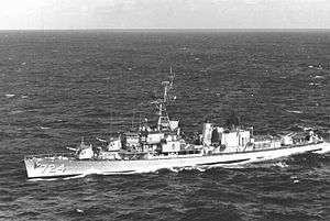
| 87 |
USS Laffey |
|
000000001983-04-12-0000April 12, 1983
(#83002189) |
West of Mt. Pleasant on the eastern side of Charleston Harbor
32°47′23″N 79°54′28″W / 32.7897°N 79.9078°W / 32.7897; -79.9078 (USS Laffey) |
Mount Pleasant |
|
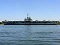
| 88 |
USS Yorktown (CV-10) |
|
000000001982-11-10-0000November 10, 1982
(#82001519) |
West of Mt. Pleasant on the eastern side of Charleston Harbor
32°47′26″N 79°54′31″W / 32.7906°N 79.9086°W / 32.7906; -79.9086 (USS Yorktown (CV-10)) |
Mount Pleasant |
|
| 89 |
Arnoldus Vander Horst House |
Upload image |
000000001973-10-25-0000October 25, 1973
(#73001697) |
25 miles southwest of Charleston on Kiawah Island
32°37′00″N 80°04′24″W / 32.6167°N 80.0733°W / 32.6167; -80.0733 (Arnoldus Vander Horst House) |
Kiawah Island |
|
| 90 |
The Wedge |
|
000000001980-11-25-0000November 25, 1980
(#80003660) |
Northeast of McClellanville
33°10′17″N 79°23′57″W / 33.1714°N 79.3992°W / 33.1714; -79.3992 (The Wedge) |
McClellanville |
|
| 91 |
Wescott Road |
|
000000001986-11-28-0000November 28, 1986
(#86003195) |
West of South Carolina Highway 174
32°33′44″N 80°16′53″W / 32.56221°N 80.28142°W / 32.56221; -80.28142 (Wescott Road) |
Edisto Island |
|
| 92 |
Wilkinson-Boineau House |
|
000000001999-01-21-0000January 21, 1999
(#98001644) |
5185 South Carolina Highway 174
32°43′10″N 80°20′56″W / 32.71953°N 80.34899°W / 32.71953; -80.34899 (Wilkinson-Boineau House) |
Adams Run |
|
| 93 |
Willtown Bluff |
|
000000001974-01-08-0000January 8, 1974
(#74001830) |
Southwest of Adams Run at the end of County Road 55 on the banks of the S. Edisto River
32°40′54″N 80°24′54″W / 32.6817°N 80.415°W / 32.6817; -80.415 (Willtown Bluff) |
Adams Run |
|
| 94 |
Windsor Plantation |
Upload image |
000000001974-07-23-0000July 23, 1974
(#74001837) |
East of South Carolina Highway 174 near Little Edisto
32°35′58″N 80°20′41″W / 32.5994°N 80.3447°W / 32.5994; -80.3447 (Windsor Plantation) |
Edisto Island |
|
_1.JPG)

.jpg)
.jpg)
%2C_County_Road_1989_vicinity%2C_Edisto_Island_(Charleston_County%2C_South_Carolina).jpg)
.jpg)
_2.jpg)
.jpg)
.jpg)
.jpg)
.jpg)
_2.JPG)
.jpg)

%2C_County_Road_768_vicinity%2C_Edisto_Island_(Charleston_County%2C_South_Carolina).jpg)
.jpg)
_3.jpg)
.png)
.jpg)
.jpg)

.jpg)
%2C_County_Road_390%2C_Meggett_(Charleston_County%2C_South_Carolina).jpg)
.jpg)
_1.JPG)
.jpg)
_1.JPG)