National Register of Historic Places listings in Whitfield County, Georgia
This is a list of properties and districts in Whitfield County, Georgia, United States, that are listed on the National Register of Historic Places (NRHP).
- This National Park Service list is complete through NPS recent listings posted December 16, 2016.[1]
Current listings
| [2] | Name on the Register | Image | Date listed[3] | Location | City or town | Description |
|---|---|---|---|---|---|---|
| 1 | Thomas A. Berry House |  |
(#84001303) |
506 Hawthorne St. 34°46′33″N 84°57′47″W / 34.775833°N 84.963056°W |
Dalton | |
| 2 | Ainsworth E. Blunt House | 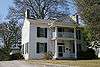 |
(#80004460) |
506 S. Thornton Ave. 34°46′00″N 84°58′19″W / 34.766667°N 84.971944°W |
Dalton | |
| 3 | Crown Mill Historic District | 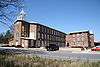 |
(#79000751) |
U.S. 41 34°47′03″N 84°58′22″W / 34.784167°N 84.972778°W |
Dalton | |
| 4 | Dalton Commercial Historic District |  |
(#88001831) |
Roughly bounded by Hamilton, Pentz, Waugh and Morris Sts.; also roughly centered on Hamilton St., and bounded by S. Thornton Ave., Morris and Hawthorne Sts., and the railroad lines 34°46′16″N 84°58′05″W / 34.771111°N 84.968056°W |
Dalton | Second set of boundaries represents a boundary increase of April 19, 2006 |
| 5 | William C. Martin House |  |
(#82002497) |
101 S. Selvidge St. 34°46′16″N 84°58′15″W / 34.771111°N 84.970833°W |
Dalton | |
| 6 | Masonic Lodge No. 238 | 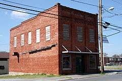 |
(#96000127) |
600 S. Hamilton St. 34°45′57″N 84°58′05″W / 34.765833°N 84.968056°W |
Dalton | |
| 7 | McCarty Subdivision Historic District |  |
(#02000714) |
Thornton Place, Willow Park Dr., Sunset Cirtcle, and Walnut Ave. 34°45′35″N 84°58′20″W / 34.759722°N 84.972222°W |
Dalton | |
| 8 | Prater's Mill | 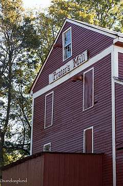 |
(#78001010) |
N of Dalton on GA 2 34°53′45″N 84°55′20″W / 34.895833°N 84.922222°W |
Dalton | |
| 9 | A. D. Strickland Store | 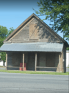 |
(#05000405) |
1385 Dawnville Rd. 34°49′17″N 84°52′45″W / 34.82151°N 84.87908°W |
Dalton | |
| 10 | Thornton Avenue-Murray Hill Historic District | 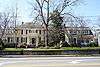 |
(#92000669) |
Roughly bounded by Crawford St., Thornton Ave., W. Franklin St., Valley Dr., Emory St. and West Hill Cemetery 34°46′04″N 84°58′28″W / 34.767778°N 84.974444°W |
Whitfield | |
| 11 | Western and Atlantic Depot |  |
(#78001009) |
Depot St., W end of King St. 34°46′20″N 84°58′02″W / 34.77236°N 84.96712°W |
Dalton | Built in 1914, renovated in 2009. Also a contributing property to the Dalton Commercial Historic District and is now a visitor's center. |
| 12 | Western and Atlantic Railroad Tunnel at Tunnel Hill | 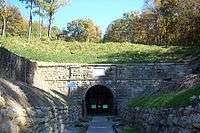 |
(#01001431) |
Western and Atlantic Railroad 34°50′19″N 85°01′52″W / 34.838611°N 85.031111°W |
Tunnel Hill |
References
- ↑ "National Register of Historic Places: Weekly List Actions". National Park Service, United States Department of the Interior. Retrieved on December 16, 2016.
- ↑ Numbers represent an ordering by significant words. Various colorings, defined here, differentiate National Historic Landmarks and historic districts from other NRHP buildings, structures, sites or objects.
- ↑ The eight-digit number below each date is the number assigned to each location in the National Register Information System database, which can be viewed by clicking the number.
| Wikimedia Commons has media related to National Register of Historic Places in Whitfield County, Georgia. |
This article is issued from Wikipedia - version of the 10/24/2016. The text is available under the Creative Commons Attribution/Share Alike but additional terms may apply for the media files.