National Register of Historic Places listings in Winneshiek County, Iowa
Location of Winneshiek County in Iowa
This is a list of the National Register of Historic Places listings in Winneshiek County, Iowa.
This is intended to be a complete list of the properties and districts on the National Register of Historic Places in Winneshiek County, Iowa, United States. Latitude and longitude coordinates are provided for many National Register properties and districts; these locations may be seen together in a map.[1]
There are 32 properties and districts listed on the National Register in the county. Five other properties have been delisted.
- This National Park Service list is complete through NPS recent listings posted December 16, 2016.[2]


Former listings
Five properties were once listed on the Register, but have been removed:
| [3] | Name on the Register | Image | Date listed | Date removed | Location | City or town | Summary |
|---|---|---|---|---|---|---|---|
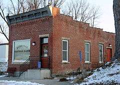
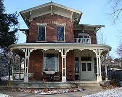
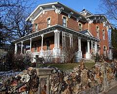
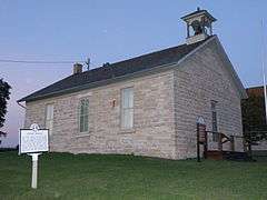
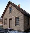
| 1 | Big Stone Mills | 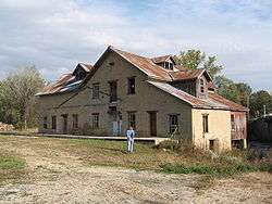 |
(#09000516) | 113 North Main Street 43°12′27″N 91°57′03″W / 43.207375°N 91.950717°W |
Spillville | Demolished June 23, 2011. | |
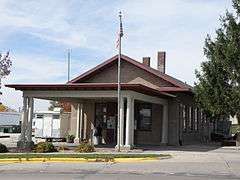
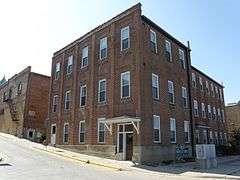
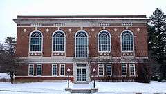
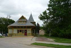
| 2 | Clarksville Diner | Upload image | (#93001356) | 504 Heivly Street |
Decorah | ||
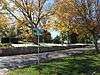
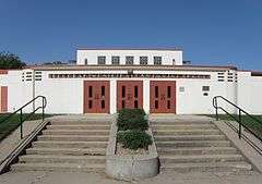
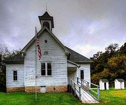
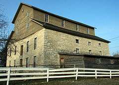
| 3 | Decorah East Side Elementary and Middle School | 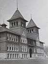 |
(#98001204) | 210 Vernon Street |
Decorah | ||
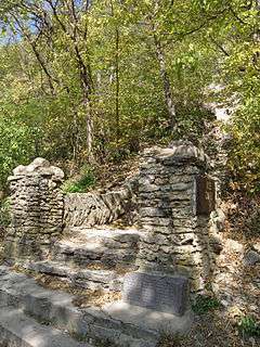
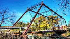
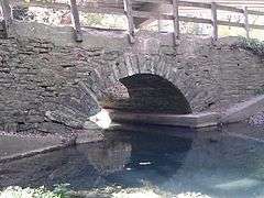
| 4 | Freeport Bowstring Arch Bridge | 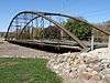 |
(#84001407) | Spans Upper Iowa River |
Freeport vicinity | Delisted after relocation | |
| 5 | Turkey River Bridge | Upload image | (#98000468) | Little Church Road over the Turkey River 43°05′06″N 91°53′38″W / 43.085°N 91.893889°W |
Festina vicinity | Demolished and replaced in 2010[7] |
See also
| Wikimedia Commons has media related to National Register of Historic Places in Winneshiek County, Iowa. |
References
- ↑ The latitude and longitude information provided in this table was derived originally from the National Register Information System, which has been found to be fairly accurate for about 99% of listings. For about 1% of NRIS original coordinates, experience has shown that one or both coordinates are typos or otherwise extremely far off; some corrections may have been made. A more subtle problem causes many locations to be off by up to 150 yards, depending on location in the country: most NRIS coordinates were derived from tracing out latitude and longitudes off of USGS topographical quadrant maps created under the North American Datum of 1927, which differs from the current, highly accurate WGS84 GPS system used by most on-line maps. Chicago is about right, but NRIS longitudes in Washington are higher by about 4.5 seconds, and are lower by about 2.0 seconds in Maine. Latitudes differ by about 1.0 second in Florida. Some locations in this table may have been corrected to current GPS standards.
- ↑ "National Register of Historic Places: Weekly List Actions". National Park Service, United States Department of the Interior. Retrieved on December 16, 2016.
- 1 2 Numbers represent an ordering by significant words. Various colorings, defined here, differentiate National Historic Landmarks and historic districts from other NRHP buildings, structures, sites or objects.
- ↑ National Park Service (2008-04-24). "National Register Information System". National Register of Historic Places. National Park Service.
- ↑ The eight-digit number below each date is the number assigned to each location in the National Register Information System database, which can be viewed by clicking the number.
- ↑ Peterson, Cynthia L.; David G. Stanley (2012-09-05). "National Register of Historic Places Multiple Property Documentation Form: Historic Properties of the Ho-Chunk (Winnebago) Removal to the Neutral Ground" (PDF). National Park Service. Retrieved 2013-12-29.
- ↑ "Turkey River Bridge". Bridgehunter.com. Retrieved April 4, 2011.
| Topics | |
|---|---|
| Lists by states |
|
| Lists by insular areas | |
| Lists by associated states | |
| Other areas | |
| |


Municipalities and communities of Winneshiek County, Iowa, United States | ||
|---|---|---|
| Cities | ||
| Townships | ||
| CDP | ||
| Unincorporated community | ||
| Ghost town | ||
This article is issued from Wikipedia - version of the 11/1/2016. The text is available under the Creative Commons Attribution/Share Alike but additional terms may apply for the media files.