Nevada State Route 487
| ||||
|---|---|---|---|---|
| Baker Road | ||||
| Route information | ||||
| Maintained by NDOT | ||||
| Length: | 11.025 mi[1] (17.743 km) | |||
| Existed: | 1976 – present | |||
| History: | Established as SR 73 by 1937 | |||
| Major junctions | ||||
| South end: |
| |||
| North end: |
| |||
| Highway system | ||||
| ||||

State Route 487 (SR 487) is a north–south state highway in White Pine County, Nevada. The route follows Baker Road, from the Utah–Nevada state line southeast of Baker to U.S. Route 6 and U.S. Route 50 (US 6 and US 50). The route was previously known as State Route 73 prior to 1976. SR 487 is designated as a Nevada Scenic Byway.
Route description
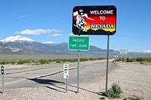
SR 487 begins as at the Utah state line northwest of Garrison, Utah as the continuation of Utah State Route 21, which serves the towns of Milford and Beaver. From there, the route heads northwesterly on Baker Road through the desert terrain. The highway comes upon the town of Baker, near which there are pockets of farmland. In Baker, the route intersects Lehman Caves Road (SR 488), which is the gateway to Great Basin National Park. Leaving the town, SR 487 continues northwesterly through more desert lands. The route ends at the intersection of US 6/US 50, approximately seven miles (11 km) west of the Nevada–Utah state line.[2]
_in_White_Pine_County%2C_Nevada.JPG)
History
Baker Road first appears on official Nevada state highway maps as far back as 1937.[3] Although the state's tourist maps did not show Baker Road carrying the State Route 73 designation until 1942, other state maps show the route number existing on the highway by 1937.[4][5] The route was upgraded to a gravel road by 1948,[6] and was fully paved by 1949.[7]
SR 73 was eliminated from the state highway system as part of a mass renumbering of Nevada's state routes. The State Route 487 designation was assigned to the former alignment of SR 73 on July 1, 1976.[8] The resulting change in the highway number was first seen on the 1978–79 edition of the official highway map.[9] Since its re-designation as SR 487, there has not been any major changes to Baker Road.
The Nevada Department of Transportation designated State Route 487 as a Nevada Scenic Byway on March 27, 2000, simultaneously with SR 488 and the portion of US 6/US 50 near the highway's northern terminus.[10]
Major intersections
The entire route is in White Pine County.
| Location | mi | km | Destinations | Notes | |
|---|---|---|---|---|---|
| | 0.00 | 0.00 | Continuation beyond southern terminus into Utah | ||
| Baker | serves Great Basin National Park | ||||
| | Northern terminus | ||||
| 1.000 mi = 1.609 km; 1.000 km = 0.621 mi | |||||
See also
 Nevada portal
 U.S. Roads portal
References
- ↑ Nevada Department of Transportation (January 2014). "State Maintained Highways of Nevada: Descriptions and Maps" (PDF). Retrieved February 16, 2014.
- ↑ Google (February 16, 2014). "Overview of SR 487" (Map). Google Maps. Google. Retrieved February 16, 2014.
- ↑ Official Road Map of the State of Nevada (PDF) (Map). Nevada State Highway Department. 1937. Retrieved February 16, 2014.
- ↑ Official Road Map of the State of Nevada (PDF) (Map). Nevada State Highway Department. 1942. Retrieved February 16, 2014.
- ↑ General Highway Map, White Pine County, Nevada (PDF) (Map). Nevada Department of Highways. 1937. Retrieved February 16, 2014.
- ↑ Official Highway Map of Nevada (PDF) (Map). Nevada State Highway Department. 1948. § E7. Retrieved February 16, 2014.
- ↑ Official Highway Map of Nevada (PDF) (Map). Nevada State Highway Department. 1949. § E7. Retrieved February 16, 2014.
- ↑ Nevada State Maintained Highways: Descriptions, Index and Maps. Nevada Department of Transportation. January 2001. p. 119.
- ↑ Official Highway Map of Nevada (PDF) (Map) (1978-79 ed.). Nevada State Highway Department. 1978. § C6. Retrieved February 16, 2014.
- ↑ "Nevada Scenic Byways". Nevada Department of Transportation. Retrieved February 16, 2014.
External links
- Nevada DOT: Photos of Nevada State Route 487
 Media related to Nevada State Route 487 at Wikimedia Commons