New Hampshire Route 137
| ||||
|---|---|---|---|---|
|
Map of southern New Hampshire with NH 137 highlighted in red | ||||
| Route information | ||||
| Maintained by NHDOT | ||||
| Length: | 16.583 mi[1] (26.688 km) | |||
| Major junctions | ||||
| South end: |
| |||
|
| ||||
| North end: |
| |||
| Location | ||||
| Counties: | Cheshire, Hillsborough | |||
| Highway system | ||||
| ||||

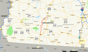
New Hampshire Route 137 (abbreviated NH 137) is a 16.583-mile-long (26.688 km) secondary north–south state highway in southern New Hampshire. The road runs between Jaffrey and Hancock.
The southern terminus of NH 137 is at U.S. Route 202 and New Hampshire Route 124 in Jaffrey. In Jaffrey, NH 137 is named North Street. The northern terminus is northeast of Hancock center at US 202 along the west side of Powder Mill Pond at the Bennington town line.
Major intersections
| County | Location[1][2] | mi[1][2] | km | Destinations | Notes |
|---|---|---|---|---|---|
| Cheshire | Jaffrey | 0.00 | 0.00 | Southern terminus | |
| Dublin | 6.518 | 10.490 | |||
| Hillsborough | Hancock | 13.488 | 21.707 | Southern end of wrong-way concurrency with NH 123 | |
| 13.664 | 21.990 | Northern end of wrong-way concurrency with NH 123 | |||
| 16.583 | 26.688 | Northern terminus | |||
1.000 mi = 1.609 km; 1.000 km = 0.621 mi
| |||||
References
- 1 2 3 Bureau of Planning & Community Assistance (February 20, 2015). "NH Public Roads". Concord, New Hampshire: New Hampshire Department of Transportation. Retrieved April 7, 2015.
- 1 2 Bureau of Planning & Community Assistance (April 3, 2015). "Nodal Reference 2015, State of New Hampshire". New Hampshire Department of Transportation. Retrieved April 7, 2015.
External links
This article is issued from Wikipedia - version of the 4/19/2015. The text is available under the Creative Commons Attribution/Share Alike but additional terms may apply for the media files.