Norvegia Point
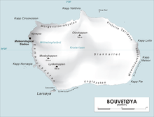
Map of Bouvetøya
Norvegia Point (54°27′S 3°21′E / 54.450°S 3.350°ECoordinates: 54°27′S 3°21′E / 54.450°S 3.350°E) is a point 2 nautical miles (3.7 km) south of Cape Circoncision on the west side of the island of Bouvetøya. First roughly charted from the Valdivia in 1898 by a German expedition under Carl Chun. Recharted in December 1927 by a Norwegian expedition under Captain Harald Horntvedt. Named by Horntvedt after his expedition ship, the Norvegia I.[1] [2]
References
- ↑ "Prof. Dr. phil., Dr. med. h. c. Carl Chun". University of Leipzig. Retrieved October 1, 2016.
- ↑ "Norvegia I". polarhistorie.no. Retrieved October 1, 2016.
![]() This article incorporates public domain material from the United States Geological Survey document "Norvegia Point" (content from the Geographic Names Information System).
This article incorporates public domain material from the United States Geological Survey document "Norvegia Point" (content from the Geographic Names Information System).
This article is issued from Wikipedia - version of the 11/1/2016. The text is available under the Creative Commons Attribution/Share Alike but additional terms may apply for the media files.