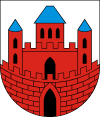
Nowe
| Nowe | ||
|---|---|---|
|
Roman Catholic church | ||
| ||
 Nowe | ||
| Coordinates: 53°38′58″N 18°43′32″E / 53.64944°N 18.72556°E | ||
| Country |
| |
| Voivodeship | Kuyavian-Pomeranian | |
| County | Świecie | |
| Gmina | Gmina Nowe | |
| Area | ||
| • Total | 3.57 km2 (1.38 sq mi) | |
| Population (2006) | ||
| • Total | 6,252 | |
| • Density | 1,800/km2 (4,500/sq mi) | |
| Postal code | 86-170 | |

Nowe [ˈnɔvɛ] (German: Neuenburg in Westpreußen) is a town in Świecie County, Kuyavian-Pomeranian Voivodeship, Poland, with 6,270 inhabitants (2004).
Geographical location
Nowe is located approximately 75 kilometers north-east of Bydgoszcz and 80 kilometers south of Gdańsk in an elevated position on the river Vistula.
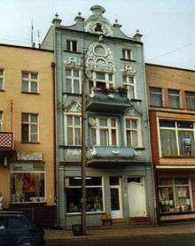
.jpg)
History
The medieval name of the town was Novo Castro, or Nowy Gród in Polish. The town was founded in 1185 by Sobieslaw I, Duke of Pomerania.[1] In 1266 the settlement is mentioned as a fortess place. In 1282 the Franciscan monks settled down here. In 1301 Nowe came into the possession of Peter Swienca.
In 1465 the Teutonic Knights, during the Thirteen Years' War between the Order and the Kingdom of Poland, lost the town as their last stronghold on the west bank of river Vistula. The region became part of Poland. In 1772, after the Partitions of Poland, the town was annexed by the Kingdom of Prussia.
Up to the end of World War I Neuenburg belonged to Kreis Schwetz in the administrative district of Regierungsbezirk Marienwerder in the Province of West Prussia of the German Reich. In 1920, after World War I the town became part of the Second Republic of Poland. After the German Invasion of Poland it was incorporated into the Third Reich, from 1939 to 1945. Shortly before the end of World War II,it was captured by the Red Army. After the end of the war the town became part of Poland once more.
Number of inhabitants by year
| Year | Number |
|---|---|
| 1773 | 1,079 |
| 1780 | 1,330 |
| 1831 | 2,430 |
| 1875 | 4,712 |
| 1880 | 4,947 |
| 1890 | 4,803 |
| 1905 | 5,142 |
| 1921 | approx. 4,000 |
| 1943 | 5,233 |
| 2006 | 6,252 |
Note that the above table is based on primary, possibly biased or inaccurate, sources.[1][2][3][4]
References
- 1 2 Johann Friedrich Goldbeck: Volständige Topographie des Königreichs Preußen. Part II: Topographie von West-Preußen. Marienwerder 1789, p. 65, paragraph 3.
- ↑ Der Große Brockhaus, 15th edition, Vol. 13, Leipzig 1932, p. 295.
- ↑ Michael Rademacher: Deutsche Verwaltungsgeschichte Provinz Westpreußen, Kreis Schwetz (2006).
- ↑ August Eduard Preuß: Preußische Landes- und Volkskunde, Königsberg 1835, pp. 386–387.
Coordinates: 53°39′N 18°44′E / 53.650°N 18.733°E