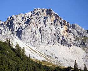
Oberreintalschrofen
| Oberreintalschrofen | |
|---|---|
 | |
| Highest point | |
| Elevation | 2,523 m (8,278 ft) |
| Coordinates | 47°23′44″N 11°6′16″E / 47.39556°N 11.10444°ECoordinates: 47°23′44″N 11°6′16″E / 47.39556°N 11.10444°E |
| Geography | |
| Location | Bavaria, Germany and Tyrol, Austria |
| Parent range | Northern Limestone Alps |
Oberreintalschrofen (Upper Rhine Crag) is a mountain on the border of Bavaria, Germany and Tyrol, Austria. The first recorded ascent was by Hermann von Barth.
This article is issued from Wikipedia - version of the 11/9/2015. The text is available under the Creative Commons Attribution/Share Alike but additional terms may apply for the media files.