Ohio State Route 241
| ||||
|---|---|---|---|---|
 | ||||
| Route information | ||||
| Maintained by ODOT | ||||
| Length: | 50.43 mi[1] (81.16 km) | |||
| Existed: | 1928 – present | |||
| Major junctions | ||||
| South end: |
| |||
|
| ||||
| North end: |
| |||
| Location | ||||
| Counties: | Holmes, Wayne, Stark, Summit | |||
| Highway system | ||||
| ||||

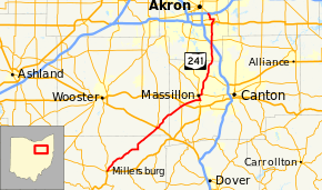
State Route 241 (SR 241) is a north–south state highway in the northeastern portion of the U.S. state of Ohio. Its southern terminus is at U.S. Route 62 in Millersburg, and its northern terminus is at State Route 18 in Akron, Ohio.
History
SR 241 was commissioned in 1924, between Massillon and Akron.[2][3] The route was extended south to Millersburg in 1937.[4][5] In 2009 the northern terminus was changed from Massillon Road to Seiberling Street and Innovation Way in Akron.[6]
Major intersections
| County | Location | mi[1] | km | Destinations | Notes |
|---|---|---|---|---|---|
| Holmes | Millersburg | 0.00 | 0.00 | ||
| Wayne | Mount Eaton | 16.10 | 25.91 | Western end of US 250 concurrency; southern terminus of SR 94 | |
| 16.23 | 26.12 | Eastern end of US 250 concurrency | |||
| Stark | Tuscarawas Township | 24.02 | 38.66 | Western end of SR 93 concurrency | |
| 24.16 | 38.88 | Eastern end of SR 93 concurrency | |||
| 24.74 | 39.82 | ||||
| Massillon | 28.33– 28.69 | 45.59– 46.17 | |||
| 29.48 | 47.44 | Western end of SR 172 concurrency | |||
| 30.23 | 48.65 | Eastern end of SR 172 concurrency | |||
| Jackson Township | 34.79 | 55.99 | Western terminus of SR 687 | ||
| Summit | Green | 42.31 | 68.09 | ||
| 43.02 | 69.23 | ||||
| Akron | 46.76 | 75.25 | |||
| 48.83 | 78.58 | Eastern terminus of SR 764 | |||
| 50.30 | 80.95 | ||||
| 50.43 | 81.16 | ||||
1.000 mi = 1.609 km; 1.000 km = 0.621 mi
| |||||
References
- 1 2 Ohio Department of Transportation. "Technical Services Straight Line Diagrams". Retrieved April 30, 2010.
- ↑ Ohio Department of Highways and Public Works (July 1923). Map of Ohio Showing State Routes (MrSID) (Map). 1:760,320. Columbus: Ohio Department of Highways and Public Works. Retrieved October 31, 2013.
- ↑ Ohio Department of Highways and Public Works (August 1924). Map of Ohio Showing State Routes (MrSID) (Map). 1:760,320. Columbus: Ohio Department of Highways and Public Works. Retrieved October 31, 2013.
- ↑ Ohio Department of Highways (1936). Official Highway Map of Ohio (MrSID) (Map). 1:760,320. Columbus: Ohio Department of Highways. OCLC 5673562. Retrieved October 31, 2013.
- ↑ Ohio Department of Highways (1937). Official Highway Map of Ohio (MrSID) (Map). 1:633,600. Columbus: Ohio Department of Highways. OCLC 5673562, 16960304. Retrieved October 31, 2013.
- ↑ Ohio Department of Transportation. "Straight-Line Diagrams County Update Table (Summit, 2009)". Retrieved October 31, 2013.
External links
This article is issued from Wikipedia - version of the 6/11/2016. The text is available under the Creative Commons Attribution/Share Alike but additional terms may apply for the media files.