Oiry
| Oiry | ||
|---|---|---|
|
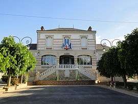
The town hall of Oiry. | ||
| ||
 Oiry | ||
|
Location within Grand Est region  Oiry | ||
| Coordinates: 49°01′28″N 4°03′04″E / 49.0244°N 4.0511°ECoordinates: 49°01′28″N 4°03′04″E / 49.0244°N 4.0511°E | ||
| Country | France | |
| Region | Grand Est | |
| Department | Marne | |
| Arrondissement | Arrondissement of Épernay | |
| Canton | Canton of Avize | |
| Intercommunality | Communauté de communes Épernay–Pays de Champagne | |
| Government | ||
| • Mayor (2008–2014) | Daniel Bouillon | |
| Area1 | 10.76 km2 (4.15 sq mi) | |
| Population (1999)2 | 946 | |
| • Density | 88/km2 (230/sq mi) | |
| Time zone | CET (UTC+1) | |
| • Summer (DST) | CEST (UTC+2) | |
| INSEE/Postal code | 51413 / 51530 | |
|
1 French Land Register data, which excludes lakes, ponds, glaciers > 1 km² (0.386 sq mi or 247 acres) and river estuaries. 2 Population without double counting: residents of multiple communes (e.g., students and military personnel) only counted once. | ||

Oiry is a commune in the Marne department in north-eastern France.
Champagne
The village's vineyards are located in the Côte de Blancs subregion of Champagne, and are classified as Grand Cru (100%) in the Champagne vineyard classification.
See also
| Wikimedia Commons has media related to Oiry. |
This article is issued from Wikipedia - version of the 11/6/2016. The text is available under the Creative Commons Attribution/Share Alike but additional terms may apply for the media files.