Oistins
| Oistins | |
|---|---|
| Town | |
 | |
 Oistins Location on a map of Barbados parishes | |
| Coordinates: 13°4′N 59°32′W / 13.067°N 59.533°WCoordinates: 13°4′N 59°32′W / 13.067°N 59.533°W[1] | |
| Country |
|
| Parish | Christ Church |
| Population (2013)[2] | |
| • Total | 2,285 |
| Time zone | Eastern Caribbean Time Zone (UTC-4) |
| Area code(s) | +1 246 |
Oistins (Pronounced /'ȯis-tins/ -- UN/LOCODE: BB OST[3]), is a costal area located in the country of Barbados. Situated in the southern portion of the parish of Christ Church, Oistins operates mostly as a fishing village and a tourist hang out, and is the location of the Anglican parish church for Christ Church. Oistins is also home to the former Christ Church hospital, the former Barbados Coast Guard station, and the offshore landing for ships delivering fossils fuels to the island. Oistins also contains bars and shopping centers.[4]
It is thought that the name "Oistins" is a corruption of "Austin's". Austin was an early landowner in this area, described by Richard Ligon, one of the first historians of Barbados, as "a wild, mad, drunken fellow whose lewd and extravagant carriage made him infamous in the island".
The name Oistin is known from the annals of Irish and Scottish history. It is probably a Gaelification of the Norse name Thorstein. The name Oistin is still used in Ireland today.[5][6]
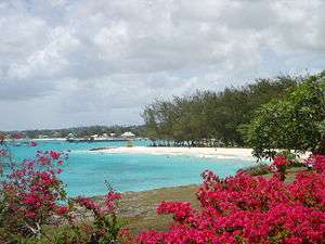
A tradition has recently developed for tourists in Oistins to join in with locals at the Friday night (and slightly quieter Saturday night) Fish Fry and "lime" (social gathering), which sees many stalls selling fried fish meals and local craft, all to the accompaniment of loud music, while older inhabitants practice more traditional 'old time' dancing. The area is fairly close to many of the south coast hotels in Barbados and has several very attractive beaches, for example Miami Beach.
Many like the beaches in Oistins because they are on the flight path of many jets landing at the Grantley Adams International Airport.
Sun bathers and those in the water can watch as every plane to Barbados swoops down from the sky on its final approach to a landing at the airport some 1-2 kilometres to the North and East.
References
- ↑ "Oistins, Barbados". GeoNames. Retrieved 9 December 2012.
- ↑ http://population.mongabay.com/population/barbados/3373652/oistins
- ↑ Barbados codes, United Nations - Code for Trade and Transport Locations (UN/LOCODE) via UNECE
- ↑ Automated Manifest System Seaport Code: 27210.
- ↑ "Glenhest - Gleann Oistín". Retrieved December 4, 2011.
- ↑ "Oistin Mac Bride". Retrieved December 4, 2011.
External links
- Oistins in line for facelift: March 7th, 2006 - Barbados Nation News