Opalchenie Peak
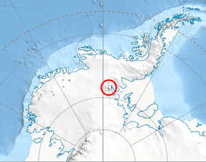
Opalchenie Peak (Bulgarian: връх Опълчение, ‘Vrah Opalchenie’ \'vr&h o-p&l-'che-ni-e\) is the peak rising to 4,500 metres (14,800 ft) at the south extremity of the ice-covered Vinson Plateau, Sentinel Range in the Ellsworth Mountains, Antarctica. It has precipitous and partly ice-free south slopes, and is of low prominence except to the south, where two parallel ridges descend steeply southwestwards with Donnellan Glacier flowing in between and Mount Slaughter rising on the more southerly ridge.
The peak is named after the Bulgarian Volunteer Force in the 1877-1878 Russo-Turkish War and the Macedonian-Adrianople Volunteer Force in the 1912-1913 Balkan Wars, ‘opalchenie’ being the Bulgarian for ‘volunteer force’.
Location
Opalchenie Peak is located at 78°34′02″S 85°34′53″W / 78.56722°S 85.58139°WCoordinates: 78°34′02″S 85°34′53″W / 78.56722°S 85.58139°W, which is 4.73 kilometres (2.94 mi) south by east of Mount Vinson, 990 metres (1,080 yd) south of Fukushima Peak, 5.2 kilometres (3.2 mi) southwest of Schoening Peak, 7.49 kilometres (4.65 mi) northwest of Mount Rutford, 4.09 kilometres (2.54 mi) north by east of Mount Slaughter, 7.41 kilometres (4.60 mi) east of Brichebor Peak and 2.66 kilometres (1.65 mi) southeast of Silverstein Peak. USGS mapping in 1961, updated in 1988.
Maps
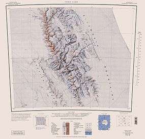
- Vinson Massif. Scale 1:250 000 topographic map. Reston, Virginia: US Geological Survey, 1988.
- Antarctic Digital Database (ADD). Scale 1:250000 topographic map of Antarctica. Scientific Committee on Antarctic Research (SCAR), 1993–2016.
References
- Opalchenie Peak. SCAR Composite Antarctic Gazetteer.
- Bulgarian Antarctic Gazetteer. Antarctic Place-names Commission. (details in Bulgarian, basic data in English)
This article includes information from the Antarctic Place-names Commission of Bulgaria which is used with permission.