Oregon Route 351
| ||||
|---|---|---|---|---|
 | ||||
| Route information | ||||
| Maintained by ODOT | ||||
| Length: | 6.94 mi (11.17 km) | |||
| Existed: | 2003 – present | |||
| Major junctions | ||||
| North end: |
| |||
| South end: | Wallowa Lake State Park | |||
| Highway system | ||||
| ||||

Oregon Route 351 (OR 351) is an Oregon state highway running from Joseph to Wallowa Lake State Park. OR 351 is known as the Joseph-Wallowa Lake Highway No. 351 (see Oregon highways and routes). It is 6.94 miles (11.17 km) long and runs north–south, entirely within Wallowa County.
OR 351 was established in 2003 as part of Oregon's project to assign route numbers to highways that previously were not assigned, and, as of August 2011, was unsigned.
Route description
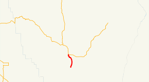
OR 351 begins at an intersection with OR 82 and OR 350 in Joseph and heads south past Wallowa Lake through Wallowa Lake State Park, ending 0.04 miles (0.064 km) past the southern boundary of the park.
History
OR 351 was assigned to the Joseph-Wallowa Lake Highway in 2003.
Major intersections
The entire route is in Wallowa County.
| Location | mi | km | Destinations | Notes | |
|---|---|---|---|---|---|
| | 6.94 | 11.17 | Wallowa Lake State Park | Southern terminus | |
| Joseph | 0.00 | 0.00 | Northern terminus | ||
| 1.000 mi = 1.609 km; 1.000 km = 0.621 mi | |||||
References
- Oregon Department of Transportation, Descriptions of US and Oregon Routes, http://www.oregon.gov/ODOT/HWY/TRAFFIC/TEOS_Publications/PDF/Descriptions_of_US_and_Oregon_Routes.pdf, page 30.
- Oregon Department of Transportation, Joseph-Wallowa Lake Highway No. 351, ftp://ftp.odot.state.or.us/tdb/trandata/maps/slchart_pdfs_1980_to_2002/Hwy351_1996.pdf