Oxspring
| Oxspring | |
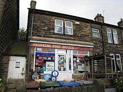 Oxspring Post Office |
|
 Oxspring |
|
| Population | 1,225 (2011) |
|---|---|
| OS grid reference | SE270020 |
| Civil parish | Oxspring |
| Metropolitan borough | Barnsley |
| Metropolitan county | South Yorkshire |
| Region | Yorkshire and the Humber |
| Country | England |
| Sovereign state | United Kingdom |
| Post town | SHEFFIELD |
| Postcode district | S36 |
| Dialling code | 01226 |
| Police | South Yorkshire |
| Fire | South Yorkshire |
| Ambulance | Yorkshire |
| EU Parliament | Yorkshire and the Humber |
| UK Parliament | Barnsley West and Penistone |
| Website | http://www.oxspring-parish.com |
Coordinates: 53°30′50″N 1°35′38″W / 53.514°N 1.594°W
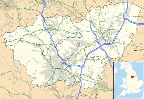
Oxspring is a village and civil parish in the Metropolitan Borough of Barnsley in South Yorkshire, England. At the 2001 census it had a population of 1,048,[1] increasing to 1,225 at the 2011 Census.[2] The civil parish includes the hamlets of Clays-Green, Roughbirchworth and Storrs.[3] It is situated on the River Don with the main village being between the Sheffield Road (B6462) and the route of the Trans Pennine Trail.[3] On the other (NE) side of the river is the A629, part of which is called Oxspring Lane, indicating the position of the original hamlet (now High Oxspring Farm). The parish has a post office, a combined C of E church and community hall, St Aidan's, a primary school and two public houses, the Waggon and Horses on the B6462 and the Travellers Inn on the A629. There is a small amount of industry at the north west end.
History

At the time of the Domesday Book the manor of Oxspring (then Ospring) was owned by Lord Swein, who also owned neighbouring [Rough]Birchworth. The book records the combined manors as having the very small value of 2 geld units.[4] It continued to be a collections of isolated buildings and farms for centuries, with Oxspring Lodge completed in 1580, and demolished.[5] The 1772 map by Thomas Jefferys shows the name on the NE side of the River Don, roughly what is now known as High Oxspring. Thus the present main habitation on the SW side mainly dates from industrial activity in the eighteenth century onwards. The Waggon and Horses dates from this time, being converted from a farmhouse and smithy.[6] When the Sheffield, Ashton-under-Lyne and Manchester Railway was being built in the middle of the eighteenth century, the barn of this site was used to house the navvies who built it.[6] The River Don in this area was used to power mills, initially for corn, but later for cloth.[5] In the nineteenth century a wire drawing industry developed and there are still wire drawing mills and associated companies today.[5]
References
- ↑ "Census 2001". Neighbourhood Statistics. Office for National Statistics. Retrieved 17 January 2009.
- ↑ "Civil Parish population". Neighbourhood Statistics. Office for National Statistics. Retrieved 5 March 2016.
- 1 2 Oxspring Neighbourhood Plan
- ↑ Open Domesday Oxspring
- 1 2 3 David Hey (2002) A History of Penistone and District, Casemate Publishers ISBN 1783378980
- 1 2 Graham Lewis (1990) The Hidden Places of Yorkshire and Humberside M&M Publishing
Further reading
- David Hey (2002) A History of Penistone and District, Casemate Publishers ISBN 1783378980
- Phyllis Crossland (1984) Years of Grace: A Biographical Story of Life in a Rural Area of England, 1850-1973, Hallamshire Press, ISBN 1-874718-45-8
- Oxspring Neighbourhood Plan
- Oxspring Parish Council (1997) Walks in the Parish of Oxspring
External links
| Wikimedia Commons has media related to Oxspring. |