Péronnes-lez-Binche
| Péronnes-lez-Binche | |
|---|---|
|
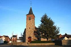
The church Sainte-Marie in Péronnes-lez-Binche | |
 Péronnes-lez-Binche Location in Belgium | |
| Coordinates: BE 50°26′N 4°8′E / 50.433°N 4.133°E | |
| Country | Belgium |
| Region | Walloon Region |
| Community | French Community |
| Province | Hainaut |
| Municipality | Binche |
| Area | |
| • Total | 10.11 km2 (3.90 sq mi) |
| Population (2006) | |
| • Total | 4,417 |
| • Density | 440/km2 (1,100/sq mi) |
| Area codes | 064 |
Péronnes-lez-Binche (Pèrone in Walloon) is a former town of Belgium, now, section of Belgian town called Binche. It is situated in Wallonia, in the province of Hainaut. The village fusioned to Binche in 1977, with the villages of Bray, Buvrinnes, Épinois, Leval-Trahegnies, Ressaix and Waudrez.
Péronnes became known for its coal rich ground which allowed the mining industry to grow. The mining industry has now been dead for decades but ancient coal hills and few infrastructure stays to remind of the golden age. The most well known building is Triage-Lavoir, coal washing plant, which was built in 1954 with the help of Marshall Plan.
External links
-
 Media related to Péronnes-lez-Binche at Wikimedia Commons
This article is issued from Wikipedia - version of the 12/1/2016. The text is available under the Creative Commons Attribution/Share Alike but additional terms may apply for the media files.