Palca Municipality
| Palca Pallqa | |
|---|---|
| Municipality | |
|
Chojahuaya, Cohoni Canton, Palca Municipality | |
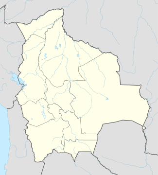 Palca Location of the Palca Municipality within Bolivia | |
| Coordinates: 16°42′0″S 67°50′0″W / 16.70000°S 67.83333°WCoordinates: 16°42′0″S 67°50′0″W / 16.70000°S 67.83333°W | |
| Country |
|
| Department | La Paz Department |
| Province | Pedro Domingo Murillo Province |
| Seat | Palca |
| Government | |
| • Mayor | Cecilio Quispe Gomez (2007) |
| Area | |
| • Total | 283 sq mi (734 km2) |
| Elevation | 12,500 ft (3,800 m) |
| Population (2001) | |
| • Total | 14,185 |
| • Ethnicities | Aymara |

Palca or Pallqa (Aymara) is the first municipal section of the Pedro Domingo Murillo Province in the La Paz Department, Bolivia. Its seat is Palca.
Geography
The Cordillera Real traverses the municipality. Some of the highest peaks of the municipality are listed below:[1]
- Achachi Qala
- Ch'iyar Qullu (Murillo)
- Ch'iyar Qullu (Palca)
- Jalancha
- Janq'u Qalani
- Jisk'a Jalancha
- Jukumarini
- Kunturiri
- Layqa Qullu
- Link'u Link'u
- Parqu Quta
- P'iq'iñ Q'ara
- Q'asiri
- Silla Pata
- Tata Ch'iyar Qullu
- Wila Quta
- Wichhu Pata
- Wichhu Pata Qullu
- Wiluma
Population
The people are predominantly indigenous citizens of Aymara descent.[2]
| Ethnic group | % |
|---|---|
| Quechua | 0.6 |
| Aymara | 91.6 |
| Guaraní, Chiquitos, Moxos | 0.1 |
| Not indigenous | 7.6 |
| Other indigenous groups | 0.1 |
Places of interest
Some of the tourist attractions of the municipality are:[3]
- Apacheta viewpoint in Palca Canton which offers a sight of the contrasting landscape and snowcapped Illimani
- Valle de los Ánimas ("Valley of the Souls") and its lake (Laguna de las Ánimas) in Palca Canton
- the town of Palca with houses of colonial times, Palca River, Chuaqueri gorge, also known as Palca gorge, and Takesi pre-Columbian trail in Palca Canton
- the communities of Quilihuaya and Pinaya in Quilihuaya Canton
- the community of Cohoni, its church dating from the 17th century and the chullpas of Ch'ullu Cahinbaya in Cohoni Canton
See also
References
- ↑ Bolivian IGM map 1:50,000 6043-I Araca, 6044-IV Chojlla, Cohoni 6043-IV, Lambate 6044-II and 6044-III Palca
- ↑ obd.descentralizacion.gov.bo/municipal/fichas/ (inactive)
- ↑ www.gobernacionlapaz.gob.bo Tourist guide by the government of the department
External links
- Palca Municipality: population data and map (PDF; 534 kB)

This article is issued from Wikipedia - version of the 2/13/2016. The text is available under the Creative Commons Attribution/Share Alike but additional terms may apply for the media files.